Museums · Mid Wales
Atcham
Atcham is a village, ecclesiastical parish and civil parish in Shropshire, England. It lies on the B4380 (once the A5), 5 miles south-east of Shrewsbury. The River Severn flows round the village. To t

Eirian Evans — CC BY-SA 2.0 via Wikimedia Commons licence
Plan your visit
- Typical visit
- 1.5 h–3 h
- Best time of year
- Year-round
- Family-friendly
- Limited wheelchair access
About
Atcham is a village, ecclesiastical parish and civil parish in Shropshire, England. It lies on the B4380 (once the A5), 5 miles south-east of Shrewsbury. The River Severn flows round the village. To the south is the village of Cross Houses and to the north-west the hamlet of Emstrey.
Photo gallery
From the Wikipedia article
Atcham is a village, ecclesiastical parish and civil parish in Shropshire, England. It lies on the B4380 (once the A5), 5 miles south-east of Shrewsbury. The River Severn flows round the village. To the south is the village of Cross Houses and to the north-west the hamlet of Emstrey.
Excerpt from Wikipedia under CC BY-SA 4.0. See the source article linked in Sources below.
Background
History
The village has the only church in England dedicated to Saint Eata, Bishop of Hexham. The reason for the dedication is unclear, as there is no written record of Eata coming so far south. However, there is a crop photograph from the 1970s of a field in Attingham Park showing the site of a Saxon palace identical to one excavated near Hexham. "Atcham" is a contraction of "Attingham", meaning "the home of Eata's people". The church building dates from the 11th century. The local airfield RAF Atcham, now returned to agriculture and light industry, was held by an American training unit for much of World War II. It used P-47 Thunderbolts and later P-38 Lightnings for operational training of…
Description
Landmarks at Atcham include Attingham Park, seat of the Berwick barons until the title became extinct in 1953. The hall at Attingham Park is now the regional headquarters of the National Trust. Also on the estate is the Shropshire office of Natural England. Adjacent to Attingham Park is Home Farm, Attingham. Now separate from the hall that it traditionally supplied, it is a family-run organic farm and tearoom open to the public. The older of the two bridges at Atcham, built in 1769–1771 by John Gwynn, is commonly known as Atcham Bridge. It is both Grade II* listed and a scheduled monument. Its replacement, opened in 1929, carries the old A5 (B4380) road over the River Severn. The village…
Sourced from Wikipedia under CC BY-SA 4.0.
- Coordinates
- 52.6796, -2.6799
- District
- Shropshire
- Parish
- Atcham
- Postcode
- SY5 6QG
- Parliamentary constituency
- South Shropshire
- Official site
- www.neighbourhood.statistics.gov.uk
Sources
- wikipedia: Atcham (CC BY-SA 4.0)
Other places nearby
Loading nearby places…
Nearby
 📷 3
📷 3Historic bridges · Mid Wales
Atcham Bridge
Atcham Bridge — scheduled monument-listed bridge in wales-mid, United Kingdom.
 📷 3
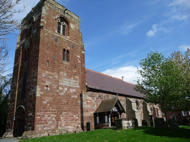
📷 3Historic churches · Mid Wales
St Eata's Church, Atcham
St Eata's Church, Atcham — church in Atcham, Shropshire, England, UK.
 📷 3
📷 3Farms (open to visitors) · Mid Wales
Home Farm Attingham Open Farm
Home Farm Attingham Open Farm — a other in wales-mid, United Kingdom.
 📷 3
📷 3Historic bridges · Mid Wales
Tern Bridge
Tern Bridge — scheduled monument-listed bridge in wales-mid, United Kingdom.
 📷 3
📷 3Historic bridges · Mid Wales
Estate Bridge Approximately 120 Metres To South East Of Attingham Park
Estate Bridge Approximately 120 Metres To South East Of Attingham Park — Grade II* listed building-listed bridge in wales-mid, United Kingdom.
📷 5Museums · Mid Wales
River Tern
River Tern — a museum in wales-mid, United Kingdom.
More museums in this region
 📷 3
📷 3Museums · Mid Wales
Aberystwyth University Ceramics Collection
Aberystwyth University Ceramics Collection — Ceramics collection in Ceredigion, Wales.
 📷 3
📷 3Museums · Mid Wales
Aberystwyth University, School of Art Museum and Galleries
Aberystwyth University, School of Art Museum and Galleries — university museum in Wales, United Kingdom.
 📷 3
📷 3Museums · Mid Wales
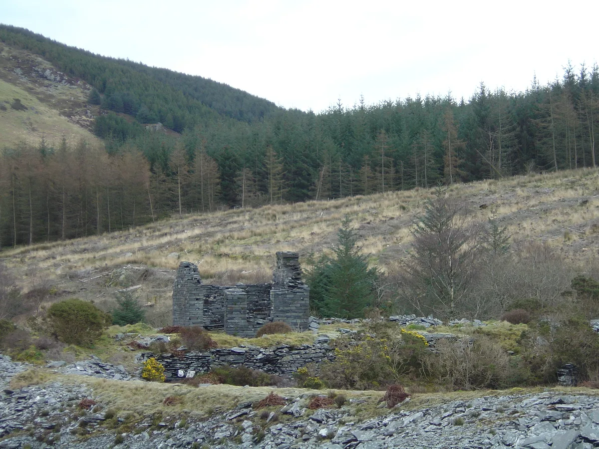
Bryneglwys Slate Quarry, Abergynolwyn Village and the Talyllyn Railway
Bryneglwys Slate Quarry, Abergynolwyn Village and the Talyllyn Railway — part of the World Heritage site “The Slate Landscape of Northwest Wales” in the United Kingdom.
 📷 3
📷 3Museums · Mid Wales
Cardigan Guildhall Market
Cardigan Guildhall Market is a place of interest in the United Kingdom.
Frequently asked questions
- Where is Atcham?
- Atcham is in Mid Wales, in the United Kingdom — coordinates 52.6796°, -2.6799°.
- Is Atcham wheelchair accessible?
- Partially — OpenStreetMap notes limited wheelchair access at Atcham. Check ahead for specific facilities.