Natural landmarks · North East England
Armboth Fell
Armboth Fell — mountain in United Kingdom.

Wikimedia Commons licence
Plan your visit
- Typical visit
- 1 h–2 h
- Nearest railway station
- Threlkeld Quarry · 8.8 km
- Free entry
- Dog-friendly
About
Armboth Fell is a named natural landmark in the United Kingdom. Wikidata describes it as: "mountain in United Kingdom". Coordinates: 54.5335°, -3.0879°.
Photo gallery
Protected designations
- Site of Special Scientific Interest: River Derwent and Tributaries SSSI
- Site of Special Scientific Interest: Armboth Fells SSSI
Designations sourced from Natural England open data under OGL v3.
From the Wikipedia article
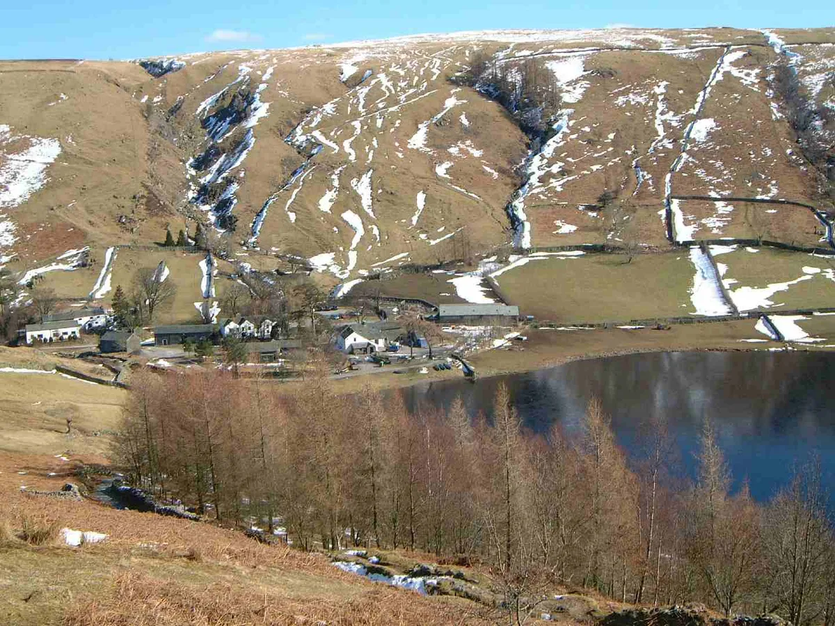
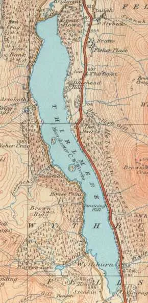
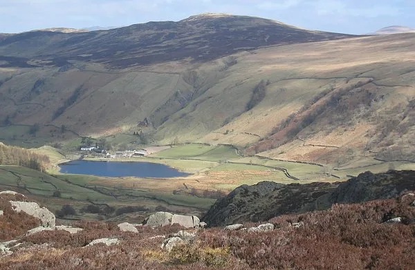
Armboth Fell is a fell in the English Lake District, regarded by Alfred Wainwright as the centre of Lakeland. It is named for the former settlement of Armboth. The fell is a domed plateau, three-quarters of a mile across, jutting out to the east of the Derwentwater-Thirlmere watershed, in the Cumberland district. The fell is wet underfoot, with large areas clad in heather. The eastern slopes above Thirlmere have been planted with conifers.
Excerpt from Wikipedia under CC BY-SA 4.0. See the source article linked in Sources below.
- Coordinates
- 54.5335, -3.0879
- Address
- Cumbria, England
- Nearest railway station
- Threlkeld Quarry — 8.8 km
Sources
- wikidata: Q4792916 (CC0)
- wikipedia: Armboth Fell (CC BY-SA 4.0)
Other places nearby
Loading nearby places…
Nearby
 📷 3
📷 3Mountains & hills · North East England
High Tove
High Tove — Named summit at 515 m.
 📷 3
📷 3Natural landmarks · North East England
High Tove
High Tove — mountain in United Kingdom.
 Flagship📷 3
Reservoirs & lochs · North East England
Thirlmere
Thirlmere — reservoir in the United Kingdom.
 📷 3
📷 3Natural landmarks · North East England
Blea Tarn
Blea Tarn — lake near Watendlath, Cumbria, United Kingdom.
 📷 3
📷 3Mountains & hills · North East England
High Seat
High Seat — Named summit at 609 m.
Campsites · North East England
Thirlspot Farm Camping
Thirlspot Farm Camping — a campsite in england north east.
More natural landmarks in this region
 Flagship📷 5
Natural landmarks · North East England
Brothers Water
Brothers Water — lake in Cumbria, England, UK.
 📷 5
📷 5Natural landmarks · North East England
Angle Tarn
Angle Tarn — lake near Patterdale, Cumbria, England, United Kingdom.
 📷 3
📷 3Natural landmarks · North East England
Angletarn Pikes
Angletarn Pikes — mountain in United Kingdom.
 📷 3
📷 3Natural landmarks · North East England
Ard Crags
Ard Crags — mountain in United Kingdom.
Frequently asked questions
- Where is Armboth Fell?
- Armboth Fell is in North-East England, United Kingdom.
- Is Armboth Fell a protected site?
- Yes — Armboth Fell is part of the River Derwent and Tributaries SSSI Site of Special Scientific Interest and the Armboth Fells SSSI Site of Special Scientific Interest.
- Is Armboth Fell free to visit?
- Yes, Armboth Fell is free to enter.