Historic churches · West Midlands
Alsager
Alsager ( AWL-say-jər) is a town and civil parish in the unitary authority of Cheshire East in Cheshire, England. It is located to the north-west of Stoke-on-Trent and east of Crewe. At the 2021 cen

Jonathan Hutchins — CC BY-SA 2.0 via Wikimedia Commons licence
Plan your visit
- Typical visit
- 30 min–1 h
- Free entry
About
Alsager ( AWL-say-jər) is a town and civil parish in the unitary authority of Cheshire East in Cheshire, England. It is located to the north-west of Stoke-on-Trent and east of Crewe. At the 2021 census, the parish had a population of 13,389 and the built up area population was 15,505. The civil parish is bordered by the parishes of Betchton to the north, Church Lawton to the north-east and east, Kidsgrove to the south-east, Audley Rural to the south, Barthomley to the south-west, Haslington to the west, and Hassall to the north-west. Alsager has hosted an annual summer carnival since 1998; it was located in Milton Park until June 2009 and moved temporarily to the Alsager School playing fields to increase capacity, before returning in 2017. In 2008, Alsager was awarded Fairtrade Town status by the Fairtrade Foundation.
Photo gallery
From the Wikipedia article
Alsager ( AWL-say-jər) is a town and civil parish in the unitary authority of Cheshire East in Cheshire, England. It is located to the north-west of Stoke-on-Trent and east of Crewe. At the 2021 census, the parish had a population of 13,389 and the built up area population was 15,505. The civil parish is bordered by the parishes of Betchton to the north, Church Lawton to the north-east and east, Kidsgrove to the south-east, Audley Rural to the south, Barthomley to the south-west, Haslington to the west, and Hassall to the north-west. Alsager has hosted an annual summer carnival since 1998; it was located in Milton Park until June 2009 and moved temporarily to the Alsager School playing fields to increase capacity, before returning in 2017. In 2008, Alsager was awarded Fairtrade Town status by the Fairtrade Foundation.
Excerpt from Wikipedia under CC BY-SA 4.0. See the source article linked in Sources below.
Background
History
]] In the village of Church Lawton are the Church Lawton Barrows, which form part of a significant Bronze Age site near the town. The town's name means 'the arable land of a person named Ælle (Old English: Ælles æċer). Alsager was recorded as 'Eleacier' in the Domesday Book of 1086, and was a small farming village until the 19th century when, due to its rail connections and rural character, it became a home of choice for pottery works managers from the nearby Federation of Six Towns which later became the city of Stoke-on-Trent. During the Second World War, a large armaments factory was built outside Alsager at Radway Green, and the town expanded dramatically to house the influx of factory…
Sourced from Wikipedia under CC BY-SA 4.0.
- Coordinates
- 53.0960, -2.3050
- District
- Cheshire East
- Parish
- Alsager
- Postcode
- ST7 2ES
- Parliamentary constituency
- Congleton
Sources
- wikipedia: Alsager (CC BY-SA 4.0)
Other places nearby
Loading nearby places…
Nearby
 📷 3
📷 3Historic churches · West Midlands
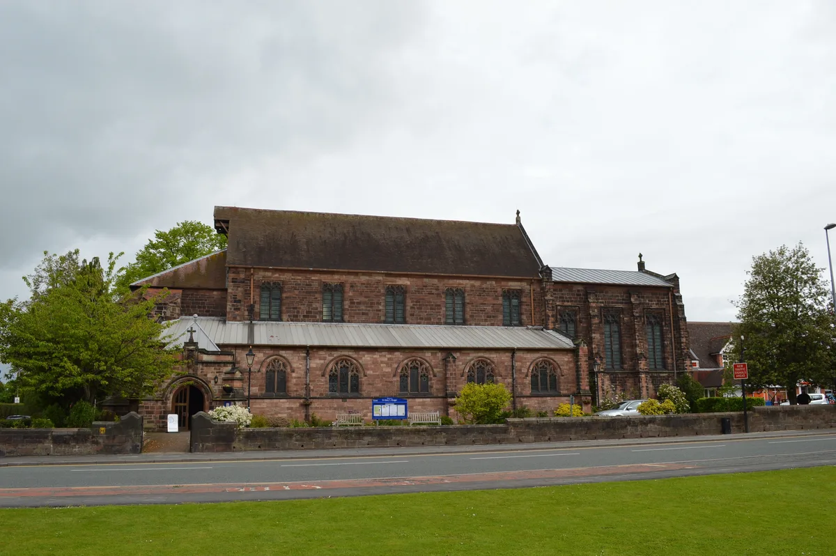
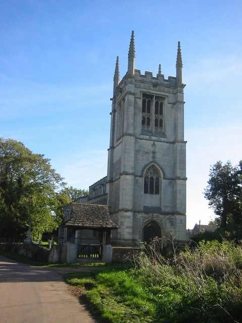
St Mary Magdalene's Church, Alsager
St Mary Magdalene's Church, Alsager — Grade II listed church in Alsager, Cheshire, England, UK.
 📷 3
📷 3Memorials & monuments · West Midlands
Alsager War Memorial
Alsager War Memorial — Grade II listed building-listed memorial in england-west-midlands, United Kingdom.
 📷 3
📷 3Historic churches · West Midlands
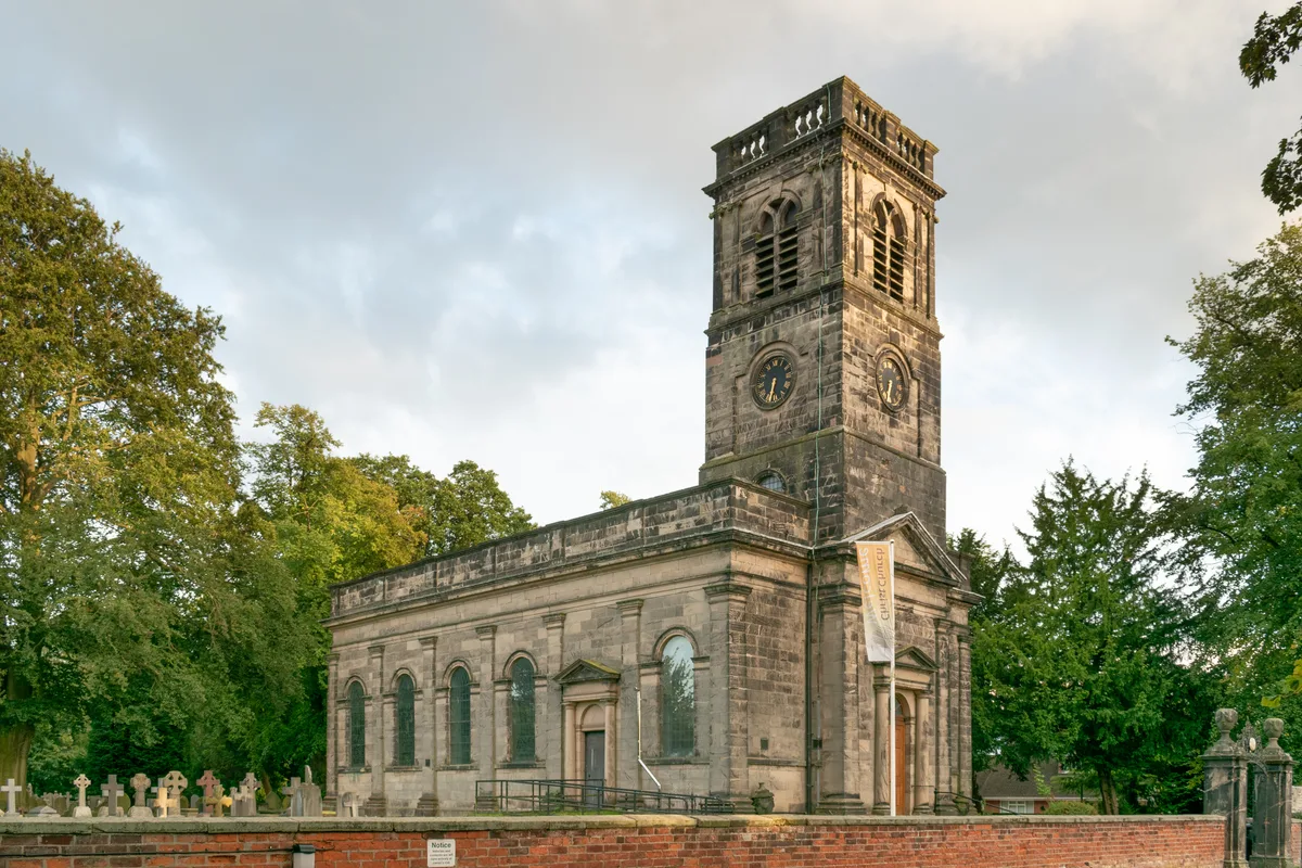
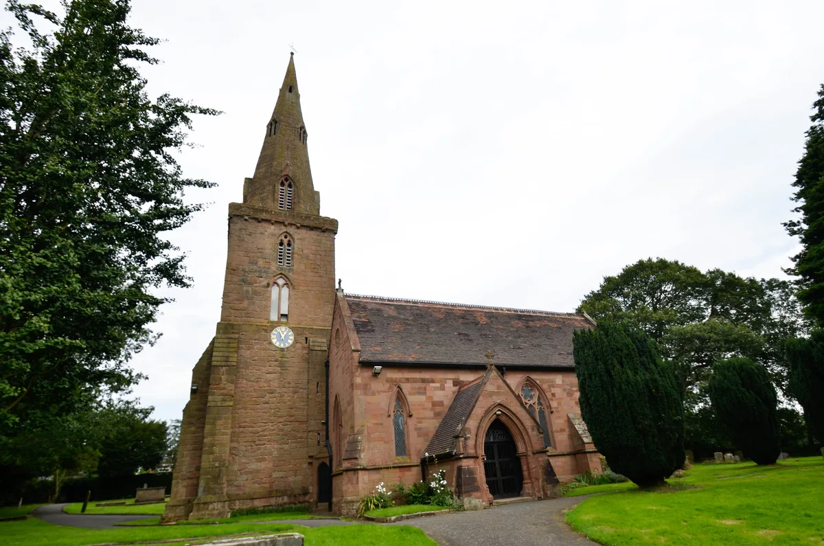
Christ Church, Alsager
Christ Church, Alsager — Grade II* listed church in Alsager, Cheshire East, Cheshire, England, UK.
 📷 3
📷 3Historic bridges · West Midlands
Bridge number 137 (Hall's Bridge) at SJ 8159 5622
Bridge number 137 (Hall's Bridge) at SJ 8159 5622 — Grade II listed building-listed bridge in england-west-midlands, United Kingdom.
 📷 3
📷 3Canal locks · West Midlands
Canal lock number 49 (Hall's Lock) at SJ 8160 5622
Canal lock number 49 (Hall's Lock) at SJ 8160 5622 — Grade II listed canal lock in Church Lawton, Cheshire, England, UK.
 📷 3
📷 3Historic bridges · West Midlands
Trent and Mersey Canal Bridge Number 136 at SJ 8187 5602
Trent and Mersey Canal Bridge Number 136 at SJ 8187 5602 — Grade II listed building-listed bridge in england-west-midlands, United Kingdom.
More places in this region
 📷 3
📷 3Historic churches · West Midlands
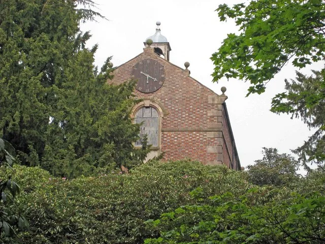
All Saints Chapel, Somerford
All Saints Chapel, Somerford — church in Cheshire East, Cheshire, England, UK.
 📷 4
📷 4Historic churches · West Midlands
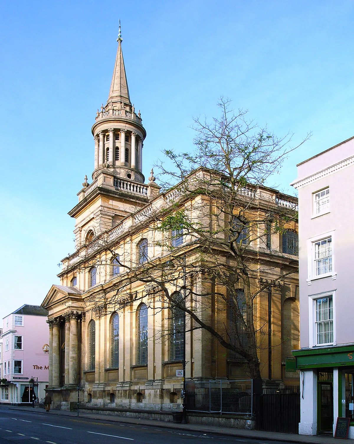
All Saints Church
All Saints Church — church building in Oxford, UK.
 📷 3
📷 3Historic churches · West Midlands
All Saints Church, Aldwincle
All Saints Church, Aldwincle — church in Aldwincle, Northamptonshire, UK.
 📷 3
📷 3Historic churches · West Midlands
All Saints Church, Allesley
All Saints Church, Allesley — Grade I listed church in Coventry, West Midlands, England, UK.
Frequently asked questions
- Where is Alsager?
- Alsager is in the West Midlands, United Kingdom (postcode ST7 2ES), in the parish of Alsager.
- Is Alsager free to visit?
- Yes, Alsager is free to enter.
- How do I get to Alsager?
- Drivers can navigate to postcode ST7 2ES. It sits within the Congleton parliamentary constituency.