Towns & cities · West Midlands
Barthomley
Barthomley — village and civil parish in Cheshire East, England.

Wikimedia Commons contributors — see linked file page for photographer and licence licence
Plan your visit
- Typical visit
- 3 h–6 h
- Nearest railway station
- Alsager · 4.3 km
- Free entry
- Family-friendly
- Dog-friendly
About
Barthomley is a town, city, village or settlement in the United Kingdom. Recent population estimates put it at around 202 people. Address: CW2. Wikidata describes it as: "village and civil parish in Cheshire East, England". Coordinates: 53.0681°, -2.3487°.
Photo gallery
From the Wikipedia article
Barthomley is a village and ancient parish, and is now a civil parish in the unitary authority of Cheshire East and the ceremonial county of Cheshire, England. According to the 2001 and the 2011 census' the parish had a population of 202. The village is situated near junction 16 of the M6 motorway and by the border with Staffordshire. It is about three miles south-west of Alsager. The hamlet of Radway Green, location of a Royal Ordnance Factory, is within the parish, north-east of the village of Barthomley and just outside Alsager. There was a railway station in Radway Green, on the Crewe to Derby Line, as well as a station reserved for the factory at Millway. However, both of these are now closed. Radway Green and Barthomley station closed to goods traffic on 7 June 1964, followed by its closure to passengers on 7 November 1966.
Excerpt from Wikipedia under CC BY-SA 4.0. See the source article linked in Sources below.
Background
History
Barthomley was an ancient parish within Cheshire. It contained five townships: Alsager, Balterley, Barthomley itself, Crewe, and Haslington. Of these, Balterley township and (now) civil parish was and is entirely in the neighbouring county of Staffordshire, and Crewe was later renamed Crewe Green to avoid confusion with the neighbouring unparished borough and railway town. All five townships were made separate civil parishes in 1866. Later on, the modern civil parish (now entirely in Cheshire) was part of Nantwich Rural District. The fantasy novel Red Shift, by Alan Garner, is largely concerned with the Barthomley massacre. There was also a medieval Knights Hospitaller Chapel at Barthomley.…
Sourced from Wikipedia under CC BY-SA 4.0.
- Coordinates
- 53.0681, -2.3487
- District
- Cheshire East
- Parish
- Barthomley
- Postcode
- CW2
- Parliamentary constituency
- Crewe and Nantwich
- Population
- 202
- Nearest railway station
- Alsager — 4.3 km
Sources
- wikidata: Q1963872 (CC0)
- wikipedia: Barthomley (CC BY-SA 4.0)
- commons: Barthomley, White Lion Inn - geograph.org.uk - 4976482.jpg (CC BY-SA 4.0)
Other places nearby
Loading nearby places…
Nearby
 📷 5
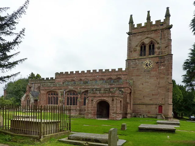
📷 5Historic churches · West Midlands
St Bertoline's Church, Barthomley
St Bertoline's Church, Barthomley — Grade I listed church in Barthomley, Cheshire East, Cheshire, England, UK.
 📷 3
📷 3Museums · West Midlands
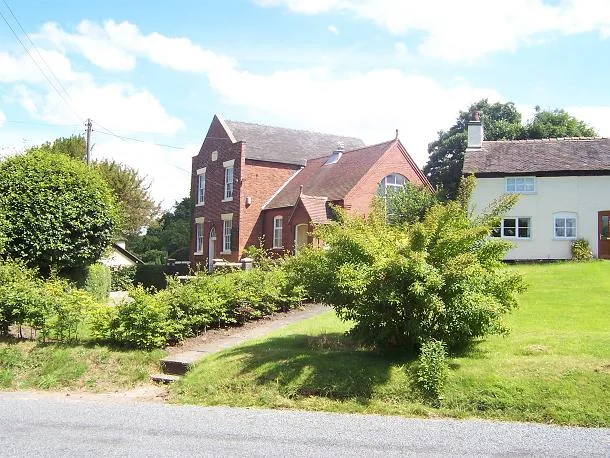
Englesea Brook Chapel and Museum of Primitive Methodism
Englesea Brook Chapel and Museum of Primitive Methodism — Primitive Methodist chapel and museum, United Kingdom.
 📷 3
📷 3Museums · West Midlands
Englesea Brook Museum of Methodism
Englesea Brook Museum of Methodism — a museum in england-west-midlands, United Kingdom.
📷 5Museums · West Midlands
Englesea-Brook
Englesea-Brook is a small rural village in the civil parish of Weston, in the unitary authority area of Cheshire East and the ceremonial county of Cheshire, England. Located close to Crewe, and to jun
 📷 2
📷 2Historic houses · West Midlands
Hall O' The Wood
Hall O' The Wood — Grade II* listed house in Balterley, Newcastle-under-Lyme, England, UK.
 📷 3
📷 3Historic churches · West Midlands
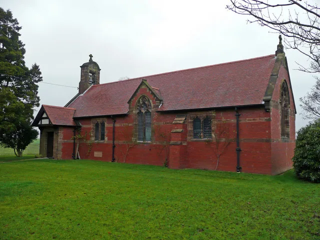
All Saints Church, Balterley
All Saints Church, Balterley — grade II listed church in Balterley, Newcastle-under-Lyme, Staffordshire, England, UK.
More towns in this region
 Flagship📷 3
Towns & cities · West Midlands
Adderbury
Adderbury — village and civil parish in Cherwell district, Oxfordshire, England.
 Flagship📷 3
Towns & cities · West Midlands
Admington
Admington — village in Warwickshire, England, UK.
 Flagship📷 3
Towns & cities · West Midlands
Aldington
Aldington — village in Worcestershire, United Kingdom.
 Flagship📷 5
Towns & cities · West Midlands
Anstey
Anstey — large village in Leicestershire, England.
Frequently asked questions
- Where is Barthomley?
- Barthomley is in the West Midlands, United Kingdom (postcode CW2), in the parish of Barthomley.
- Is Barthomley free to visit?
- Yes, Barthomley is free to enter.
- How do I get to Barthomley?
- The nearest railway station is Alsager, about 4.3 km away. Drivers can navigate to postcode CW2.