Towns & cities · South East England
Woodchurch
Woodchurch — village and civil parish in Kent, UK.

Wikimedia Commons contributors — see linked file page for photographer and licence licence
Plan your visit
- Typical visit
- 3 h–6 h
- Nearest railway station
- Appledore · 5.3 km
- Free entry
- Family-friendly
- Dog-friendly
About
Woodchurch is a town, city, village or settlement in the United Kingdom. It covers approximately 28 km². Recent population estimates put it at around 1,824 people. Address: TN26. Wikidata describes it as: "village and civil parish in Kent, UK". Coordinates: 51.0740°, 0.7774°.
Photo gallery
Protected designations
- Area of Outstanding Natural Beauty: High Weald
- Area of Outstanding Natural Beauty: Kent Downs
Designations sourced from Natural England open data under OGL v3.
From the Wikipedia article
There is another Woodchurch in Kent, a hamlet in the Manston civil parish within the Thanet district. Woodchurch is a Kent village, the largest civil parish in the Borough of Ashford. It is centred 6 miles (9.7 km) from the market town of Ashford and 4 miles (6 km) from the Cinque Ports town of Tenterden, in Kent, South East England. It is situated to the north of the B2067 road from Tenterden to Hamstreet. The windmill that overlooks the village from the north commands extensive views over the Walland marshes to the English Channel coast. It is a fine example of a Kentish smock mill and was originally one of a pair of windmills standing on this site, known locally as The Twins. The mill is open throughout the summer and is accessible via a footpath that passes between the village pubs. The village is on the edge of the Weald of Kent, whilst the parish extends 6 miles (10 km) north to south and 4 miles (6 km) east to west, one of Kent's largest. Within the village are the settlements of Brattle and Townland Green. To the south-west is the flat expanse of Shirley Moor leading to Romney Marsh and the low wooded hills overlooking Appledore and the Marsh are to the south-east. The surrounding area is designated as a Kent Special Landscape Area.
Excerpt from Wikipedia under CC BY-SA 4.0. See the source article linked in Sources below.
- Coordinates
- 51.0740, 0.7774
- County
- Kent
- District
- Ashford
- Parish
- Woodchurch
- Postcode
- TN26
- Parliamentary constituency
- Weald of Kent
- Population
- 1,824
- Nearest railway station
- Appledore — 5.3 km
Sources
- wikidata: Q1874946 (CC0)
- wikipedia: Woodchurch, Kent (CC BY-SA 4.0)
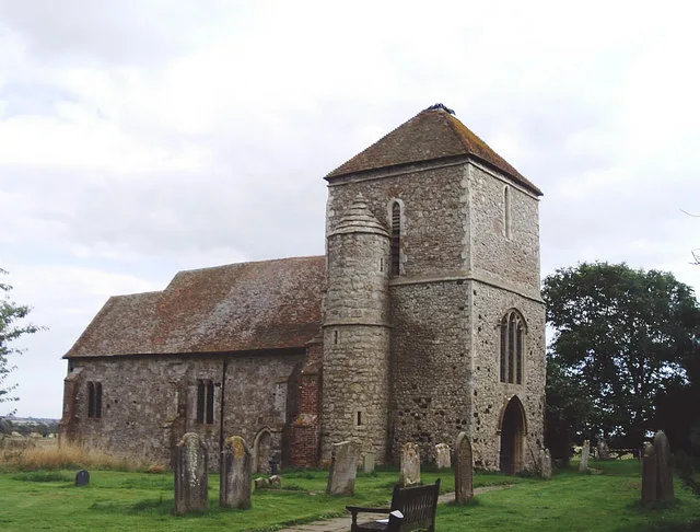
- commons: All Saints Church, Woodchurch, Kent - geograph.org.uk - 786828.jpg (CC BY-SA 4.0)
Other places nearby
Loading nearby places…
Nearby
 📷 5
📷 5Museums · South East England
Lower Mill, Woodchurch
Lower Mill is a smock mill in Woodchurch, Kent, England that was built in 1820. It was a Scheduled Ancient Monument from 1976 to 1978, and remains a Grade II* listed building.
 📷 5
📷 5Natural landmarks · South East England
Rare Breeds Centre
Rare Breeds Centre — a other in england-south-east, United Kingdom.
📷 5Farms (open to visitors) · South East England
Canterbury Oast Trust
Canterbury Oast Trust (COT) is a registered charity in England providing accommodation, care and training for people with learning disabilities, and autistic adults in Kent. Its public site is the Sou
 📷 5
📷 5Museums · South East England
Woodchurch Museum
Woodchurch Museum — a museum in england-south-east, United Kingdom.
 📷 5
📷 5Historic houses · South East England
Diamond House
Diamond House — house in Woodchurch, Ashford, England, UK.
 Flagship📷 10
Towns & cities · South East England
Kenardington
Kenardington — village and civil parish in Kent, United Kingdom.
More towns in this region
 Flagship📷 10
Towns & cities · South East England
Aldermaston
Aldermaston — village and civil parish in West Berkshire in England, UK.
 Flagship📷 10
Towns & cities · South East England
Aldingbourne
Aldingbourne — village and civil parish in Arun, West Sussex, UK.
 Flagship📷 10
Towns & cities · South East England
Aldington
Aldington — village and civil parish in the Ashford District of Kent, England.
 Flagship📷 10
Towns & cities · South East England
Aldworth
Aldworth — village and civil parish in the English county of Berkshire.
Frequently asked questions
- Where is Woodchurch?
- Woodchurch is in Kent, South-East England, United Kingdom (postcode TN26), in the parish of Woodchurch.
- Is Woodchurch a protected site?
- Yes — Woodchurch is part of the High Weald National Landscape (AONB) and the Kent Downs National Landscape (AONB).
- Is Woodchurch free to visit?
- Yes, Woodchurch is free to enter.
- How do I get to Woodchurch?
- The nearest railway station is Appledore, about 5.3 km away. Drivers can navigate to postcode TN26.