Mountains & hills · South West England
Wind Hill
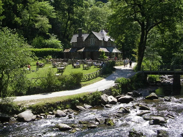
Wind Hill — Named summit at 261 m.

Wikimedia Commons contributors — see linked file page for photographer and licence licence
Plan your visit
- Typical visit
- 3 h–8 h
- Best time of year
- Late spring – early autumn (May–Oct)
- Nearest railway station
- Lynmouth Bay · 1.8 km
- Free entry
- Dog-friendly
About
Wind Hill is a named summit in the United Kingdom. Wikidata describes it as: "Named summit at 261 m.". Coordinates: 51.2289°, -3.8064°.
Photo gallery
Protected designations
- Site of Special Scientific Interest: Watersmeet SSSI
- Site of Special Scientific Interest: Exmoor Coastal Heaths SSSI
Designations sourced from Natural England open data under OGL v3.
From the Wikipedia article
Wind Hill, situated close to Lynmouth in Devon, England, is the location of an Iron Age enclosure or "spur" hill fort. The site is effectively a hillside forming a spur or promontory between the steep valley of the East Lyn River to the south and the cliffs to the north. Wind Hill's summit is at 261 metres (856 ft) above sea level, though the enormous earthworks defending the spur are at a lower level to the east.
Excerpt from Wikipedia under CC BY-SA 4.0. See the source article linked in Sources below.
- Coordinates
- 51.2289, -3.8064
- County
- Devon
- District
- North Devon
- Parish
- Brendon and Countisbury
- Postcode
- EX35 6NT
- Parliamentary constituency
- North Devon
- Nearest railway station
- Lynmouth Bay — 1.8 km
Sources
- osm: n668104311 (ODbL)
- wikipedia: Wind Hill (CC BY-SA 4.0)
- commons: Windhilldevon.jpg (CC BY-SA 4.0)
Other places nearby
Loading nearby places…
Nearby
Vineyards · South West England
Earthwork defences of Countisbury Castle promontory fort
Earthwork defences of Countisbury Castle promontory fort — a UK vineyard in england south west, producing English or Welsh wine from cool-climate grape varieties.
 📷 3
📷 3Historic houses · South West England
Myrtlebury North Iron Age Enclosure
Myrtlebury North Iron Age Enclosure — a historic house in england-south-west, United Kingdom.
Vineyards · South West England
Myrtleberry North Camp, a late prehistoric multiple enclosure fort 200m north west of Waters Meet House
Myrtleberry North Camp, a late prehistoric multiple enclosure fort 200m north west of Waters Meet House — a UK vineyard in england south west, producing English or Welsh wine from cool-climate grape varieties.
Hostels · South West England
National Trust bunkhouse
National Trust bunkhouse — a hostel in england south west.
 📷 5
📷 5Museums · South West England
Hoar Oak Water
Hoar Oak Water is a moorland tributary of the East Lyn River in Exmoor, Somerset, England. It rises at Hoaroak Hill in the Chains geological site and flows to Watersmeet in the East Lyn Valley in Devo
 📷 5
📷 5Historic houses · South West England
Watersmeet House
Watersmeet House — house in Countisbury, Devon, England, UK.
More mountains in this region
 📷 5
📷 5Mountains & hills · South West England
Alex Tor
Alex Tor — Named summit at 291 m.
 📷 5
📷 5Mountains & hills · South West England
Ash Hole Cavern
Ash Hole Cavern — cave in Brixham, Devon, England, UK.
 📷 5
📷 5Mountains & hills · South West England
Babbacombe Bay
Babbacombe Bay — bay in Devon, England.
 📷 5
📷 5Mountains & hills · South West England
Barley Bay
Barley Bay — bay in the United Kingdom.
Frequently asked questions
- Where is Wind Hill?
- Wind Hill is in Devon, South-West England, United Kingdom (postcode EX35 6NT), in the parish of Brendon and Countisbury.
- Is Wind Hill a protected site?
- Yes — Wind Hill is part of the Watersmeet SSSI Site of Special Scientific Interest and the Exmoor Coastal Heaths SSSI Site of Special Scientific Interest.
- Is Wind Hill free to visit?
- Yes, Wind Hill is free to enter.
- How do I get to Wind Hill?
- The nearest railway station is Lynmouth Bay, about 1.8 km away. Drivers can navigate to postcode EX35 6NT.