Other places · South East England
Whiteley
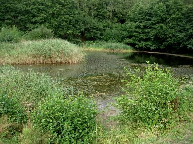
Whiteley — a other in england-south-east, United Kingdom.

Basher Eyre — CC BY-SA 2.0 via Wikimedia Commons licence
Plan your visit
- Typical visit
- 1 h–2 h
About
Whiteley is a other in england-south-east, United Kingdom, listed in the Wikipedia register of British heritage and tourism sites. See the linked Wikipedia article for full details.
Photo gallery
Place summary
Whiteley is a suburb located in South-East England. It is primarily known for its residential developments and proximity to the city of Fareham. The area features a blend of modern amenities and green spaces.
AI-generated from the structured facts on this page (operator, designation, listing, era). Not a substitute for visiting.
Background
History
Historically, the site now occupied by Whiteley was farmland and coppice. The nearest historical settlements are those of Park Gate situated just south of Swanwick Hill, Little Park to the South, Swanwick to the West, Botley and Curdridge to the North. Farm land taken over by the initial development included Rookery, Yew Tree, Sweethills and Whiteley. North Whiteley development was based on land released by Bury, Bridge and Barn Farms. Barn Farmhouse which remains in North Whiteley is listed by Historic England as a C17 timber frame house with a C18 extension. The wooded areas in Whiteley were used to provide shelter to troops in the build-up of forces for transportation to northern France…
Sourced from Wikipedia under CC BY-SA 4.0.
- Coordinates
- 50.8809, -1.2665
- County
- Hampshire
- District
- Fareham
- Parish
- Fareham, unparished area
- Postcode
- SO31 1EA
- Parliamentary constituency
- Hamble Valley
- Official site
- www.neighbourhood.statistics.gov.uk
Sources
- wikipedia: Whiteley (CC BY-SA 4.0)
Other places nearby
Loading nearby places…
Nearby
📷 5Museums · South East England
Swanwick, Hampshire
Swanwick () is a village in Hampshire, England, east of the River Hamble and north of the M27 motorway. The village is located within the borough of Fareham and is the site of the London Area Control
 📷 5
📷 5Wildlife reserves · South East England
Swanwick Lakes
Swanwick Lakes is a wildlife reserve in the United Kingdom.
Hotels · South East England
The Solent Hotel
The Solent Hotel — a hotel in england south east.
 📷 5
📷 5Memorials & monuments · South East England
Sarisbury War Memorial
Sarisbury War Memorial — Grade II listed building-listed memorial in england-south-east, United Kingdom.
 📷 5
📷 5Theatres · South East England
Cineworld Cinema Whiteley
Cineworld Cinema Whiteley in England South East, United Kingdom.
 📷 5
📷 5Manor houses · South East England
Coldeast
Coldeast — a manor in england-south-east, United Kingdom.
More places in this region
 📷 5
📷 5Other places · South East England
Afloat
Afloat — Public artwork (sculpture) by Hamish Black.
 📷 5
📷 5Other places · South East England
Bexhill Farmers' Market
Bexhill Farmers' Market is a place of interest in the United Kingdom.
 📷 5
📷 5Other places · South East England
Denbigh Carving
Denbigh Carving — Public artwork (sculpture) by Joc Hare.
 📷 5
📷 5Other places · South East England
Dinosaur Egg
Dinosaur Egg — Public artwork (sculpture) by Dave Lucas.
Frequently asked questions
- Where is Whiteley?
- Whiteley is in South East England, in the United Kingdom — coordinates 50.8809°, -1.2665°.