Museums · South East England
Swanwick, Hampshire
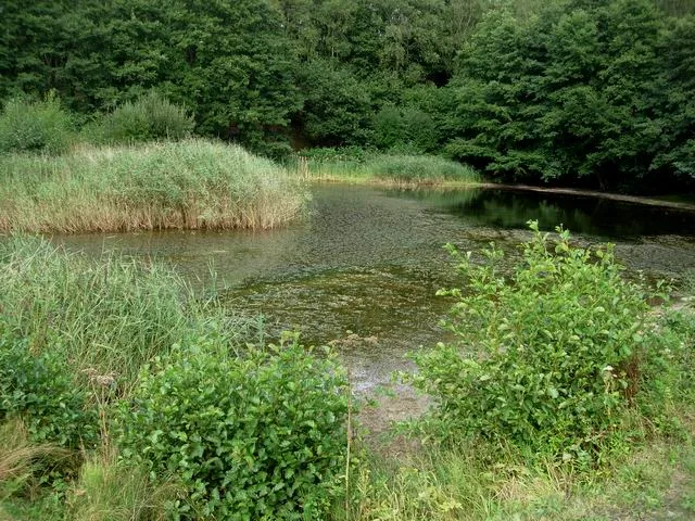
Swanwick () is a village in Hampshire, England, east of the River Hamble and north of the M27 motorway. The village is located within the borough of Fareham and is the site of the London Area Control

Basher Eyre — CC BY-SA 2.0 via Wikimedia Commons licence
Plan your visit
- Typical visit
- 1.5 h–3 h
- Best time of year
- Year-round
- Family-friendly
- Limited wheelchair access
About
Swanwick () is a village in Hampshire, England, east of the River Hamble and north of the M27 motorway. The village is located within the borough of Fareham and is the site of the London Area Control Centre (LACC) and the London Terminal Control Centre (LTCC), part of National Air Traffic Services Air Traffic Control Centre, and Bursledon Brickworks, the last remaining example of a Victorian steam-powered brickworks. Swanwick has no real village centre and the only commercial premises of note is the Elm Tree Public House. Since the 1980s, the gradual spread of housing developments has meant that Swanwick has partly merged with the new development of Whiteley although the only direct vehicular access is via Yew Tree Drive (once a bus only route). Swanwick railway station on the West Coastway Line is approximately one mile south of the village and is nearer Park Gate than Swanwick. The village's "twin" Lower Swanwick is situated two miles west of the village on the edge of the River Hamble.
Photo gallery
From the Wikipedia article
Swanwick () is a village in Hampshire, England, east of the River Hamble and north of the M27 motorway. The village is located within the borough of Fareham and is the site of the London Area Control Centre (LACC) and the London Terminal Control Centre (LTCC), part of National Air Traffic Services Air Traffic Control Centre, and Bursledon Brickworks, the last remaining example of a Victorian steam-powered brickworks. Swanwick has no real village centre and the only commercial premises of note is the Elm Tree Public House. Since the 1980s, the gradual spread of housing developments has meant that Swanwick has partly merged with the new development of Whiteley although the only direct vehicular access is via Yew Tree Drive (once a bus only route). Swanwick railway station on the West Coastway Line is approximately one mile south of the village and is nearer Park Gate than Swanwick. The village's "twin" Lower Swanwick is situated two miles west of the village on the edge of the River Hamble.
Excerpt from Wikipedia under CC BY-SA 4.0. See the source article linked in Sources below.
Background
History
Human activity at Swanwick dates back to the Bronze Age. It is understood that a ritual from the era involved the digging of shafts or wells to the underworld; one such shaft at Swanwick was found to contain 20 cylindrical loom-weights and a wooden post with organic residues believed to be the remains of flesh and blood. A refuse pit dating from Roman times has also been found at Swanwick. In the autumn of 877 AD Alfred the Great blockaded the city of Exeter in order to capture the band of pagans there; some of the pagans fled by sea and were pursued by king's ships to Swanwick where the pagans' boats were sunk after a month at sea. Some historians have debated whether this was at Swanwick…
Sourced from Wikipedia under CC BY-SA 4.0.
- Coordinates
- 50.8813, -1.2680
- County
- Hampshire
- District
- Fareham
- Parish
- Fareham, unparished area
- Postcode
- SO31 1FW
- Parliamentary constituency
- Hamble Valley
Sources
- wikipedia: Swanwick, Hampshire (CC BY-SA 4.0)
Other places nearby
Loading nearby places…
Nearby
📷 5Other places · South East England
Whiteley
Whiteley — a other in england-south-east, United Kingdom.
 📷 5
📷 5Wildlife reserves · South East England
Swanwick Lakes
Swanwick Lakes is a wildlife reserve in the United Kingdom.
Hotels · South East England
The Solent Hotel
The Solent Hotel — a hotel in england south east.
 📷 5
📷 5Memorials & monuments · South East England
Sarisbury War Memorial
Sarisbury War Memorial — Grade II listed building-listed memorial in england-south-east, United Kingdom.
 📷 5
📷 5Manor houses · South East England
Coldeast
Coldeast — a manor in england-south-east, United Kingdom.
 📷 5
📷 5Museums · South East England
Bursledon Brickworks
Bursledon Brickworks — a museum in england-south-east, United Kingdom.
More museums in this region
 📷 5
📷 5Museums · South East England
Adjutant General's Corps Museum
Adjutant General's Corps Museum — military museum in Winchester, Hampshire, England, United Kingdom.
 📷 5
📷 5Museums · South East England
Alexander Keiller Museum
Alexander Keiller Museum — museum in South West England, United Kingdom.
 📷 5
📷 5Museums · South East England
Amberley Museum
Amberley Museum — open-air industrial museum in West Sussex, United Kingdom.
 📷 5
📷 5Museums · South East England
American Museum and Gardens
American Museum and Gardens — culture and arts museum near Bath, England, United Kingdom.
Frequently asked questions
- Where is Swanwick, Hampshire?
- Swanwick, Hampshire is in South East England, in the United Kingdom — coordinates 50.8813°, -1.2680°.
- Is Swanwick, Hampshire wheelchair accessible?
- Partially — OpenStreetMap notes limited wheelchair access at Swanwick, Hampshire. Check ahead for specific facilities.