Mountains & hills · South East England
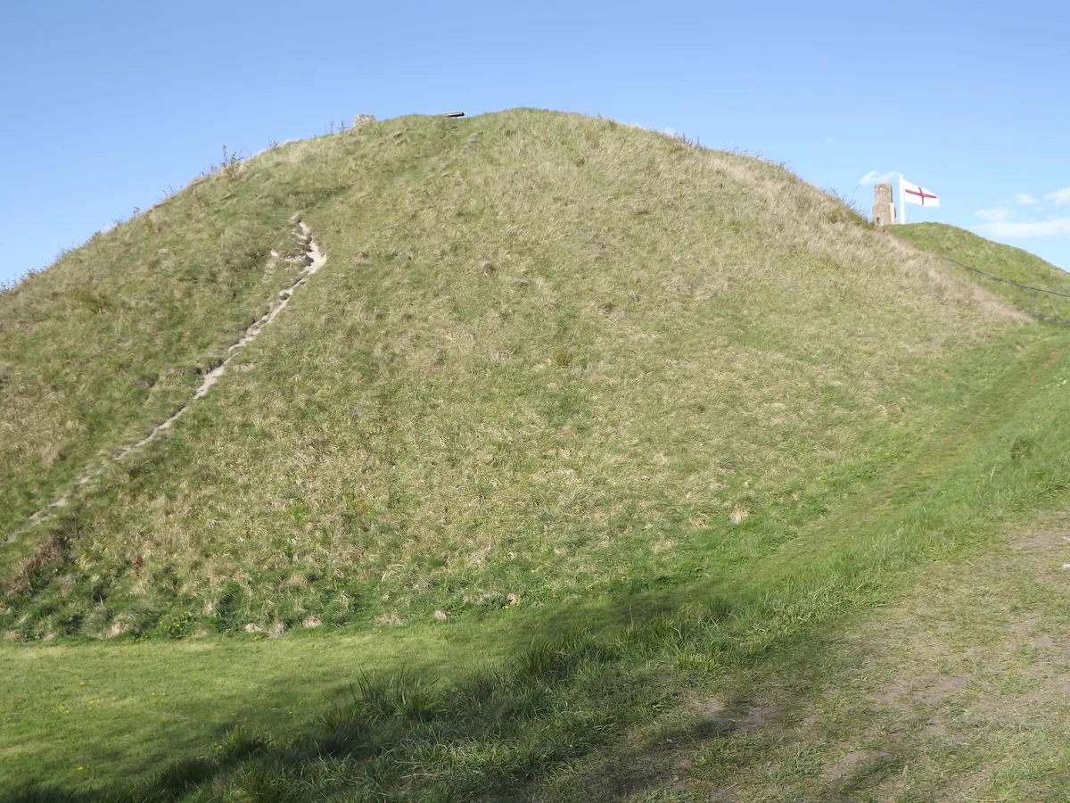
White Sheet Hill
White Sheet Hill — Named summit at 245 m.

Wikimedia Commons contributors — see linked file page for photographer and licence licence
Plan your visit
- Typical visit
- 3 h–8 h
- Best time of year
- Late spring – early autumn (May–Oct)
- Nearest railway station
- Longleat · 8.5 km
- Free entry
- Dog-friendly
About
White Sheet Hill is a named summit in the United Kingdom. Wikidata describes it as: "Named summit at 245 m.". Coordinates: 51.1108°, -2.2819°.
Photo gallery
Protected designations
- Site of Special Scientific Interest: Whitesheet Hill SSSI
- Area of Outstanding Natural Beauty: Cranborne Chase & West Wiltshire Downs
Designations sourced from Natural England open data under OGL v3.
From the Wikipedia article
White Sheet Hill, also known as Whitesheet Hill, is a hill in the English county of Wiltshire. As one of the most westerly areas of downland in Britain the area is noted for its chalky farmland which contains a rich variety of rare and protected fauna and flora. The hill is also the site of a Neolithic causeway camp and barrows; and an Iron Age hill fort. The Roman road which runs along the hill was at one time the main route through the Selwood Forest. The hill is part of the Stourhead estate and has been in the ownership of the National Trust since 1946. The hill is the site of the 136.1 hectares (336 acres) Whitesheet Hill biological Site of Special Scientific Interest, notified in 1965. Both the National Trust and the Dutchy of Cornwall own land within Whitesheet Hill SSSI. White Sheet Hill is divided between the civil parishes of Kilmington, Mere and Stourton with Gasper. It is situated within the Cranborne Chase and West Wiltshire Downs Area of Outstanding Natural Beauty, and has extensive views over Somerset, Dorset and Wiltshire. It is home to White Sheet Radio Flying Club who use it as a slope soaring site for fun and competition flying.
Excerpt from Wikipedia under CC BY-SA 4.0. See the source article linked in Sources below.
- Coordinates
- 51.1108, -2.2819
- District
- Wiltshire
- Parish
- Stourton with Gasper
- Postcode
- BA12 6QQ
- Parliamentary constituency
- South West Wiltshire
- Nearest railway station
- Longleat — 8.5 km
Sources
- osm: n8278683776 (ODbL)
- wikipedia: White Sheet Hill (CC BY-SA 4.0)
- commons: Whitesheet hill.jpg (CC BY-SA 4.0)
Other places nearby
Loading nearby places…
Nearby
Vineyards · South East England
White Sheet camp
White Sheet camp — a UK vineyard in england south east, producing English or Welsh wine from cool-climate grape varieties.
 📷 5
📷 5Castles · South East England
White Sheet Castle
White Sheet Castle — a castle in england-south-east, United Kingdom.
 📷 5
📷 5Memorials & monuments · South East England
Sir Winston Churchill
Sir Winston Churchill — a memorial in england-south-east, United Kingdom.
 📷 5
📷 5Castles · South East England
Mere Castle
Mere Castle — a castle in england-south-east, United Kingdom.
 📷 5
📷 5Castles · South East England
Castle Hill
Castle Hill — castle in Mere, Wiltshire.
 📷 5
📷 5Museums · South East England
Visit Hillbrush
Visit Hillbrush — a museum in england-south-east, United Kingdom.
More mountains in this region
 📷 5
📷 5Mountains & hills · South East England
Alum Bay
Alum Bay is a mountain or hill in the United Kingdom.
 📷 5
📷 5Mountains & hills · South East England
Arish Mell
Arish Mell — bay in Dorset, England.
 📷 5
📷 5Mountains & hills · South East England
Balaclava Bay
Balaclava Bay — bay in Dorset, England.
 📷 5
📷 5Mountains & hills · South East England
Balch Cave
Balch Cave — Cave in Somerset, England.
Frequently asked questions
- Where is White Sheet Hill?
- White Sheet Hill is in South-East England, United Kingdom (postcode BA12 6QQ), in the parish of Stourton with Gasper.
- Is White Sheet Hill a protected site?
- Yes — White Sheet Hill is part of the Whitesheet Hill SSSI Site of Special Scientific Interest and the Cranborne Chase & West Wiltshire Downs National Landscape (AONB).
- Is White Sheet Hill free to visit?
- Yes, White Sheet Hill is free to enter.
- How do I get to White Sheet Hill?
- Drivers can navigate to postcode BA12 6QQ. It sits within the South West Wiltshire parliamentary constituency.