Towns & cities · South East England
West Knighton
Also known as: West Knighton, Dorset
West Knighton — village and civil parish in Dorset, England, UK.

Wikimedia Commons contributors — see linked file page for photographer and licence licence
Plan your visit
- Typical visit
- 3 h–6 h
- Nearest railway station
- Dorchester South · 4.6 km
- Free entry
- Family-friendly
- Dog-friendly
About
West Knighton is a town, city, village or settlement in the United Kingdom. Recent population estimates put it at around 246 people. Wikidata describes it as: "village and civil parish in Dorset, England, UK". Coordinates: 50.6880°, -2.3810°.
Photo gallery
Protected designations
- Site of Special Scientific Interest: River Frome SSSI
- Area of Outstanding Natural Beauty: Dorset
Designations sourced from Natural England open data under OGL v3.
From the Wikipedia article
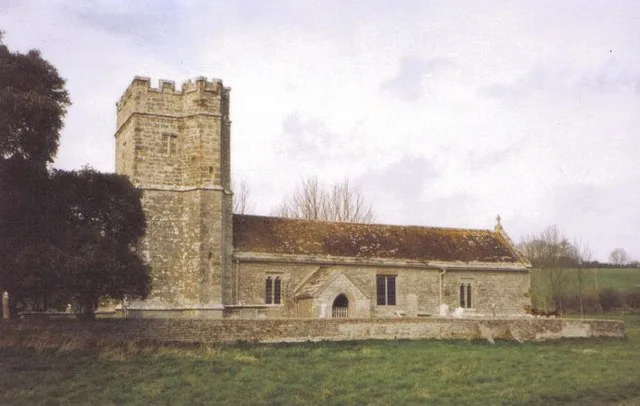
West Knighton is a village and civil parish in Dorset, England, situated 3 miles (4.8 km) southeast of the county town Dorchester. It has an 11th-century church and a village pub. In the 2011 census the civil parish had a population of 375. The village name derives from the Old English cniht and tūn, meaning the village or farmstead of the young men or retainers. At Little Mayne Farm 0.5 miles (0.80 km) southwest of the village is the site of a deserted medieval village, which was recorded in the Domesday Book as Maine and in 1201 was known as Parva Maene. West Knighton parish historically developed out of the amalgamation of four medieval settlements within the ancient hundred of Cullifordtree: the existing main village, the previously mentioned Parva Maene, another medieval settlement at Friarmayne to the south—also deserted and now within neighbouring Broadmayne civil parish—and the fourth at Lewell to the north (now just a farmhouse).
Excerpt from Wikipedia under CC BY-SA 4.0. See the source article linked in Sources below.
- Coordinates
- 50.6880, -2.3810
- District
- Dorset
- Parish
- West Knighton
- Postcode
- DT2 8PF
- Parliamentary constituency
- West Dorset
- Population
- 246
- Nearest railway station
- Dorchester South — 4.6 km
- Official site
- www.neighbourhood.statistics.gov.uk
Sources
- wikidata: Q1847682 (CC0)
- wikipedia: West Knighton, Dorset (CC BY-SA 4.0)
- commons: West Knighton, Church Cottage - geograph.org.uk - 532876.jpg (CC BY-SA 4.0)
Other places nearby
Loading nearby places…
Nearby
 📷 5
📷 5Stone circles · South East England
Mayne Stone Circle
Mayne Stone Circle — a stone circle in england-south-east, United Kingdom.
 📷 4
📷 4Abbeys & priories · South East England
Mayne Preceptory
Mayne Preceptory — monastery in Dorset, England, UK.
📷 4Manor houses · South East England
Fryer Mayne Manor
Fryer Mayne Manor — Grade II listed building-listed manor in england-south-east, United Kingdom.
Vineyards · South East England
Medieval settlement remains at Whitcombe
Medieval settlement remains at Whitcombe — a UK vineyard in england south east, producing English or Welsh wine from cool-climate grape varieties.
 📷 5
📷 5Historic churches · South East England
Whitcombe Church
Whitcombe Church — church in Whitcombe, Dorset, England, UK.
 📷 5
📷 5Parks · South East England
Dorset Falconry Park
Dorset Falconry Park — a other in england-south-east, United Kingdom.
More towns in this region
 Flagship📷 10
Towns & cities · South East England
Aldermaston
Aldermaston — village and civil parish in West Berkshire in England, UK.
 Flagship📷 10
Towns & cities · South East England
Aldingbourne
Aldingbourne — village and civil parish in Arun, West Sussex, UK.
 Flagship📷 10
Towns & cities · South East England
Aldington
Aldington — village and civil parish in the Ashford District of Kent, England.
 Flagship📷 10
Towns & cities · South East England
Aldworth
Aldworth — village and civil parish in the English county of Berkshire.
Frequently asked questions
- Where is West Knighton?
- West Knighton is in South-East England, United Kingdom (postcode DT2 8PF), in the parish of West Knighton.
- Is West Knighton a protected site?
- Yes — West Knighton is part of the River Frome SSSI Site of Special Scientific Interest and the Dorset National Landscape (AONB).
- Is West Knighton free to visit?
- Yes, West Knighton is free to enter.
- How do I get to West Knighton?
- The nearest railway station is Dorchester South, about 4.6 km away. Drivers can navigate to postcode DT2 8PF.