Archaeological sites · South East England
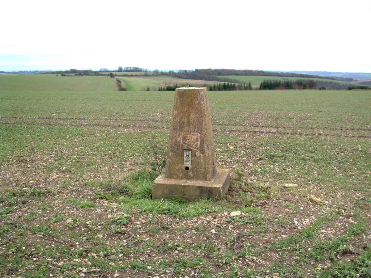
Wansdyke, section 530yds (490m) on W side of Old Dyke Lane
Wansdyke, section 530yds (490m) on W side of Old Dyke Lane — archaeological site in Inkpen, West Berkshire, England, UK.

Wikimedia Commons contributors — see linked file page for photographer and licence licence
Plan your visit
- Typical visit
- 45 min–1.5 h
- Nearest railway station
- Hungerford · 4.9 km
- Free entry
- Dog-friendly
About
Wansdyke, section 530yds (490m) on W side of Old Dyke Lane is a place of interest in South-East England. Officially recognised as scheduled monument. The site is within the Cotswolds National Landscape (AONB). It sits within the Newbury parliamentary constituency. The nearest railway station is Hungerford, about 4.9 km away. Postcode area RG17.
Photo gallery
Protected designations
- Area of Outstanding Natural Beauty: Cotswolds
- Area of Outstanding Natural Beauty: North Wessex Downs
Designations sourced from Natural England open data under OGL v3.
Place summary
Wansdyke is an archaeological site located in Inkpen, South-East England, specifically 530 yards (490 metres) on the west side of Old Dyke Lane. This scheduled monument is situated within the Areas of Outstanding Natural Beauty of the Cotswolds and North Wessex Downs.
AI-generated from the structured facts on this page (operator, designation, listing, era). Not a substitute for visiting.
- Coordinates
- 51.3718, -1.4962
- District
- West Berkshire
- Parish
- Inkpen
- Postcode
- RG17 9DU
- Parliamentary constituency
- Newbury
- Nearest railway station
- Hungerford — 4.9 km
Sources
- wikidata: Q17642282 (CC0)
- commons: Wansdyke, Old Dyke Lane, Inkpen 03.jpg (CC BY-SA 4.0)
Other places nearby
Loading nearby places…
Nearby
 📷 5
📷 5Historic houses · South East England
Inkpen House
Inkpen House — house in Inkpen, West Berkshire, England, UK.
 📷 5
📷 5Forests & woodlands · South East England
Inkpen Crocus Field
Inkpen Crocus Field is a forest or woodland in the United Kingdom.
 📷 5
📷 5Mountains & hills · South East England
Inkpen Hill
Inkpen Hill — Named summit at 291.1 m.
 📷 5
📷 5Other places · South East England
Combe Gibbet
Combe Gibbet is a gibbet at the top of Gallows Down, near the village and just within the civil parish of Combe in Berkshire (formerly Hampshire), England.
 Flagship📷 9
Towns & cities · South East England
Inkpen
Inkpen — village and civil parish in Berkshire, UK.
 📷 5
📷 5Historic houses · South East England
Dove's House
Dove's House — house in Ham, Wiltshire, England, UK.
More archaeological sites in this region
 Flagship📷 6
Archaeological sites · South East England
America Wood
America Wood — biological Site of Special Scientific Interest on the Isle of Wight.
 Flagship📷 10
Archaeological sites · South East England
Bisham Woods
Bisham Woods — woodland in Berkshire, England.
 Flagship📷 10
Archaeological sites · South East England
Savernake Forest
Savernake Forest — 4500 acre forest in Wiltshire, England.
 📷 5
📷 5Archaeological sites · South East England
A quadrangular castle and its landscaped setting, an associated millpond, medieval crofts and cultivation earthworks, and a World War II pillbox at Bodiam
A quadrangular castle and its landscaped setting, an associated millpond, medieval crofts and cultivation earthworks, and a World War II pillbox at Bodiam — archaeological site in Bodiam, Rother, England, UK.
Frequently asked questions
- Where is Wansdyke, section 530yds (490m) on W side of Old Dyke Lane?
- Wansdyke, section 530yds (490m) on W side of Old Dyke Lane is in South-East England, United Kingdom (postcode RG17 9DU), in the parish of Inkpen.
- Is Wansdyke, section 530yds (490m) on W side of Old Dyke Lane a listed building?
- Wansdyke, section 530yds (490m) on W side of Old Dyke Lane is officially recognised as scheduled monument listed.
- Is Wansdyke, section 530yds (490m) on W side of Old Dyke Lane a protected site?
- Yes — Wansdyke, section 530yds (490m) on W side of Old Dyke Lane is part of the Cotswolds National Landscape (AONB) and the North Wessex Downs National Landscape (AONB).
- How do I get to Wansdyke, section 530yds (490m) on W side of Old Dyke Lane?
- The nearest railway station is Hungerford, about 4.9 km away. Drivers can navigate to postcode RG17 9DU.