Archaeological sites · London
Piney Copse
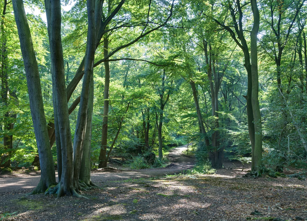
Piney Copse — woodland in Surrey, England.

Wikimedia Commons contributors — see linked file page for photographer and licence licence
Plan your visit
- Typical visit
- 45 min–1.5 h
- Nearest railway station
- Gomshall · 0.5 km
- Free entry
- Dog-friendly
About
Piney Copse is an archaeological site in the United Kingdom. Wikidata describes it as: "woodland in Surrey, England". Coordinates: 51.2195°, -0.4347°.
Photo gallery
Protected designations
- Area of Outstanding Natural Beauty: Surrey Hills
Designations sourced from Natural England open data under OGL v3.
From the Wikipedia article
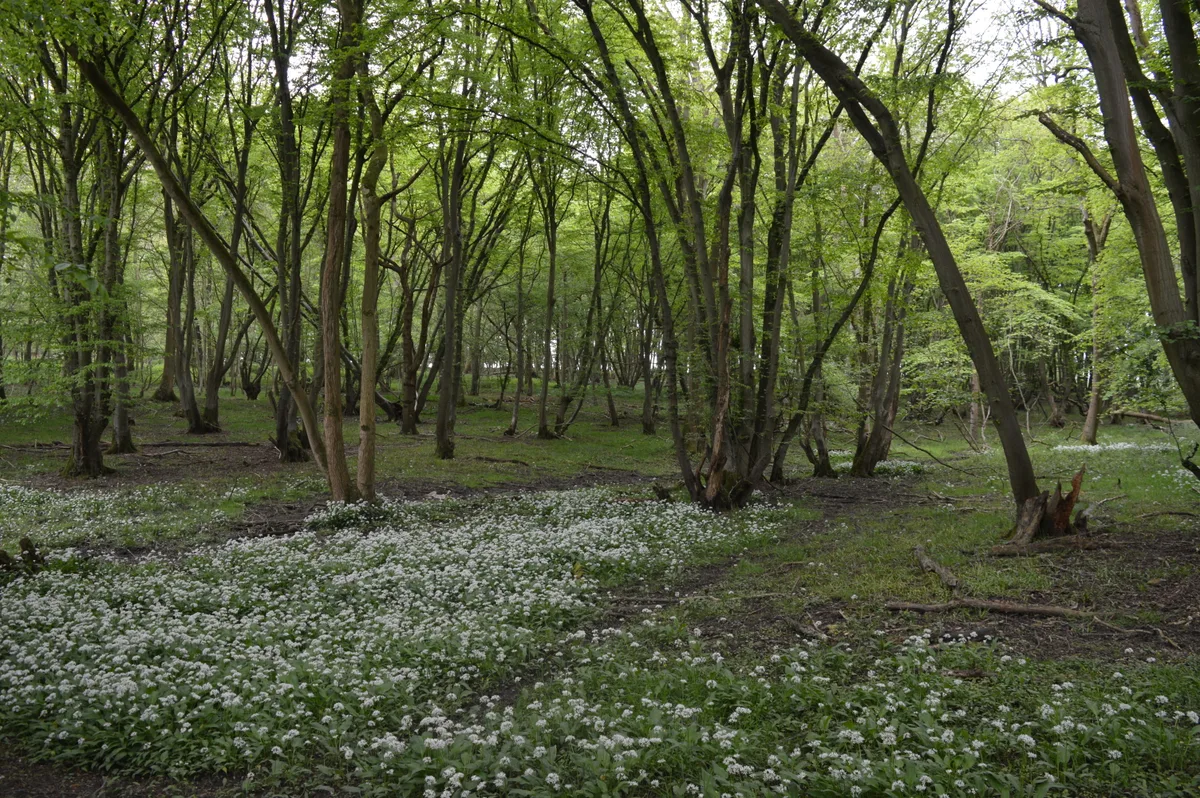
Piney Copse is 1.7 hectares (4.2 acres) of woodland located approximately 450 metres (1,480 ft) east of Gomshall railway station and north of the Surrey village of Abinger Hammer. The copse is bisected by a public footpath. It was once owned by E. M. Forster, who used to live nearby and purchased the wood using funds from book sales - principally from A Passage to India - in order to prevent it from being developed into housing. When Forster died in 1970, he transferred ownership of the land in his will to the National Trust. In 1926 Forster wrote a short essay about Piney Copse in "Abinger Harvest", entitled "My Wood". The woodland is a secondary woodland comprising oaks, sweet chestnuts, and beech trees. The soil is freely draining, highly acidic, and loamy/sandy, sitting just south of a band of very chalky soils.
Excerpt from Wikipedia under CC BY-SA 4.0. See the source article linked in Sources below.
- Coordinates
- 51.2195, -0.4347
- County
- Surrey
- District
- Guildford
- Parish
- Shere
- Postcode
- RH5 6SD
- Parliamentary constituency
- Godalming and Ash
- Nearest railway station
- Gomshall — 0.5 km
Sources
- wikidata: Q24988372 (CC0)
- wikipedia: Piney Copse (CC BY-SA 4.0)
- commons: Piney Copse - geograph.org.uk - 668329.jpg (CC BY-SA 4.0)
Other places nearby
Loading nearby places…
Nearby
Mountain bike trails · London
BW 11
BW 11 — a mtb trail in england london.
Mountain bike trails · London
BW 11
BW 11 — a mtb trail in england london.
 📷 5
📷 5Natural landmarks · London
Abinger Hammer Clock
Abinger Hammer Clock — a other in england-london, United Kingdom.
 📷 5
📷 5Public art & sculpture · London
Abinger Hammer Village Sign
Abinger Hammer Village Sign — a public art in england-london, United Kingdom.
 📷 5
📷 5Manor houses · London
Tower Hill Manor
Tower Hill Manor — Grade II listed building-listed manor in england-london, United Kingdom.
 📷 5
📷 5Archaeological sites · London
Oxmoor Copse
Oxmoor Copse — woodland in Surrey, England.
More archaeological sites in this region
 Flagship📷 10
Archaeological sites · London
Epping Forest
Epping Forest — royal forest in England.
 Flagship📷 10
Archaeological sites · London
Grangewood Park
Grangewood Park — park in the United Kingdom.
 Flagship📷 10
Archaeological sites · London
Nunn Wood
Nunn Wood — woods in Essex, England, a Site of Special Scientific Interest.
 📷 5
📷 5Archaeological sites · London
A Bronze Age post alignment and timber platform at Flag Fen and associated Bronze Age and later field systems and settlement to
A Bronze Age post alignment and timber platform at Flag Fen and associated Bronze Age and later field systems and settlement to — archaeological site in Thorney, City of Peterborough, England, UK.
Frequently asked questions
- Where is Piney Copse?
- Piney Copse is in Surrey, London, United Kingdom (postcode RH5 6SD), in the parish of Shere.
- Who owns Piney Copse?
- Piney Copse is owned by | website =.
- Is Piney Copse a protected site?
- Yes — Piney Copse is part of the Surrey Hills National Landscape (AONB).
- How do I get to Piney Copse?
- The nearest railway station is Gomshall, about 0.5 km away. Drivers can navigate to postcode RH5 6SD.