Towns & cities · South East England
Upton Scudamore
Upton Scudamore — village and civil parish in Wiltshire, UK.

Wikimedia Commons contributors — see linked file page for photographer and licence licence
Plan your visit
- Typical visit
- 3 h–6 h
- Nearest railway station
- Dilton Marsh · 2.5 km
- Free entry
- Family-friendly
- Dog-friendly
About
Upton Scudamore is a town, city, village or settlement in the United Kingdom. Recent population estimates put it at around 286 people. Address: BA12. Wikidata describes it as: "village and civil parish in Wiltshire, UK". Coordinates: 51.2280°, -2.1940°.
Photo gallery
From the Wikipedia article
Upton Scudamore is a village and civil parish in Wiltshire, England. The village lies about 1.8 miles (3 km) north of the town of Warminster and about the same distance south of Westbury. The parish includes the hamlet of Halfway. The village occupies a ridge which is the watershed between tributaries of the Bristol Avon and those of the Hampshire Avon. Upton Cow Down rises above the village to the north-east, on the western edge of Salisbury Plain. Springs in the north of the parish are the source of the River Biss, known here as the Biss Brook.
Excerpt from Wikipedia under CC BY-SA 4.0. See the source article linked in Sources below.
Background
History
Several bowl barrows are evidence of Bronze Age activity in the area. In earlier centuries, the name of the village was often spelt Upton Skidmore. It appears on John Sexton's map of Wiltshire (1610) as simply Upton. A church school was built in 1839, enlarged in 1871, and closed in 1925 owing to falling pupil numbers. The village has a pub, the Angel Inn. An inn with the same name was operating in 1807, close to the site of the present establishment.
Sourced from Wikipedia under CC BY-SA 4.0.
- Coordinates
- 51.2280, -2.1940
- District
- Wiltshire
- Parish
- Upton Scudamore
- Postcode
- BA12
- Parliamentary constituency
- South West Wiltshire
- Population
- 286
- Nearest railway station
- Dilton Marsh — 2.5 km
- Official site
- www.uptonscudamore.org.uk
Sources
- wikidata: Q1215576 (CC0)
- wikipedia: Upton Scudamore (CC BY-SA 4.0)
- commons: Cattle pasture, Upton Scudamore - geograph.org.uk - 923787.jpg (CC BY-SA 4.0)
Other places nearby
Loading nearby places…
Nearby
 📷 5
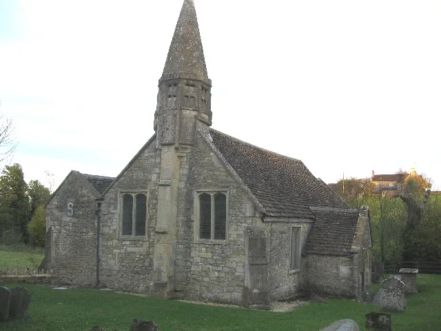
📷 5Historic churches · South East England
St Mary's Church, Old Dilton
St Mary's Church, Old Dilton — church in Dilton Marsh, UK.
 📷 5
📷 5Memorials & monuments · South East England
Unidentified Monument In The Churchyard About 3 Metres South Of Church Of St Mary
Unidentified Monument In The Churchyard About 3 Metres South Of Church Of St Mary — Grade II listed building-listed memorial in england-south-east, United Kingdom.
 📷 5
📷 5Cathedrals · South East England
Warminster School
Warminster School — a school heritage in england-south-east, United Kingdom.
 📷 5
📷 5Historic houses · South East England
Byne House
Byne House — house in Warminster, Wiltshire, England, UK.
 📷 5
📷 5Gardens · South East England
Portway House
Portway House — a garden in england-south-east, United Kingdom.
_(geograph_6808156).jpg?width=1200) 📷 5
📷 5Historic houses · South East England
Boyer's House
Boyer's House — house in Westbury, Wiltshire, England, UK.
More towns in this region
 Flagship📷 10
Towns & cities · South East England
Aldermaston
Aldermaston — village and civil parish in West Berkshire in England, UK.
 Flagship📷 10
Towns & cities · South East England
Aldingbourne
Aldingbourne — village and civil parish in Arun, West Sussex, UK.
 Flagship📷 10
Towns & cities · South East England
Aldington
Aldington — village and civil parish in the Ashford District of Kent, England.
 Flagship📷 10
Towns & cities · South East England
Aldworth
Aldworth — village and civil parish in the English county of Berkshire.
Frequently asked questions
- Where is Upton Scudamore?
- Upton Scudamore is in South-East England, United Kingdom (postcode BA12), in the parish of Upton Scudamore.
- Is Upton Scudamore free to visit?
- Yes, Upton Scudamore is free to enter.
- How do I get to Upton Scudamore?
- The nearest railway station is Dilton Marsh, about 2.5 km away. Drivers can navigate to postcode BA12.