Towns & cities · South East England
Upper Beeding
Upper Beeding — village in West Sussex, England, UK.

Wikimedia Commons contributors — see linked file page for photographer and licence licence
Plan your visit
- Typical visit
- 3 h–6 h
- Nearest railway station
- Shoreham-by-Sea · 5.8 km
- Free entry
- Family-friendly
- Dog-friendly
About
Upper Beeding is a town, city, village or settlement in the United Kingdom. It covers approximately 19 km². Recent population estimates put it at around 3,763 people. Wikidata describes it as: "village in West Sussex, England, UK". Coordinates: 50.8823°, -0.3051°.
Photo gallery
From the Wikipedia article
Upper Beeding is a village and civil parish in the Horsham District of West Sussex, England. It is located at the northern end of the River Adur gap in the South Downs, four miles (6.4 km) north of Shoreham-by-Sea and has a land area of 1,877 hectares (4,640 acres). The site is a bridging point over the river: on the opposite bank are Bramber and Steyning, making the whole area somewhat built-up. The civil parish also includes the smaller village of Small Dole to the north (nearer to Henfield), and the village of Edburton to the northeast. Upper Beeding is on the northern edge of the South Downs National Park which was created in 2010. The South Downs Way and Monarch's Way long-distance footpaths run through the parish; the area is popular with walkers, cyclists and equestrians. It is also at the western end of the Beeding Hill to Newtimber Hill Site of Special Scientific Interest.
Excerpt from Wikipedia under CC BY-SA 4.0. See the source article linked in Sources below.
Background
History
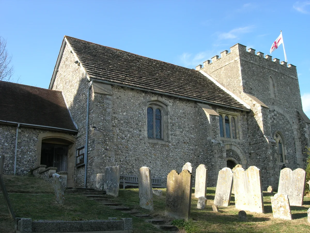
Church)]] The community was originally (and for the majority of its history) called Beeding, with the civil parish changing to Upper Beeding in modern times (date unknown). As is common in such cases, the ecclesiastical parish retains the original name (hence it is the parish of Beeding, and the parish church is Beeding Church). In the early 13th Century the monks of Sele Priory (St Peter's Church, Beeding) began a mission to the area of St Leonard's Forest near Horsham, and established a small mission base, naming it Lower Beeding. Despite being about 12 mi away, Lower Beeding remained a part of (Upper) Beeding parish until Victorian times. The existence of Lower Beeding led to…
Sourced from Wikipedia under CC BY-SA 4.0.
- Coordinates
- 50.8823, -0.3051
- County
- West Sussex
- District
- Horsham
- Parish
- Upper Beeding
- Postcode
- BN44 3WP
- Parliamentary constituency
- Arundel and South Downs
- Population
- 3,763
- Nearest railway station
- Shoreham-by-Sea — 5.8 km
- Official site
- www.upperbeeding-pc.gov.uk
Sources
- wikidata: Q846873 (CC0)
- wikipedia: Upper Beeding (CC BY-SA 4.0)
- commons: Upper Beeding Priory Church.jpg (CC BY-SA 4.0)
Other places nearby
Loading nearby places…
Nearby
 📷 5
📷 5Memorials & monuments · South East England
Upper Beeding War Memorial
Upper Beeding War Memorial — Grade II listed building-listed memorial in england-south-east, United Kingdom.
 Flagship📷 10
Towns & cities · South East England
Bramber
Bramber — village in West Sussex, England, UK.
 📷 5
📷 5Manor houses · South East England
Valerie Manor
Valerie Manor — Grade II listed building-listed manor in england-south-east, United Kingdom.
 📷 5
📷 5Hill forts · South East England
Bramber Castle
Bramber Castle — Norman castle in Bamber, West Sussex, England, UK.
 📷 5
📷 5Towns & cities · South East England
Botolphs
Botolphs — village in West Sussex, England, UK.
 📷 5
📷 5Historic churches · South East England
St Botolph's Church, Botolphs
St Botolph's Church, Botolphs — church in Botolphs, West Sussex, England, UK.
More towns in this region
 Flagship📷 10
Towns & cities · South East England
Aldermaston
Aldermaston — village and civil parish in West Berkshire in England, UK.
 Flagship📷 10
Towns & cities · South East England
Aldingbourne
Aldingbourne — village and civil parish in Arun, West Sussex, UK.
 Flagship📷 10
Towns & cities · South East England
Aldington
Aldington — village and civil parish in the Ashford District of Kent, England.
 Flagship📷 10
Towns & cities · South East England
Aldworth
Aldworth — village and civil parish in the English county of Berkshire.
Frequently asked questions
- Where is Upper Beeding?
- Upper Beeding is in West Sussex, South-East England, United Kingdom (postcode BN44 3WP), in the parish of Upper Beeding.
- Is Upper Beeding free to visit?
- Yes, Upper Beeding is free to enter.
- How do I get to Upper Beeding?
- The nearest railway station is Shoreham-by-Sea, about 5.8 km away. Drivers can navigate to postcode BN44 3WP.