Hill forts · Northern Ireland
Tullyhogue Fort
Also known as: Dún Thulaigh Óg
Tullyhogue Fort is a hill fort in the United Kingdom.

Wikimedia Commons contributors — see linked file page for photographer and licence licence
Plan your visit
- Typical visit
- 1 h–2 h
- Free entry
- Dog-friendly
About
Tullyhogue Fort is a hill fort in the United Kingdom. Coordinates: 54.6100°, -6.7231°. This entry is part of The Great Britain Guide, a free, ad-free, open-data tourist directory.
Photo gallery
From the Wikipedia article
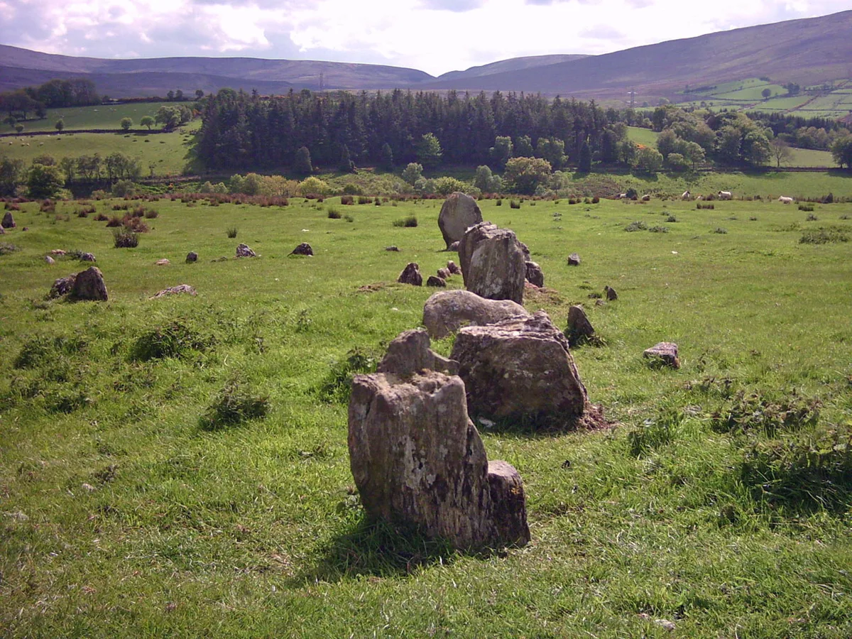
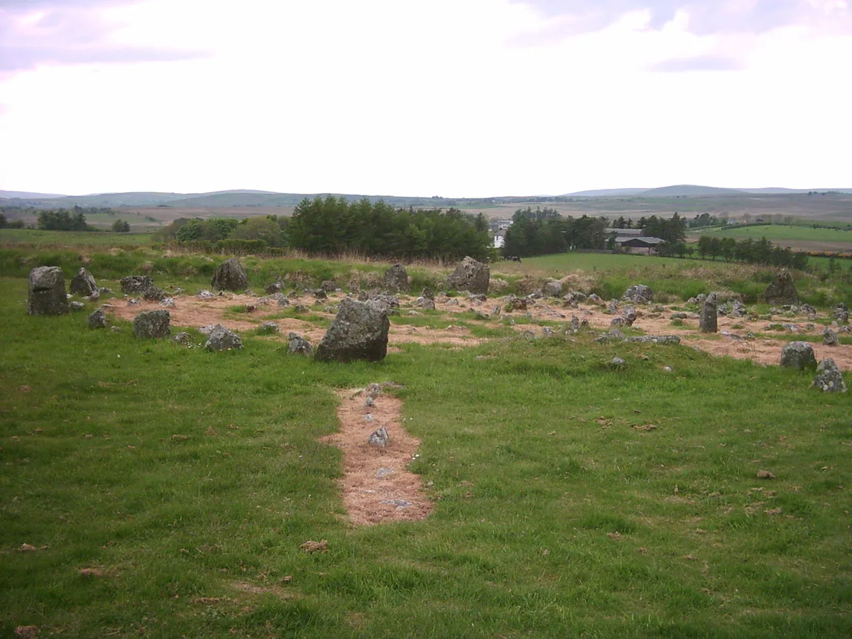
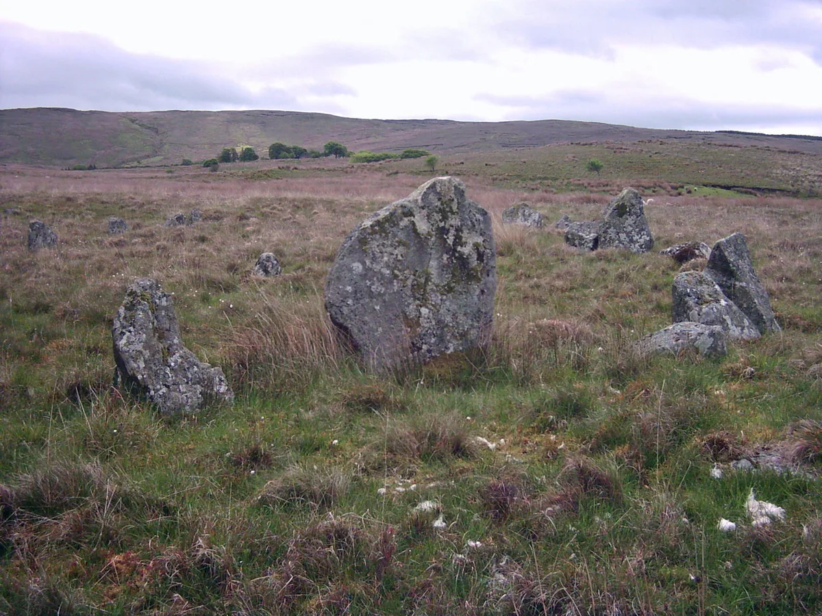
Tullyhogue Fort, also spelt Tullaghoge or Tullahoge (from Middle Irish Tulach Óc meaning "hill of youth" or "mound of the young warriors"), is a large mound on the outskirts of Tullyhogue village near Cookstown, County Tyrone, Northern Ireland. It has a depressed centre and is surrounded by trees. It is an ancient ceremonial site where the Chiefs of the Clan O'Neill of Tyrone were inaugurated. It is a State Care Historic Monument sited in the townland of Ballymully Glebe, in the Cookstown District Council area, at grid reference: H8250 7430. The inauguration site is a Scheduled Historic Monument at grid ref: H8251 7428.
Excerpt from Wikipedia under CC BY-SA 4.0. See the source article linked in Sources below.
Background
History
The date of the construction of Tullyhogue fort is not known; however, it is believed to have held great significance from early times, possessing a form of ritual importance long before the O'Neills became associated with the site. Tullyhogue ráth was originally associated with the Uí Tuirtri of Airgialla who were displaced by branches of the Cenél nEógain. The first to enter the area in the tenth-century were the who are described in their genealogies in the twelfth-century manuscript Rawlinson B 502 as of 'Tilcha Oc'. Over time they moved north into Glenconkeyne and Loughinsholin and were replaced by the Cenél Feargusa who included the O'Hagans, supporters of the O'Neill dynasty…
Sourced from Wikipedia under CC BY-SA 4.0.
- Coordinates
- 54.6100, -6.7231
- District
- Mid Ulster
- Postcode
- BT80 8UB
- Parliamentary constituency
- Mid Ulster
Sources
- wikidata: Q2459481 (CC0)
- wikipedia: Tullyhogue Fort (CC BY-SA 4.0)
- commons: Tullyhogue Fort - geograph.org.uk - 1598431.jpg (CC BY-SA 4.0)
Other places nearby
Loading nearby places…
Nearby
 📷 3
📷 3Archaeological sites · Northern Ireland
Tullaghoge Fort
Tullaghoge Fort — a archaeological in northern-ireland, United Kingdom.
📷 3Natural landmarks · Northern Ireland
Ballymully Glebe
Ballymully Glebe in Northern Ireland, United Kingdom.
 📷 4
📷 4Natural landmarks · Northern Ireland
Tullyhogue
Tullyhogue in Northern Ireland, United Kingdom.
 📷 2
📷 2Natural landmarks · Northern Ireland
Mid-Ulster Ladies F.C.
Mid-Ulster Ladies F.C. in Northern Ireland, United Kingdom.
📷 2Natural landmarks · Northern Ireland
Tullywiggan
Tullywiggan in Northern Ireland, United Kingdom.
 📷 3
📷 3Natural landmarks · Northern Ireland
Desertcreat
Desertcreat in Northern Ireland, United Kingdom.
More places in this region
 📷 3
📷 3Hill forts · Northern Ireland
Aughlish
Aughlish — archaeological site in County Londonderry, Northern Ireland, England, UK.
 📷 3
📷 3Hill forts · Northern Ireland
Beaghmore
Beaghmore — complex of early Bronze Age megalithic features in Northern Ireland.
 📷 3
📷 3Hill forts · Northern Ireland
Corick
Corick — archaeological site in United Kingdom.
 📷 3
📷 3Hill forts · Northern Ireland
Craig Hill
Craig Hill is a hill fort in the United Kingdom.
Frequently asked questions
- Where is Tullyhogue Fort?
- Tullyhogue Fort is in Northern Ireland, United Kingdom (postcode BT80 8UB).
- Is Tullyhogue Fort free to visit?
- Yes, Tullyhogue Fort is free to enter.
- How do I get to Tullyhogue Fort?
- Drivers can navigate to postcode BT80 8UB. It sits within the Mid Ulster parliamentary constituency.