Beaches · Mid Wales
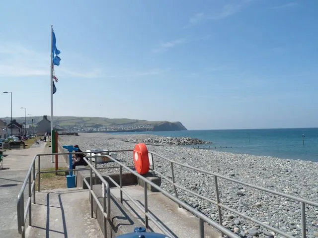
Traeth Mawr
Also known as: Traeth Mawr, Porthmadog
Traeth Mawr is a beach in the United Kingdom.

Alan Hughes — CC BY-SA 2.0 via Wikimedia Commons licence
Plan your visit
- Typical visit
- 1 h–3 h
- Best time of year
- Summer (Jun–Aug)
- Nearest railway station
- Fishguard Harbour · 6.5 km
- Free entry
- Family-friendly
- Dog-friendly
About
Traeth Mawr is a named beach on the United Kingdom coastline. Coordinates: 52.0237°, -4.8943°. This entry is part of The Great Britain Guide, a free, ad-free, open-data tourist directory.
Photo gallery
From the Wikipedia article
Traeth Mawr (Welsh for 'large beach') is a polder near Porthmadog in Gwynedd in Wales. The area was formerly the large tidal estuary of the Afon Glaslyn. It was created after large-scale land reclamation occurred in the late 18th and early 19th centuries. A large embankment, called the Cob, separates the area from the sea and carries a road and railway line.
Excerpt from Wikipedia under CC BY-SA 4.0. See the source article linked in Sources below.
- Coordinates
- 52.0237, -4.8943
- District
- Pembrokeshire
- Parish
- Dinas Cross
- Postcode
- SA42 0SN
- Parliamentary constituency
- Ceredigion Preseli
- Nearest railway station
- Fishguard Harbour — 6.5 km
Sources
- osm: w685193834 (ODbL)
- wikipedia: Traeth Mawr (CC BY-SA 4.0)
Other places nearby
Loading nearby places…
Nearby
 📷 3
📷 3Archaeological sites · Mid Wales
Saint Brynach's Belfry
Saint Brynach's Belfry — a archaeological in wales-mid, United Kingdom.
Caravan parks · Mid Wales
Cwm-yr-Eglwys Caravan Club
Cwm-yr-Eglwys Caravan Club — a caravan park in wales mid.
Campsites · Mid Wales
Dinas Island Campsite
Dinas Island Campsite — a campsite in wales mid.
 📷 3
📷 3Memorials & monuments · South East England
Dinas Island
Dinas Island (Welsh: Ynys Dinas) is a peninsula, partially detached from the mainland, in the community of Dinas Cross between Fishguard and Newport, Pembrokeshire, in southwest Wales. A triangulation
.jpg?width=1200) 📷 3
📷 3Chapels · Mid Wales
Brynhenllan Chapel
Brynhenllan Chapel — Calvinistic Methodist chapel in Brynhenllan.
 📷 3
📷 3Beaches · Mid Wales
Aberfforest Beach
Aberfforest Beach — Beach (pebblestone).
More beaches in this region
.jpg?width=1200) 📷 3
📷 3Beaches · Mid Wales
Aberdovey Bar
Aberdovey Bar is a beach in the United Kingdom.
📷 3Beaches · Mid Wales
Aberfforest Beach
Aberfforest Beach — Beach (pebblestone).
 📷 3
📷 3Beaches · Mid Wales
Bilis
Bilis is a beach in the United Kingdom.
 📷 3
📷 3Beaches · Mid Wales
Borth Beach
Borth Beach is a beach in the United Kingdom.
Frequently asked questions
- Where is Traeth Mawr?
- Traeth Mawr is in Mid Wales, United Kingdom (postcode SA42 0SN), in the parish of Dinas Cross.
- Is Traeth Mawr free to visit?
- Yes, Traeth Mawr is free to enter.
- How do I get to Traeth Mawr?
- The nearest railway station is Fishguard Harbour, about 6.5 km away. Drivers can navigate to postcode SA42 0SN.