Beaches · Mid Wales
Bilis
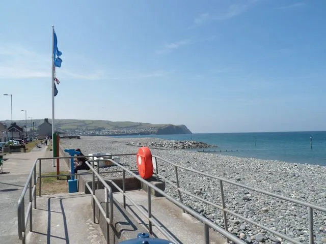
Bilis is a beach in the United Kingdom.

Dave Croker — CC BY-SA 2.0 via Wikimedia Commons licence
Plan your visit
- Typical visit
- 1 h–3 h
- Best time of year
- Summer (Jun–Aug)
- Free entry
- Family-friendly
- Dog-friendly
About
Bilis is a named beach on the United Kingdom coastline. Coordinates: 52.1686°, -4.4677°. This entry is part of The Great Britain Guide, a free, ad-free, open-data tourist directory.
Photo gallery
From the Wikipedia article
Bitlis (Armenian: Բաղեշ, romanized: Baghesh or Paghesh; Kurdish: Bidlîs; Arabic: بدليس) is a city in southeastern Turkey. It is the seat of Bitlis District and Bitlis Province. Its population is 53,023 (2021). The city is located at an elevation of 1,545 metres, 15 km from Lake Van, in the steep-sided valley of the Bitlis River, a tributary of the Tigris. The local economy is mainly based on agricultural products which include fruits, grain and tobacco. Industry is fairly limited, and deals mainly with leatherworking, manufacture of tobacco products as well as weaving and dyeing of coarse cloth. Bitlis is connected to other urban centres by road, including Tatvan on Lake Van, 25 km to the northeast, and the cities of Muş (Mush), 100 km northwest, and Diyarbakır, 200 km to the west. The climate of Bitlis can be harsh, with long winters and heavy snowfalls. Since the local elections of March 2019, the Mayor of Bitlis is Nesrullah Tanğlay. Bitlis has been identified in the scholarly literature as a historically Kurdish city. Martin van Bruinessen (2013), examining Kurdish urbanisation, noted the predominantly Kurdish character of Bitlis and its population. Demographic studies of Turkey's Kurdish-majority provinces have consistently identified Bitlis among the provinces with the highest concentrations of Kurdish speakers.
Excerpt from Wikipedia under CC BY-SA 4.0. See the source article linked in Sources below.
- Coordinates
- 52.1686, -4.4677
- District
- Ceredigion
- Parish
- Llangrannog
- Postcode
- SA44 6SF
- Parliamentary constituency
- Ceredigion Preseli
Sources
- osm: w743315007 (ODbL)
- wikipedia: Bilis (CC BY-SA 4.0)
Other places nearby
Loading nearby places…
Nearby
Vineyards · Mid Wales
Ynys Lochtyn
Ynys Lochtyn — a UK vineyard in wales mid, producing English or Welsh wine from cool-climate grape varieties.
 📷 3
📷 3Archaeological sites · Mid Wales
Ynys Lochtyn Defended Enclosure
Ynys Lochtyn Defended Enclosure — a archaeological in wales-mid, United Kingdom.
 📷 3
📷 3Archaeological sites · Mid Wales
Pendinaslochdyn
Pendinaslochdyn — a archaeological in wales-mid, United Kingdom.
Vineyards · Mid Wales
Pendinas Lochtyn
Pendinas Lochtyn — a UK vineyard in wales mid, producing English or Welsh wine from cool-climate grape varieties.
 📷 3
📷 3Beaches · Mid Wales
Traeth yr Ynys
Traeth yr Ynys is a beach in the United Kingdom.
 📷 5
📷 5Islands · Mid Wales
Ynys Lochtyn
Ynys Lochtyn in Wales Mid, United Kingdom.
More beaches in this region
.jpg?width=1200) 📷 3
📷 3Beaches · Mid Wales
Aberdovey Bar
Aberdovey Bar is a beach in the United Kingdom.
 📷 3
📷 3Beaches · Mid Wales
Aberfforest Beach
Aberfforest Beach — Beach (pebblestone).
 📷 3
📷 3Beaches · Mid Wales
Borth Beach
Borth Beach is a beach in the United Kingdom.
 📷 3
📷 3Beaches · Mid Wales
Cei-bâch / Little Quay
Cei-bâch / Little Quay is a beach in the United Kingdom.
Frequently asked questions
- Where is Bilis?
- Bilis is in Mid Wales, United Kingdom (postcode SA44 6SF), in the parish of Llangrannog.
- Is Bilis free to visit?
- Yes, Bilis is free to enter.
- How do I get to Bilis?
- Drivers can navigate to postcode SA44 6SF. It sits within the Ceredigion Preseli parliamentary constituency.