Towns & cities · Scottish Highlands
Tomintoul
Also known as: Tom an t-Sabhail
Tomintoul — village in Moray, Scotland, UK.

Wikimedia Commons contributors — see linked file page for photographer and licence licence
Plan your visit
- Typical visit
- 3 h–6 h
- Free entry
- Family-friendly
- Dog-friendly
About
Tomintoul is a town, city, village or settlement in the United Kingdom. Recent population estimates put it at around 716 people. Wikidata describes it as: "village in Moray, Scotland, UK". Coordinates: 57.2508°, -3.3781°.
Photo gallery
From the Wikipedia article
Tomintoul ( ; from Scottish Gaelic: Tom an t-Sabhail, meaning "Hillock of the Barn") is a village in the Moray council area of Scotland in the historic county of Banffshire. Within Cairngorms National Park, the village lies close to the banks of the River Avon and is said by some to be the highest village in the Scottish Highlands, although at 345 m (1,132 ft) it is still much lower than the highest village in Scotland (Wanlockhead, in Dumfries and Galloway at 466 m (1,529 ft)). By 1841, the parish reached a population of 1,722. In 1951, this had fallen to just 531. The 2011 census indicated a village population of 716 people. The village is historically part of the Parish of Kirmichael. The 2004 film One Last Chance, starring Kevin McKidd and Dougray Scott, was filmed in the village and the areas around it. The village is on the famed Malt Whisky Trail, which also includes Dufftown, Keith, Tomnavoulin, and Marypark. The surrounding countryside forms the Glenlivet Estate. Tomintoul Golf Club, founded in 1897, disappeared at the time of World War II.
Excerpt from Wikipedia under CC BY-SA 4.0. See the source article linked in Sources below.
Background
History
The village was laid out on a grid pattern by Alexander Gordon, 4th Duke of Gordon in 1775. It followed the construction, 20 years previously, of a military road by William Caulfeild now the A939. The duke's motivation for his efforts was the hope that a permanent settlement would minimise cattle theft and illegal distilling of spirits in the area. Estimates suggest that in the early 1700s there had been up to 200 illicit stills in the Livet glen, with spirits smuggled out over the Ladder hills. In this "model village", he encouraged the production of linen but this plan was not successful; the locals stuck to subsistence agriculture, growing vegetables and raising cattle. A report in 1797…
Sourced from Wikipedia under CC BY-SA 4.0.
- Coordinates
- 57.2508, -3.3781
- District
- Moray
- Postcode
- AB37 9EE
- Parliamentary constituency
- Moray West, Nairn and Strathspey
- Population
- 716
Sources
- wikidata: Q1236329 (CC0)
- wikipedia: Tomintoul (CC BY-SA 4.0)
- commons: Tomintoul.jpg (CC BY-SA 4.0)
Other places nearby
Loading nearby places…
Nearby
 📷 5
📷 5Historic churches · Scottish Highlands
St Michael's Roman Catholic Chapel, Tomintoul
St Michael's Roman Catholic Chapel, Tomintoul — category B listed building-listed church in scotland-highlands, United Kingdom.
Hostels · Scottish Highlands
The Smugglers Hostel
The Smugglers Hostel — a hostel in scotland highlands.
 📷 3
📷 3Museums · Scottish Highlands
Tomintoul and Glenlivet Discovery Centre
Tomintoul and Glenlivet Discovery Centre — a museum in scotland-highlands, United Kingdom.
 📷 5
📷 5Historic churches · Scottish Highlands
Tomintoul Parish Church and Burial Ground, Main Street, Tomintoul
Tomintoul Parish Church and Burial Ground, Main Street, Tomintoul — category B listed building-listed church in scotland-highlands, United Kingdom.
 📷 3
📷 3Historic bridges · Scottish Highlands
Conglass Bridge
Conglass Bridge is a historic bridge in the United Kingdom.
 📷 3
📷 3Viewpoints · Scottish Highlands
The Queen Victoria viewpoint
The Queen Victoria viewpoint is a viewpoint in the United Kingdom.
More towns in this region
 Flagship📷 3
Towns & cities · Scottish Highlands
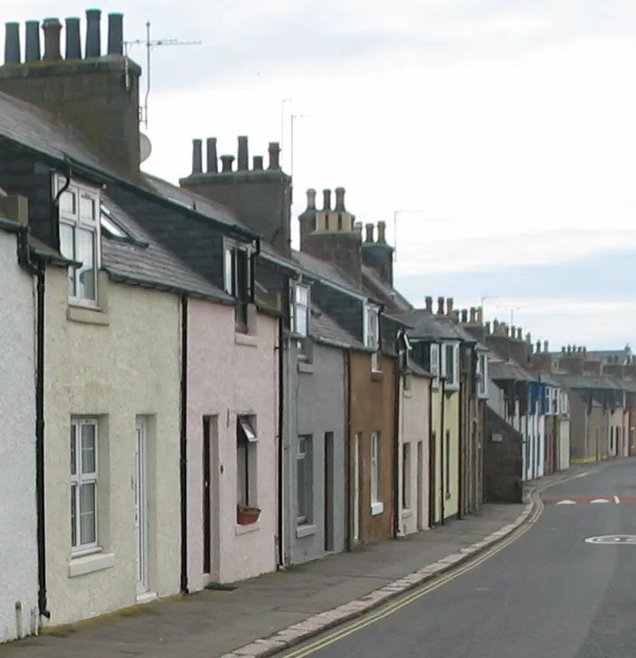
Cruden Bay
Cruden Bay — village in Aberdeenshire, Scotland, UK.
 Flagship📷 3
Towns & cities · Scottish Highlands
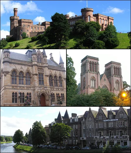
Inverness
Inverness — city in the Highlands of Scotland, United Kingdom.
 Flagship📷 3
Towns & cities · Scottish Highlands
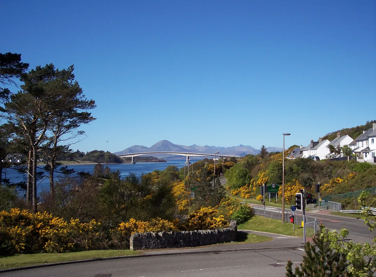
Kyle of Lochalsh
Kyle of Lochalsh — village in Highland, Scotland, UK.
 📷 4
📷 4Towns & cities · Scottish Highlands
Aberchirder
Aberchirder — village in Aberdeenshire, Scotland, UK.
Frequently asked questions
- Where is Tomintoul?
- Tomintoul is in the Scottish Highlands, United Kingdom (postcode AB37 9EE).
- Is Tomintoul free to visit?
- Yes, Tomintoul is free to enter.
- How do I get to Tomintoul?
- Drivers can navigate to postcode AB37 9EE. It sits within the Moray West, Nairn and Strathspey parliamentary constituency.