Wildlife reserves · East Midlands
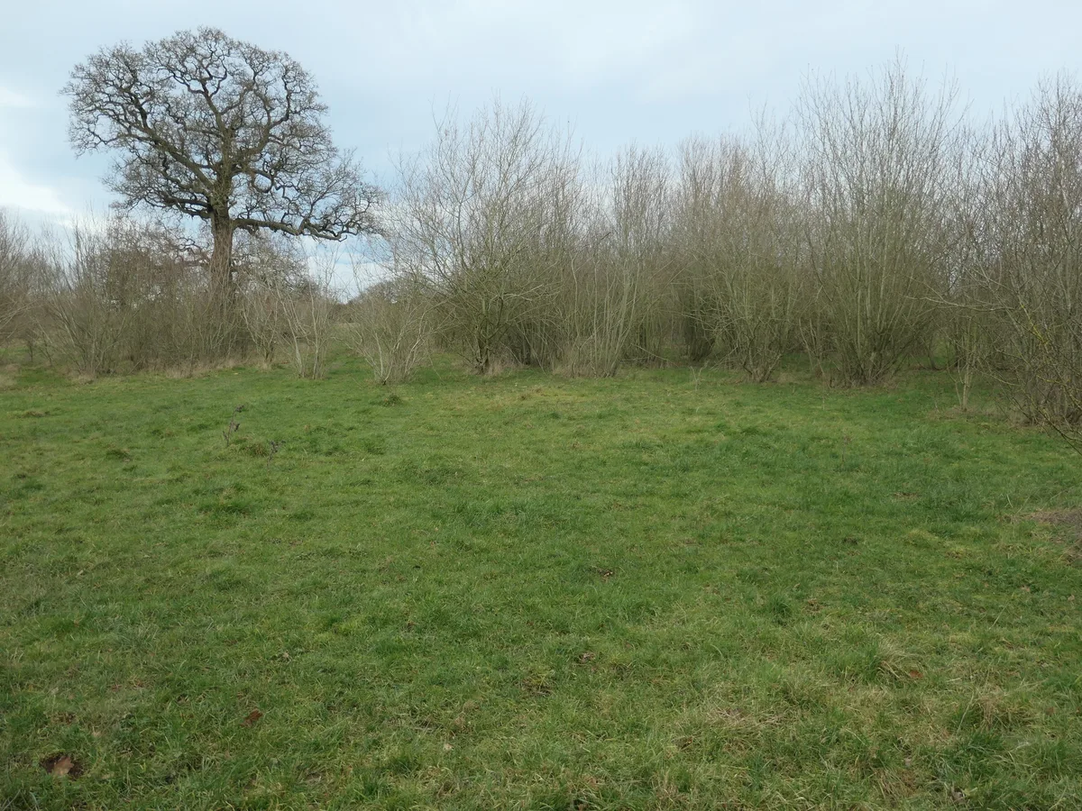
Thorswood
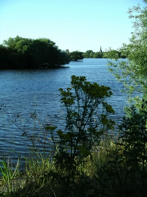
Thorswood — nature reserve in Staffordshire, UK.

Wikimedia Commons contributors — see linked file page for photographer and licence licence
Plan your visit
- Typical visit
- 2 h–4 h
- Best time of year
- Autumn & winter (migration & wildfowl)
- Nearest railway station
- Alton Towers Car Park · 4.9 km
- Free entry
- Family-friendly
- Dog-friendly
- Limited wheelchair access
About
Thorswood is a wildlife reserve in the United Kingdom. Heritage designation: Site of Special Scientific Interest. Managed by Staffordshire Wildlife Trust. Wikidata describes it as: "nature reserve in Staffordshire, UK". Coordinates: 53.0200°, -1.8320°.
Photo gallery
Protected designations
- Site of Special Scientific Interest: Stanton Pastures & Cuckoocliff Valley SSSI
Designations sourced from Natural England open data under OGL v3.
From the Wikipedia article
Thorswood is a nature reserve of the Staffordshire Wildlife Trust, situated in the Weaver Hills near the village of Stanton, in Staffordshire, England. It is a Site of Special Scientific Interest.
Excerpt from Wikipedia under CC BY-SA 4.0. See the source article linked in Sources below.
Background
History
There are three Bronze Age bowl barrows within the reserve; they are scheduled monuments. Lead mining, dating back to the 17th century, took place at Thorswood; the remains of this activity survive in parts of the reserve as extensive hillocks, up to 3 m high, and a number of shafts have been identified. The remains are a scheduled monument. Visitors to the reserve are advised to keep to the marked trails where indicated, in order to avoid mineshafts.
Description
Its area is 81 ha; the terrain is steep in places. There are hay meadows on low-lying ground, where ox-eye daisy, knapweed and betony may be found with the tall grasses. On the limestone grassland of the higher ground, there are low-growing flowering plants including salad burnet, cowslip and wild thyme. Instead of intensive farming practices, there is light grazing and traditional farming techniques, some fields being mown to make hay; the grazing and mowing prevents the grass becoming overgrown and smothering the rarer plants.
Sourced from Wikipedia under CC BY-SA 4.0.
- Coordinates
- 53.0200, -1.8320
- County
- Staffordshire
- District
- East Staffordshire
- Parish
- Stanton
- Postcode
- DE6 2BY
- Parliamentary constituency
- Burton and Uttoxeter
- Nearest railway station
- Alton Towers Car Park — 4.9 km
- Opening
- | website = [https://www.staffs-wildlife.org.uk/nature-reserves/thorswood Thorswood]
- Official site
- www.staffs-wildlife.org.uk
Sources
- wikidata: Q99756470 (CC0)
- wikipedia: Thorswood (CC BY-SA 4.0)
- commons: Thorswood path.jpg (CC BY-SA 4.0)
Other places nearby
Loading nearby places…
Nearby
Campsites · East Midlands
Common End Farm
Common End Farm — a campsite in england east midlands.
 📷 5
📷 5Caves · East Midlands
Waterways Swallet
Waterways Swallet — a cave broad in england-east-midlands, United Kingdom.
 📷 3
📷 3Historic churches · East Midlands
Church of St Bartholomew, Blore
Church of St Bartholomew, Blore — Grade I listed building-listed church in england-east-midlands, United Kingdom.
 📷 3
📷 3Historic bridges · East Midlands
Tit Bridge And Flanking Causeway
Tit Bridge And Flanking Causeway — Grade II listed building-listed bridge in england-east-midlands, United Kingdom.
 📷 3
📷 3Manor houses · East Midlands
Wootton Lodge
Wootton Lodge — a manor in england-east-midlands, United Kingdom.
 📷 3
📷 3Memorials & monuments · East Midlands
Service Wing And Tower To North Of Mayfield Hall
Service Wing And Tower To North Of Mayfield Hall — Grade II listed building-listed memorial in england-east-midlands, United Kingdom.
More places run by Staffordshire Wildlife Trust
 📷 5
📷 5Wildlife reserves · East Midlands
Black Brook
Black Brook — nature reserve in Staffordshire, UK.
 📷 3
📷 3Wildlife reserves · East Midlands
Brankley Pastures
Brankley Pastures — nature reserve in Staffordshire, UK.
 📷 3
📷 3Wildlife reserves · East Midlands
Brown End Quarry
Brown End Quarry — nature reserve in Staffordshire, England.
 📷 3
📷 3Wildlife reserves · East Midlands
Castern Wood
Castern Wood — nature reserve in Staffordshire, UK.
More places in this region
 Flagship📷 5
Wildlife reserves · East Midlands
Cley Marshes
Cley Marshes — nature reserve on the North Sea coast of England.
 Flagship📷 5
Wildlife reserves · East Midlands
Salthouse Marshes
Salthouse Marshes — nature reserve in Norfolk, England.
 📷 3
📷 3Wildlife reserves · East Midlands
Titchwell Marsh
Titchwell Marsh — nature reserve in the United Kingdom.
 📷 5
📷 5Wildlife reserves · East Midlands
Attenborough Nature Reserve
Attenborough Nature Reserve — nature reserve in the United Kingdom.
Frequently asked questions
- Where is Thorswood?
- Thorswood is in Staffordshire, the East Midlands, United Kingdom (postcode DE6 2BY), in the parish of Stanton.
- Who runs Thorswood?
- Thorswood is operated by Staffordshire Wildlife Trust.
- Is Thorswood a listed building?
- Thorswood is officially recognised as Site of Special Scientific Interest listed.
- Is Thorswood a protected site?
- Yes — Thorswood is part of the Stanton Pastures & Cuckoocliff Valley SSSI Site of Special Scientific Interest.
- Is Thorswood free to visit?
- Yes, Thorswood is free to enter.
- How do I get to Thorswood?
- The nearest railway station is Alton Towers Car Park, about 4.9 km away. Drivers can navigate to postcode DE6 2BY.