Towns & cities · South West England
Thorncombe
Thorncombe — village and civil parish in Dorset, UK.

Wikimedia Commons contributors — see linked file page for photographer and licence licence
Plan your visit
- Typical visit
- 3 h–6 h
- Nearest railway station
- Crewkerne · 9.2 km
- Free entry
- Family-friendly
- Dog-friendly
About
Thorncombe is a town, city, village or settlement in the United Kingdom. Recent population estimates put it at around 600 people. Wikidata describes it as: "village and civil parish in Dorset, UK". Coordinates: 50.8257°, -2.8853°.
Photo gallery
Protected designations
- Area of Outstanding Natural Beauty: Dorset
Designations sourced from Natural England open data under OGL v3.
From the Wikipedia article
Thorncombe is a village and civil parish in the English county of Dorset. It was historically, until 1844, an exclave of Devon. It lies five miles (8 km) south east of the town of Chard in neighbouring Somerset. Thorncombe is situated close to the borders of both Somerset and Devon. In the 2011 census the population of the civil parish was 687.
Excerpt from Wikipedia under CC BY-SA 4.0. See the source article linked in Sources below.
Background
History
The original church at Thorncombe was dedicated to St Mary by William Brewer, Bishop of Exeter, in 1239. The building of the church, as well as nearby Forde Abbey (founded in 1136), was superintended by Cistercian monks from Waverley, Surrey. Thomas Chard, alias Tyblis, the last Abbot, was Suffragan Bishop to the Bishop of Exeter from 1508 and was appointed Vicar of Thorncombe in 1529, 10 years before he left Forde Abbey at the Dissolution of the Monasteries in 1539. Local legend has it that Rev. John Bragge, Vicar of Thorncombe from 1644 to 1647, was deprived of his living, probably because he was involved in a royalist plot against Cromwell, and was transported to Barbados. Although this…
Description
Approximately half of the population of the parish live in the village of Thorncombe, the rest are divided between the hamlets of Holditch, Hewood and Synderford, and outlying farms and houses. The layout of Thorncombe village consists of three roads which meet at a "T" in the middle of the village. These roads are Chard Street, Fore Street and High Street. Chard Street heads north to the Somerset town of Chard. Chard Street is probably the busiest road with the Village Hall, St Mary's Primary School and the housing estates of Gribb View and Tansee Hill. Gribb View breaks from the tradition of most of the village in being mostly brick or rendered buildings, the traditional build of the…
Sourced from Wikipedia under CC BY-SA 4.0.
- Coordinates
- 50.8257, -2.8853
- District
- Dorset
- Parish
- Thorncombe
- Postcode
- TA20 4PP
- Parliamentary constituency
- West Dorset
- Population
- 600
- Nearest railway station
- Crewkerne — 9.2 km
- Official site
- www.neighbourhood.statistics.gov.uk
Sources
- wikidata: Q1944795 (CC0)
- wikipedia: Thorncombe (CC BY-SA 4.0)
- commons: St Mary's Church Thorncombe - geograph.org.uk - 410088.jpg (CC BY-SA 4.0)
Other places nearby
Loading nearby places…
Nearby
 📷 4
📷 4Mountains & hills · South West England
Blackdown Hill, Dorset
Blackdown Hill, Dorset — a mountain in england-south-west, United Kingdom, 215 m.
 📷 5
📷 5Abbeys & priories · South West England
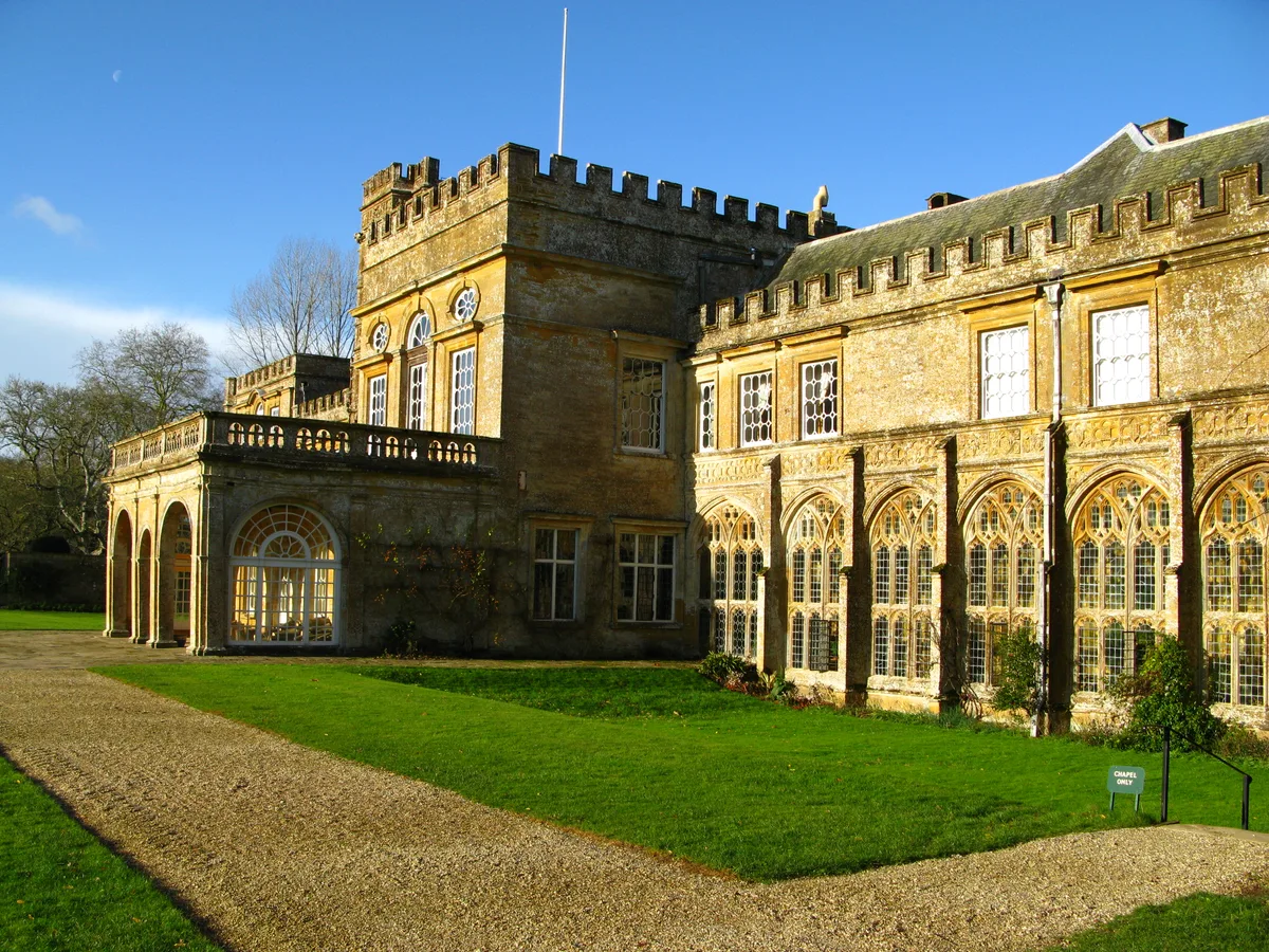
Forde Abbey
Forde Abbey — Grade I listed historic house museum in West Dorset, England, UK.
 📷 4
📷 4Cathedrals · South West England
Forde Abbey
Forde Abbey is a cathedral in the United Kingdom.
 📷 3
📷 3Historic bridges · South West England
Winsham Bridge (That Part In Winsham Civil Parish And Somerset County Council)
Winsham Bridge (That Part In Winsham Civil Parish And Somerset County Council) — Grade II listed building-listed bridge in england-south-west, United Kingdom.
 📷 3
📷 3Memorials & monuments · South West England
Marshwood War Memorial
Marshwood War Memorial — Grade II listed building-listed memorial in england-south-west, United Kingdom.
 Flagship📷 5
Stately homes · South West England
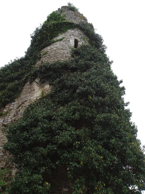
Holditch Court Tower
Holditch Court Tower — Grade I listed building in Thorncombe, Dorset, England, UK.
More towns in this region
 Flagship📷 10
Towns & cities · South West England
All Saints
All Saints — village and civil parish in Devon, England, UK.
 Flagship📷 10
Towns & cities · South West England
Axmouth
Axmouth — village and civil parish in Devon, England, UK.
 ★ Iconic📷 10
Towns & cities · South West England
Beer
Beer — village and civil parish in Devon, UK.
 Flagship📷 10
Towns & cities · South West England
Branscombe
Branscombe — village and civil parish in Devon, UK.
Frequently asked questions
- Where is Thorncombe?
- Thorncombe is in South-West England, United Kingdom (postcode TA20 4PP), in the parish of Thorncombe.
- Is Thorncombe a protected site?
- Yes — Thorncombe is part of the Dorset National Landscape (AONB).
- Is Thorncombe free to visit?
- Yes, Thorncombe is free to enter.
- How do I get to Thorncombe?
- Drivers can navigate to postcode TA20 4PP. It sits within the West Dorset parliamentary constituency.