Viewpoints · North West England
The Mushroom
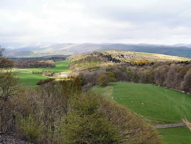
The Mushroom is a viewpoint in the United Kingdom.

Karl and Ali — CC BY-SA 2.0 via Wikimedia Commons licence
Plan your visit
- Typical visit
- 20 min–45 min
- Best time of year
- Clear days year-round
- Nearest railway station
- Kendal · 3.5 km
- Free entry
- Dog-friendly
About
The Mushroom is a named viewpoint in North-West England, marked on Ordnance Survey maps for its outlook. The site is a designated Site of Special Scientific Interest. It sits within the Westmorland and Lonsdale parliamentary constituency. The nearest railway station is Kendal, about 3.5 km away. Postcode area LA8.
Photo gallery
Protected designations
- Site of Special Scientific Interest: River Kent and Tributaries SSSI
- Site of Special Scientific Interest: Scout and Cunswick Scars SSSI
Designations sourced from Natural England open data under OGL v3.
From the Wikipedia article
A mushroom is the fruiting body of a fungus. Mushroom(s) or The Mushroom may also refer to:
Excerpt from Wikipedia under CC BY-SA 4.0. See the source article linked in Sources below.
- Coordinates
- 54.3208, -2.7908
- District
- Westmorland and Furness
- Parish
- Underbarrow and Bradleyfield
- Postcode
- LA8 8HB
- Parliamentary constituency
- Westmorland and Lonsdale
- Nearest railway station
- Kendal — 3.5 km
- Official site
- en.wikipedia.org
Sources
- osm: w1111711440 (ODbL)
- wikipedia: The Mushroom (CC BY-SA 4.0)
Other places nearby
Loading nearby places…
Nearby
 📷 3
📷 3Natural landmarks · North West England
Cunswick Scar
Cunswick Scar — mountain in United Kingdom.
 📷 3
📷 3Historic bridges · North West England
Underbarrow Road
Underbarrow Road is a historic bridge in the United Kingdom.
 📷 3
📷 3Historic bridges · North West England
Brigsteer Road
Brigsteer Road is a historic bridge in the United Kingdom.
 📷 3
📷 3Archaeological sites · North West England
Greenside Lime Kilns
Greenside Lime Kilns — a archaeological in england-north-west, United Kingdom.
 📷 3
📷 3Historic bridges · North West England
Bridge Carrying Drive To North East Of Helsington Laithes Farmhouse
Bridge Carrying Drive To North East Of Helsington Laithes Farmhouse — Grade II* listed building-listed bridge in england-north-west, United Kingdom.
📷 3Historic bridges · North West England
Bridge Carrying Farm Road To North East Of Helsington Laithes Farmhouse
Bridge Carrying Farm Road To North East Of Helsington Laithes Farmhouse — Grade II listed building-listed bridge in england-north-west, United Kingdom.
More viewpoints in this region
 📷 3
📷 3Viewpoints · North West England
Bad Step
Bad Step is a viewpoint in the United Kingdom.
 📷 3
📷 3Viewpoints · North West England
Baxenghyll Gorge
Baxenghyll Gorge is a viewpoint in the United Kingdom.
 📷 3
📷 3Viewpoints · North West England
Belmont Lodge
Belmont Lodge is a viewpoint in the United Kingdom.
 📷 3
📷 3Viewpoints · North West England
Biskey Howe
Biskey Howe is a viewpoint in the United Kingdom.
Frequently asked questions
- Where is The Mushroom?
- The Mushroom is in North-West England, United Kingdom (postcode LA8 8HB), in the parish of Underbarrow and Bradleyfield.
- Is The Mushroom a protected site?
- Yes — The Mushroom is part of the River Kent and Tributaries SSSI Site of Special Scientific Interest and the Scout and Cunswick Scars SSSI Site of Special Scientific Interest.
- Is The Mushroom free to visit?
- Yes, The Mushroom is free to enter.
- How do I get to The Mushroom?
- The nearest railway station is Kendal, about 3.5 km away. Drivers can navigate to postcode LA8 8HB.