Mountains & hills · South East England
Tennyson Down
Tennyson Down — Named summit at 147 m.

Wikimedia Commons contributors — see linked file page for photographer and licence licence
Plan your visit
- Typical visit
- 3 h–8 h
- Best time of year
- Late spring – early autumn (May–Oct)
- Free entry
- Family-friendly
- Dog-friendly
About
Tennyson Down is a named summit in the United Kingdom. Wikidata describes it as: "Named summit at 147 m.". Coordinates: 50.6667°, -1.5416°.
Photo gallery
Protected designations
- Site of Special Scientific Interest: Headon Warren and West High Down SSSI
- Area of Outstanding Natural Beauty: Isle Of Wight
Designations sourced from Natural England open data under OGL v3.
From the Wikipedia article
Tennyson Down is a hill at the west end of the Isle of Wight just south of Totland. Tennyson Down is a grassy, whale-backed ridge of chalk which rises to 482 ft/147m above sea level. Tennyson Down is named after the poet Lord Tennyson who lived at nearby Farringford House for nearly 40 years. The poet used to walk on the down almost every day, saying that the air was worth 'sixpence a pint'.
Excerpt from Wikipedia under CC BY-SA 4.0. See the source article linked in Sources below.
Background
Description
It is part of the chalk ridge that forms the backbone of the Isle of Wight, this ridge extends to the west for 3 mi where it ends with The Needles. To the east the hill descends gently down to Freshwater Bay where the sea has cut through the ridge. To the south is Highdown Cliffs, a near vertical chalk cliff drop of over 100 metres to the sea below. The top of the Down is fairly flat and is predominantly grass downland which provides a wide area for walking. There is some scrubland and small trees mainly on the northern side which is away from the prevailing wind. The Down is owned and managed by the National Trust and is grazed by cattle and rabbits which ensures that its grass surface is…
Sourced from Wikipedia under CC BY-SA 4.0.
- Coordinates
- 50.6667, -1.5416
- District
- Isle of Wight
- Parish
- Totland
- Postcode
- PO39 0HY
- Parliamentary constituency
- Isle of Wight West
Sources
- osm: n2433344 (ODbL)
- wikipedia: Tennyson Down (CC BY-SA 4.0)
- commons: Tennyson Down towards Freshwater.JPG (CC BY-SA 4.0)
Other places nearby
Loading nearby places…
Nearby
 📷 5
📷 5Memorials & monuments · South East England
Tennyson Monument
Tennyson Monument is a memorial in the United Kingdom.
Natural landmarks · South East England
Nodes Beacon Replica
Nodes Beacon Replica — a other in england-south-east, United Kingdom.
Caravan parks · South East England
Stoats Farm
Stoats Farm — a caravan park in england south east.
 Flagship📷 5
Stately homes · South East England
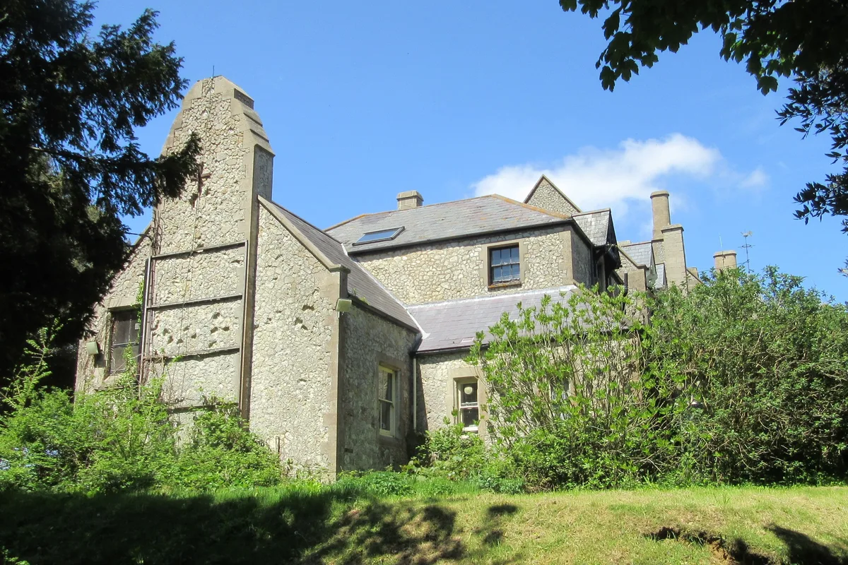
Weston Manor
Weston Manor — manor house in Totland, Isle of Wight, England, UK.
 📷 5
📷 5Quarries · South East England
Lacey's Farm Quarry
Lacey's Farm Quarry is a quarry in the United Kingdom.
 📷 5
📷 5Historic churches · South East England
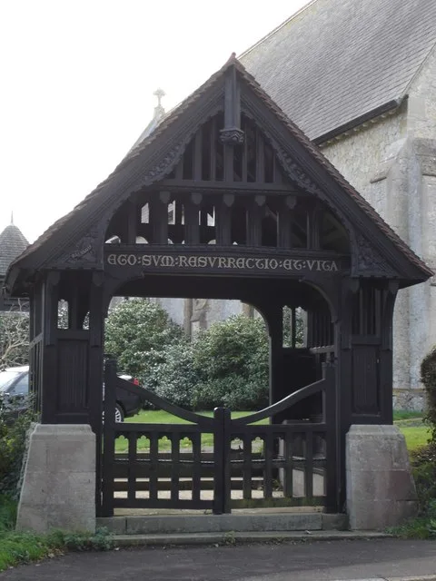
Christ Church, Totland
Christ Church, Totland — church in United Kingdom.
More mountains in this region
 📷 5
📷 5Mountains & hills · South East England
Alum Bay
Alum Bay is a mountain or hill in the United Kingdom.
 📷 5
📷 5Mountains & hills · South East England
Arish Mell
Arish Mell — bay in Dorset, England.
 📷 5
📷 5Mountains & hills · South East England
Balaclava Bay
Balaclava Bay — bay in Dorset, England.
 📷 5
📷 5Mountains & hills · South East England
Balch Cave
Balch Cave — Cave in Somerset, England.
Frequently asked questions
- Where is Tennyson Down?
- Tennyson Down is in South-East England, United Kingdom (postcode PO39 0HY), in the parish of Totland.
- Is Tennyson Down a protected site?
- Yes — Tennyson Down is part of the Headon Warren and West High Down SSSI Site of Special Scientific Interest and the Isle Of Wight National Landscape (AONB).
- Is Tennyson Down free to visit?
- Yes, Tennyson Down is free to enter.
- How do I get to Tennyson Down?
- Drivers can navigate to postcode PO39 0HY. It sits within the Isle of Wight West parliamentary constituency.