Mountains & hills · London
Botley Hill
Botley Hill — Named summit at 269.6 m.

Wikimedia Commons contributors — see linked file page for photographer and licence licence
Plan your visit
- Typical visit
- 3 h–8 h
- Best time of year
- Late spring – early autumn (May–Oct)
- Nearest railway station
- Oxted · 2.4 km
- Free entry
- Dog-friendly
About
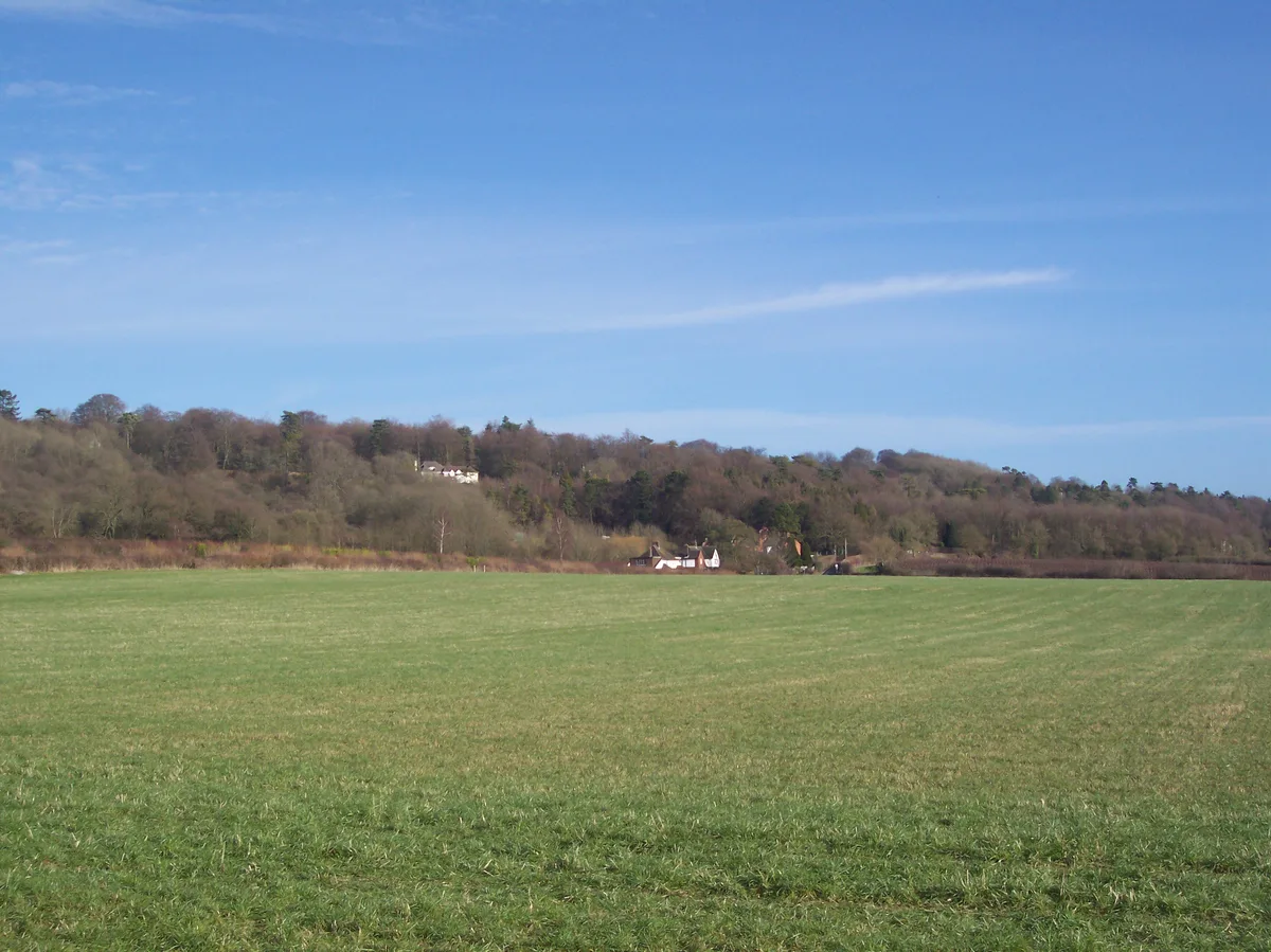
Botley Hill is a named summit in the United Kingdom. Wikidata describes it as: "Named summit at 269.6 m.". Coordinates: 51.2789°, -0.0131°.
Photo gallery
Protected designations
- Site of Special Scientific Interest: Woldingham & Oxted Downs SSSI
- Area of Outstanding Natural Beauty: Surrey Hills
Designations sourced from Natural England open data under OGL v3.
From the Wikipedia article
Botley Hill is a hill in Surrey and is the highest point of the North Downs, with a height of 269.6 metres (885 ft). The Prime Meridian crosses the hill.
Excerpt from Wikipedia under CC BY-SA 4.0. See the source article linked in Sources below.
- Coordinates
- 51.2789, -0.0131
- County
- Surrey
- District
- Tandridge
- Parish
- Oxted
- Postcode
- CR3 7AN
- Parliamentary constituency
- East Surrey
- Nearest railway station
- Oxted — 2.4 km
Sources
- osm: n2101166160 (ODbL)
- wikipedia: Botley Hill (CC BY-SA 4.0)
- commons: Botley Hill trig point - geograph.org.uk - 788400.jpg (CC BY-SA 4.0)
Other places nearby
Loading nearby places…
Nearby
 📷 5
📷 5Natural landmarks · London
Titsey Place
Titsey Place — a other in england-london, United Kingdom.
 📷 5
📷 5Gardens · London
Tatsfield Receiving Station
Tatsfield Receiving Station — a garden in england-london, United Kingdom.
 📷 5
📷 5Theatres · London
The Barn Theatre
The Barn Theatre is a theatre in the United Kingdom.
 📷 5
📷 5Historic churches · London
Church of St Mary the Virgin
Church of St Mary the Virgin — church in Oxted, Surrey, England, UK.
 📷 5
📷 5Gardens · London
Barrow Green Court
Barrow Green Court — a garden in england-london, United Kingdom.
 📷 5
📷 5Zoos & aquariums · London
Beaver Water World
Beaver Water World — a zoo aquarium in england-london, United Kingdom.
More mountains in this region
 📷 5
📷 5Mountains & hills · London
Betsom's Hill
Betsom's Hill — Named summit at 251 m.
 📷 5
📷 5Mountains & hills · London
Cambridgeshire County Top
Cambridgeshire County Top — Named summit at 146 m.
 📷 5
📷 5Mountains & hills · London
Little Trees Hill
Little Trees Hill — Named summit at 74 m.
 📷 5
📷 5Mountains & hills · London
Parliament Hill
Parliament Hill — Named summit at 93 m.
Frequently asked questions
- Where is Botley Hill?
- Botley Hill is in Surrey, London, United Kingdom (postcode CR3 7AN), in the parish of Oxted.
- Is Botley Hill a protected site?
- Yes — Botley Hill is part of the Woldingham & Oxted Downs SSSI Site of Special Scientific Interest and the Surrey Hills National Landscape (AONB).
- Is Botley Hill free to visit?
- Yes, Botley Hill is free to enter.
- How do I get to Botley Hill?
- The nearest railway station is Oxted, about 2.4 km away. Drivers can navigate to postcode CR3 7AN.