Islands · Scottish Highlands
Tahay
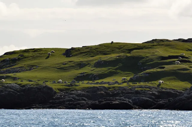
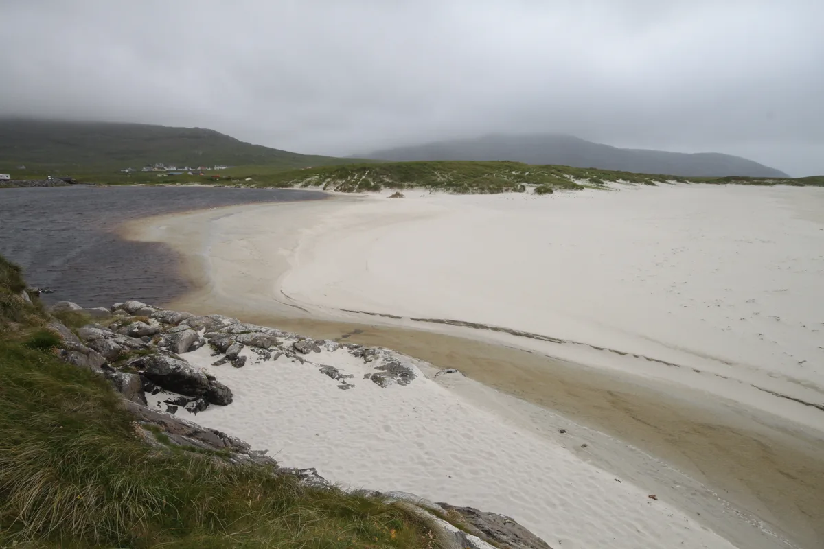
Tahay — island in Outer Hebrides, Scotland, UK.

Wikimedia Commons contributors — see linked file page for photographer and licence licence
Plan your visit
- Typical visit
- 4 h–12 h
- Free entry
- Dog-friendly
About
Tahay is a island in the United Kingdom. It covers approximately 53 km². Wikidata describes it as: "island in Outer Hebrides, Scotland, UK". Coordinates: 57.6667°, -7.0918°.
Photo gallery
From the Wikipedia article
Tahay (Scottish Gaelic: Taghaigh) is an island in the Outer Hebrides of Scotland. The name originates from the Old Norse tagg-øy meaning island with a prominent hill. At 53 hectares (130 acres) in area and with a central peak of 65 metres (213 ft), it is the largest of the group of uninhabited islands off the north east coast of North Uist. The island is used for sheep grazing and peat cutting.
Excerpt from Wikipedia under CC BY-SA 4.0. See the source article linked in Sources below.
Background
History
In 1846, six families who had been evicted from their homes on Pabbay to make way for sheep, moved to the previously uninhabited island of Tahay. Although the island has no arable land, they hoped to make a living from fishing. However this proved too hard and they gave up the struggle in the 1850s and emigrated to Australia. Tahay is owned by the Scottish Government.
Sourced from Wikipedia under CC BY-SA 4.0.
- Coordinates
- 57.6667, -7.0918
- District
- Na h-Eileanan Siar
- Postcode
- HS6 5AX
- Parliamentary constituency
- Na h-Eileanan an Iar
Sources
- wikidata: Q3105741 (CC0)
- wikipedia: Tahay (CC BY-SA 4.0)
- commons: Island of Taghaigh - geograph.org.uk - 1343512.jpg (CC BY-SA 4.0)
Other places nearby
Loading nearby places…
Nearby
 📷 4
📷 4Islands · Scottish Highlands
Sursaigh
Sursaigh — island in Outer Hebrides, Scotland, UK.
 📷 4
📷 4Islands · Scottish Islands
South Lewis, Harris and North Uist NSA
South Lewis, Harris and North Uist NSA in Scotland Islands, United Kingdom.
Vineyards · Scottish Highlands
North Uist, Groatay, Dun Mhic Laitheann
North Uist, Groatay, Dun Mhic Laitheann — a UK vineyard in scotland highlands, producing English or Welsh wine from cool-climate grape varieties.
 📷 5
📷 5Archaeological sites · Scottish Highlands
Dun Mhic Laitheann
Dun Mhic Laitheann — a archaeological in scotland-highlands, United Kingdom.
 📷 3
📷 3Islands · Scottish Highlands
Hermetray
Hermetray — uninhabited island off North Uist, in the Outer Hebrides of Scotland.
 📷 4
📷 4Islands · Scottish Highlands
Stromay
Stromay — tidal island off North Uist in the Sound of Harris, Scotland, UK.
More places in this region
 📷 5
📷 5Islands · Scottish Highlands
Bac Beag
Bac Beag — Scottish island, part of the Treshnish Isles in the Inner Hebrides.
 📷 5
📷 5Islands · Scottish Highlands
Bac Mòr
Bac Mòr — island in Argyll and Bute, Scotland, UK, one of the Treshnish Isles.
 Flagship📷 3
Islands · Scottish Highlands
Baleshare
Baleshare — flat tidal island in the Outer Hebrides, Scotland, UK.
 Flagship📷 5
Islands · Scottish Highlands
Barra
Barra — island in Outer Hebrides, Scotland, UK.
Frequently asked questions
- Where is Tahay?
- Tahay is in the Scottish Highlands, United Kingdom (postcode HS6 5AX).
- Is Tahay free to visit?
- Yes, Tahay is free to enter.
- How do I get to Tahay?
- Drivers can navigate to postcode HS6 5AX. It sits within the Na h-Eileanan an Iar parliamentary constituency.