Islands · Scottish Highlands
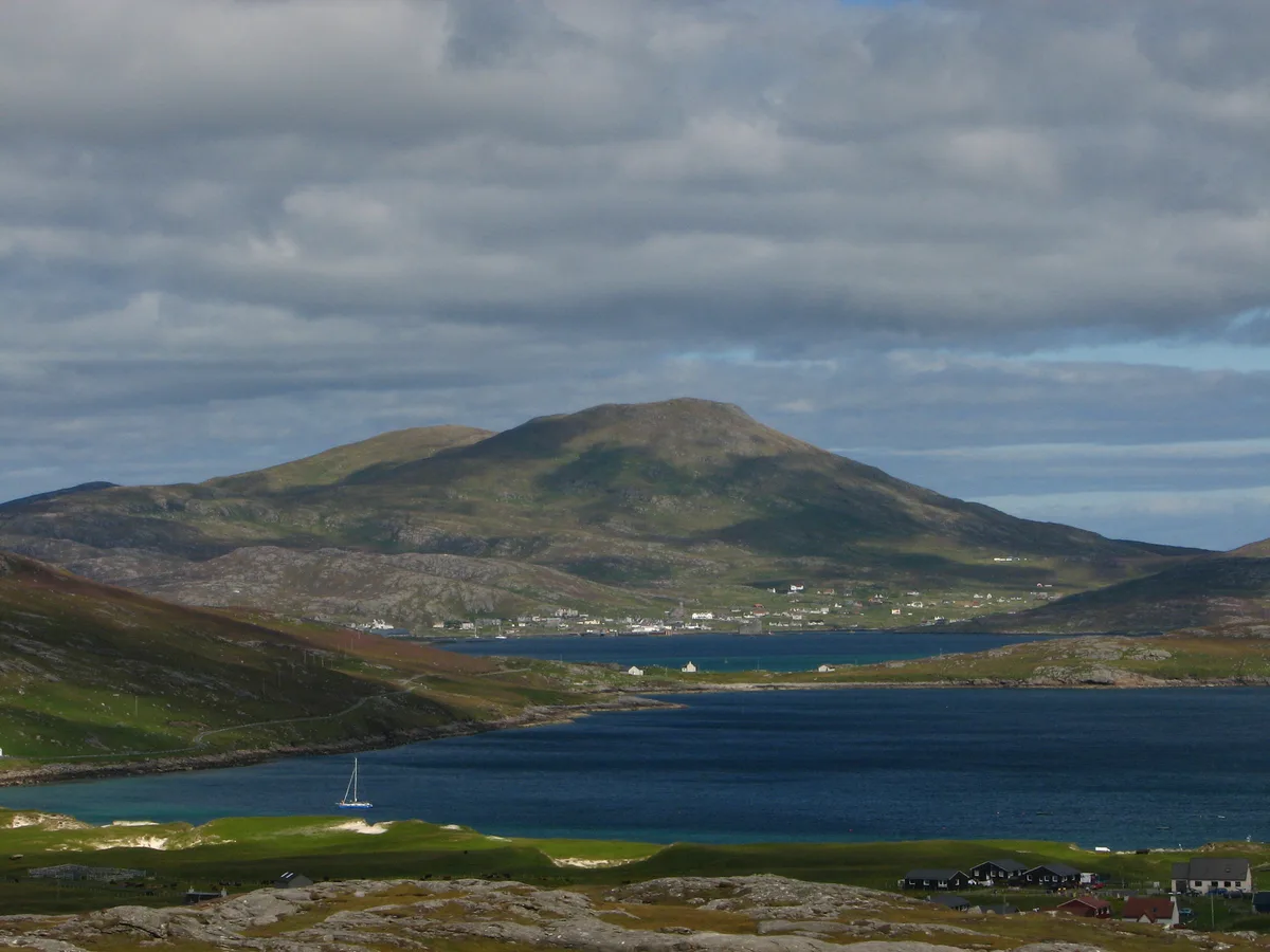
Barra
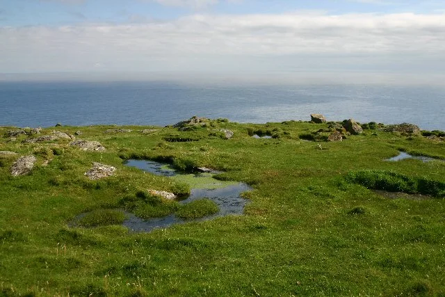
Barra — island in Outer Hebrides, Scotland, UK.

Wikimedia Commons contributors — see linked file page for photographer and licence licence
Plan your visit
- Typical visit
- 4 h–12 h
- Free entry
- Dog-friendly
About
Barra is a island in the United Kingdom. It covers approximately 5,875 km². Recent population estimates put it at around 1,174 people. Part of Outer Hebrides. Wikidata describes it as: "island in Outer Hebrides, Scotland, UK". Coordinates: 56.9833°, -7.4667°.
Photo gallery
From the Wikipedia article
Barra (; Scottish Gaelic: Barraigh [ˈparˠaj] or Eilean Bharraigh [ˈelan ˈvarˠaj] ; Scots: Barra) is an island in the Outer Hebrides, Scotland, and the second southernmost inhabited island there, after the adjacent island of Vatersay to which it is connected by the Vatersay Causeway. In 2022, the population was 1,209, an increase of 35 since the 2011 census. English and Gaelic are widely spoken, and at the 2011 Census, there were 761 Gaelic speakers (62% of the population, falling from 76% in the 1991 census). Barra's airport is claimed to be the only one in the world to have regular scheduled flights landing on a beach.
Excerpt from Wikipedia under CC BY-SA 4.0. See the source article linked in Sources below.
Background
History
Human presence on Barra since the Neolithic era was established by the discovery of a near-complete pottery beaker dating from 2500 BC during the construction of a road in the 1990s. A number of stone remains were also found, including a Neolithic "work platform", which complement the several standing stones scattered around the island. In the hills to the north of Borve, there is a large chambered cairn, sited in a prominent position. Beyond the main island, a Bronze Age cemetery is located on Vatersay, as well as an Iron Age broch; the remains of a similarly aged broch is located on the east of Barra itself. Remains of Bronze Age burials and Iron Age roundhouses were also discovered in…
Sourced from Wikipedia under CC BY-SA 4.0.
- Coordinates
- 56.9833, -7.4667
- Population
- 1,174
- Official site
- d3lmsxlb5aor5x.cloudfront.net
Sources
- wikidata: Q223212 (CC0)
- wikipedia: Barra (CC BY-SA 4.0)
- commons: Bagh Halaman Barra.JPG (CC BY-SA 4.0)
Other places nearby
Loading nearby places…
Nearby
Distilleries · Scottish Highlands
Isle of Barra Distillery
Isle of Barra Distillery — Whisky/spirit distillery.
 📷 3
📷 3Mountains & hills · Scottish Highlands
Heabhal
Heabhal — Named summit at 383 m.
 📷 3
📷 3Archaeological sites · Scottish Highlands
Dun an t-Sleibh, broch site
Dun an t-Sleibh, broch site — a archaeological in scotland-highlands, United Kingdom.
 📷 3
📷 3Public art & sculpture · Scottish Highlands
Moire Maighdeannan
Moire Maighdeannan — a public art in scotland-highlands, United Kingdom.
 📷 3
📷 3Archaeological sites · Scottish Highlands
Dun (now inundated)
Dun (now inundated) — a archaeological in scotland-highlands, United Kingdom.
 📷 5
📷 5Historic churches · Scottish Highlands
Cuier Parish Church and Churchyard
Cuier Parish Church and Churchyard — category C listed building-listed church in scotland-highlands, United Kingdom.
More places in this region
 📷 5
📷 5Islands · Scottish Highlands
Bac Beag
Bac Beag — Scottish island, part of the Treshnish Isles in the Inner Hebrides.
 📷 5
📷 5Islands · Scottish Highlands
Bac Mòr
Bac Mòr — island in Argyll and Bute, Scotland, UK, one of the Treshnish Isles.
 Flagship📷 3
Islands · Scottish Highlands
Baleshare
Baleshare — flat tidal island in the Outer Hebrides, Scotland, UK.
 Flagship📷 5
Islands · Scottish Highlands
Barra Head
Barra Head — southernmost island of the Outer Hebrides in Scotland, UK.
Frequently asked questions
- Where is Barra?
- Barra is in Scottish Highlands, in the United Kingdom — coordinates 56.9833°, -7.4667°.
- Is Barra free to visit?
- Yes — admission to Barra is free.