Hill forts · South West England
Sweet Track
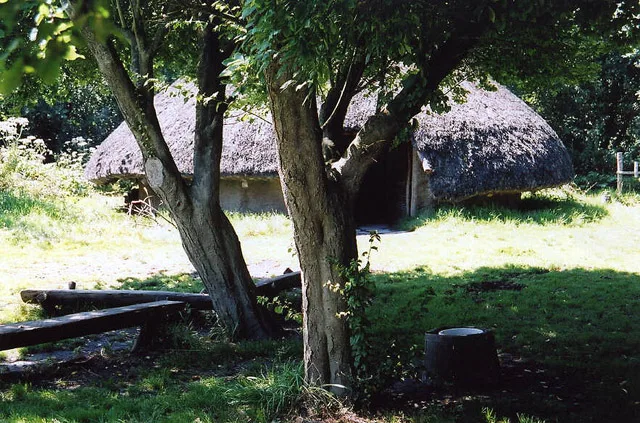
Sweet Track — ancient causeway in the Somerset Levels, England.

Wikimedia Commons contributors — see linked file page for photographer and licence licence
Plan your visit
- Typical visit
- 1 h–2 h
- Free entry
- Dog-friendly
About
Sweet Track is a hill fort in the United Kingdom. Wikidata describes it as: "ancient causeway in the Somerset Levels, England". Coordinates: 51.1642°, -2.8264°.
Photo gallery
Protected designations
- Site of Special Scientific Interest: Shapwick Heath SSSI
- National Nature Reserve: SOMERSET WETLANDS
- Ramsar wetland: Severn Estuary
- Ramsar wetland: Somerset Levels & Moors
Designations sourced from Natural England open data under OGL v3.
From the Wikipedia article
The Sweet Track is an ancient trackway, or causeway, in the Somerset Levels, England, named after its finder, Ray Sweet. It was built in 3807 BC (determined using dendrochronology – tree-ring dating) and is the second-oldest timber trackway discovered in the British Isles, dating to the Neolithic. The Sweet Track was predominantly built along the course of an earlier structure, the Post Track. The track extended across the now largely drained marsh between what was then an island at Westhay and a ridge of high ground at Shapwick, a distance close to 1,800 metres (5,900 ft) or around 1.1 mi. The track is one of a network that once crossed the Somerset Levels. Various artifacts and prehistoric finds, including a jadeitite ceremonial axe head, have been found in the peat bogs along its length. Construction was of crossed wooden poles, driven into the waterlogged soil to support a walkway that consisted mainly of planks of oak, laid end-to-end. The track was used for a period of only around ten years and was then abandoned, probably due to rising water levels. Following its discovery in 1970, most of the track has been left in its original location, with active conservation measures taken, including a water pumping and distribution system to maintain the wood in its damp condition. Some of the track is stored at the British Museum and at the Museum of Somerset in Taunton. A reconstruction has been made on which visitors can walk, on the same line as the original, in Shapwick Heath National Nature Reserve.
Excerpt from Wikipedia under CC BY-SA 4.0. See the source article linked in Sources below.
Background
Architecture
Built in 3807 or 3806 BC, The length, straightness, and lack of forks or branches in the pegs suggest that they were taken from coppiced woodland. Longitudinal log rails up to 6.1 m long and 7.6 cm in diameter, made of mostly hazel and alder, were laid down and held in place with the pegs, which were driven at an angle across the rails and into the peat base of the bog. Notches were then cut into the planks to fit the pegs, and the planks were laid along the X shapes to form the walkway. In some places a second rail was placed on top of the first one to bring the plank above it level with the rest of the walkway. Some of the planks were then stabilised with slender, vertical wooden pegs…
Sourced from Wikipedia under CC BY-SA 4.0.
- Coordinates
- 51.1642, -2.8264
- District
- Somerset
- Parish
- Shapwick
- Postcode
- TA7 9NW
- Parliamentary constituency
- Wells and Mendip Hills
Sources
- wikidata: Q2736549 (CC0)
- wikipedia: Sweet Track (CC BY-SA 4.0)
- commons: Sweettrack.jpg (CC BY-SA 4.0)
Featured in this guide
Other places nearby
Loading nearby places…
Nearby
 📷 5
📷 5Public art & sculpture · South West England
Sword
Sword — a public art in england-south-west, United Kingdom.
 📷 3
📷 3Natural landmarks · South West England
Shapwick West
Shapwick West — a other in england-south-west, United Kingdom.
 📷 3
📷 3Maritime museums · South West England
Viking Trading Ship
Viking Trading Ship — a maritime museum in england-south-west, United Kingdom.
📷 3Natural landmarks · South West England
Avalon Marshes Visitor Centre
Avalon Marshes Visitor Centre — a natural landmark in england-south-west, United Kingdom.
 📷 5
📷 5Museums · South West England
Peat Moors Centre
Peat Moors Centre — former museum in Somerset, England.
 📷 3
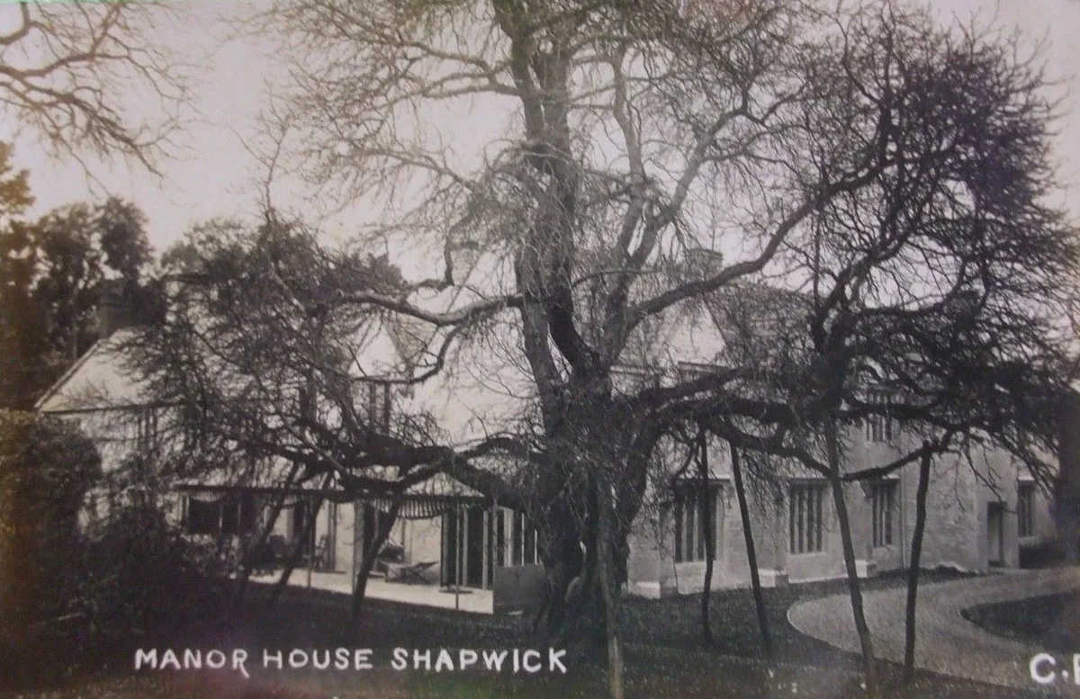
📷 3Stately homes · South West England
Shapwick Manor
Shapwick Manor — manor house in Shapwick, Somerset, England, UK.
More places in this region
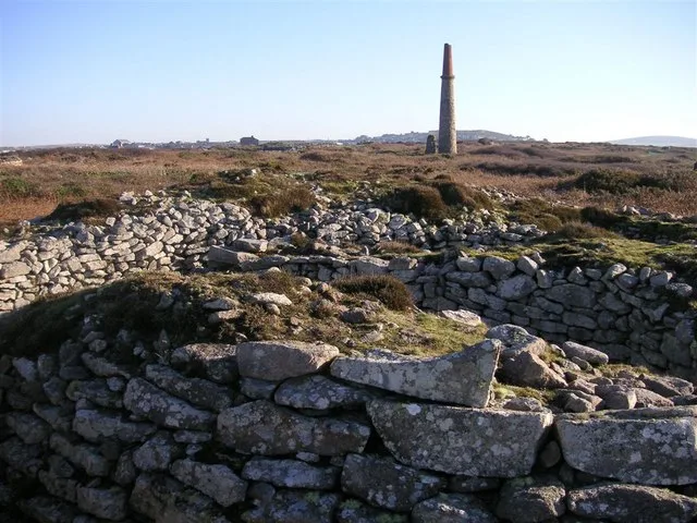 📷 5
📷 5Hill forts · South West England
Ballowall Barrow
Ballowall Barrow — archaeological site in St Just, Cornwall, England, UK.
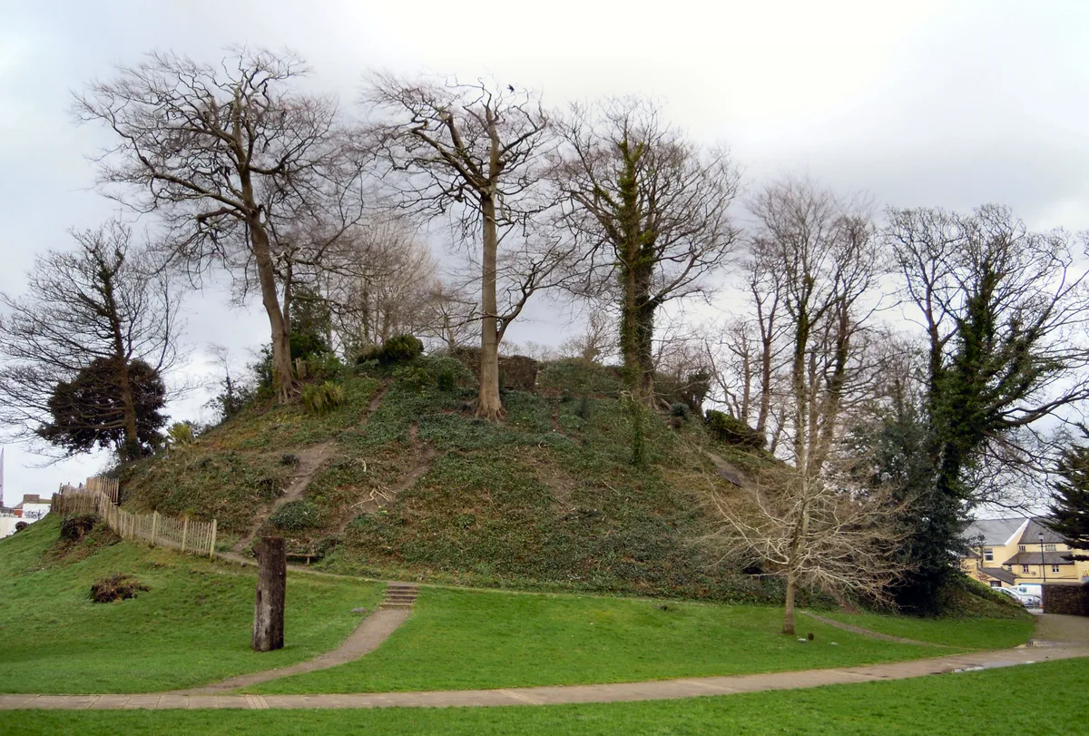 📷 5
📷 5Hill forts · South West England
Barnstaple Castle
Barnstaple Castle — castle in Devon, England, UK.
 📷 5
📷 5Hill forts · South West England
Bartinney Castle
Bartinney Castle — Iron Age enclosure in Cornwall, England, UK.
 📷 5
📷 5Hill forts · South West England
Berry's Wood
Berry's Wood — iron Age hill fort in south Devon, England, UK.
Frequently asked questions
- Where is Sweet Track?
- Sweet Track is in South-West England, United Kingdom (postcode TA7 9NW), in the parish of Shapwick.
- Who owns Sweet Track?
- Sweet Track is owned by | designation1 = Scheduled Ancient Monument.
- Is Sweet Track a protected site?
- Yes — Sweet Track is part of the Shapwick Heath SSSI Site of Special Scientific Interest and the SOMERSET WETLANDS National Nature Reserve.
- Is Sweet Track free to visit?
- Yes, Sweet Track is free to enter.
- How do I get to Sweet Track?
- Drivers can navigate to postcode TA7 9NW. It sits within the Wells and Mendip Hills parliamentary constituency.