Towns & cities · West Midlands
Swalcliffe
Swalcliffe — village and civil parish in Cherwell district, Oxfordshire, England.

Wikimedia Commons contributors — see linked file page for photographer and licence licence
Plan your visit
- Typical visit
- 3 h–6 h
- Nearest railway station
- Banbury · 8.9 km
- Free entry
- Family-friendly
- Dog-friendly
About
Swalcliffe is a town, city, village or settlement in the United Kingdom. It covers approximately 7 km². Recent population estimates put it at around 237 people. Address: OX15. Wikidata describes it as: "village and civil parish in Cherwell district, Oxfordshire, England". Coordinates: 52.0380°, -1.4520°.
Photo gallery
Protected designations
- Area of Outstanding Natural Beauty: Cotswolds
Designations sourced from Natural England open data under OGL v3.
From the Wikipedia article
Swalcliffe is a village and civil parish about 5 miles (8 km) west of Banbury in Oxfordshire. The parish is about 2+1⁄2 miles (4 km) long north–south and about 1 mile (1.6 km) east–west. The 2011 Census recorded the population of the modern Swalcliffe parish as 210. The toponym "Swalcliffe" comes from the Old English swealwe and clif, meaning a slope or cliff frequented by swallows. The ancient parish of Swalcliffe was larger than the present civil parish, and included the townships of East Shutford, Epwell, Sibford Ferris, Sibford Gower and West Shutford.
Excerpt from Wikipedia under CC BY-SA 4.0. See the source article linked in Sources below.
- Coordinates
- 52.0380, -1.4520
- County
- Oxfordshire
- District
- Cherwell
- Parish
- Swalcliffe
- Postcode
- OX15
- Parliamentary constituency
- Banbury
- Population
- 237
- Nearest railway station
- Banbury — 8.9 km
- Official site
- www.swalcliffevillage.co.uk
Sources
- wikidata: Q1917574 (CC0)
- wikipedia: Swalcliffe (CC BY-SA 4.0)
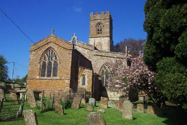
- commons: SS Peter and Paul, Swalcliffe - geograph.org.uk - 119497.jpg (CC BY-SA 4.0)
Other places nearby
Loading nearby places…
Nearby
 📷 3
📷 3Museums · West Midlands
Swalcliffe Tithe Barn
Swalcliffe Tithe Barn — a museum in england-west-midlands, United Kingdom.
📷 3Historic houses · West Midlands
Swalcliffe Barn
Swalcliffe Barn — a Grade I-listed historic house in england-west-midlands, United Kingdom.
Vineyards · West Midlands
Madmarston Hill Camp
Madmarston Hill Camp — a UK vineyard in england west midlands, producing English or Welsh wine from cool-climate grape varieties.
 Flagship📷 5
Towns & cities · West Midlands
Tadmarton
Tadmarton — village and civil parish in Cherwell district, Oxfordshire, England.
 📷 5
📷 5Natural landmarks · West Midlands
Sibford School
Sibford School — a school heritage in england-west-midlands, United Kingdom.
Vineyards · West Midlands
Tadmarton Camp
Tadmarton Camp — a UK vineyard in england west midlands, producing English or Welsh wine from cool-climate grape varieties.
More towns in this region
 Flagship📷 3
Towns & cities · West Midlands
Adderbury
Adderbury — village and civil parish in Cherwell district, Oxfordshire, England.
 Flagship📷 3
Towns & cities · West Midlands
Admington
Admington — village in Warwickshire, England, UK.
 Flagship📷 3
Towns & cities · West Midlands
Aldington
Aldington — village in Worcestershire, United Kingdom.
 Flagship📷 5
Towns & cities · West Midlands
Anstey
Anstey — large village in Leicestershire, England.
Frequently asked questions
- Where is Swalcliffe?
- Swalcliffe is in Oxfordshire, the West Midlands, United Kingdom (postcode OX15), in the parish of Swalcliffe.
- Is Swalcliffe a protected site?
- Yes — Swalcliffe is part of the Cotswolds National Landscape (AONB).
- Is Swalcliffe free to visit?
- Yes, Swalcliffe is free to enter.
- How do I get to Swalcliffe?
- Drivers can navigate to postcode OX15. It sits within the Banbury parliamentary constituency.