Mountains & hills · North West England
Stream Passage Pot
Stream Passage Pot is a mountain or hill in the United Kingdom.

Wikimedia Commons contributors — see linked file page for photographer and licence licence
Plan your visit
- Typical visit
- 3 h–8 h
- Best time of year
- Late spring – early autumn (May–Oct)
- Nearest railway station
- Clapham · 5.0 km
- Free entry
- Dog-friendly
About
Stream Passage Pot is a named summit in the United Kingdom. Coordinates: 54.1478°, -2.3866°. This entry is part of The Great Britain Guide, a free, ad-free, open-data tourist directory.
Photo gallery
Protected designations
- Site of Special Scientific Interest: Ingleborough SSSI
- National Nature Reserve: INGLEBOROUGH
Designations sourced from Natural England open data under OGL v3.
From the Wikipedia article
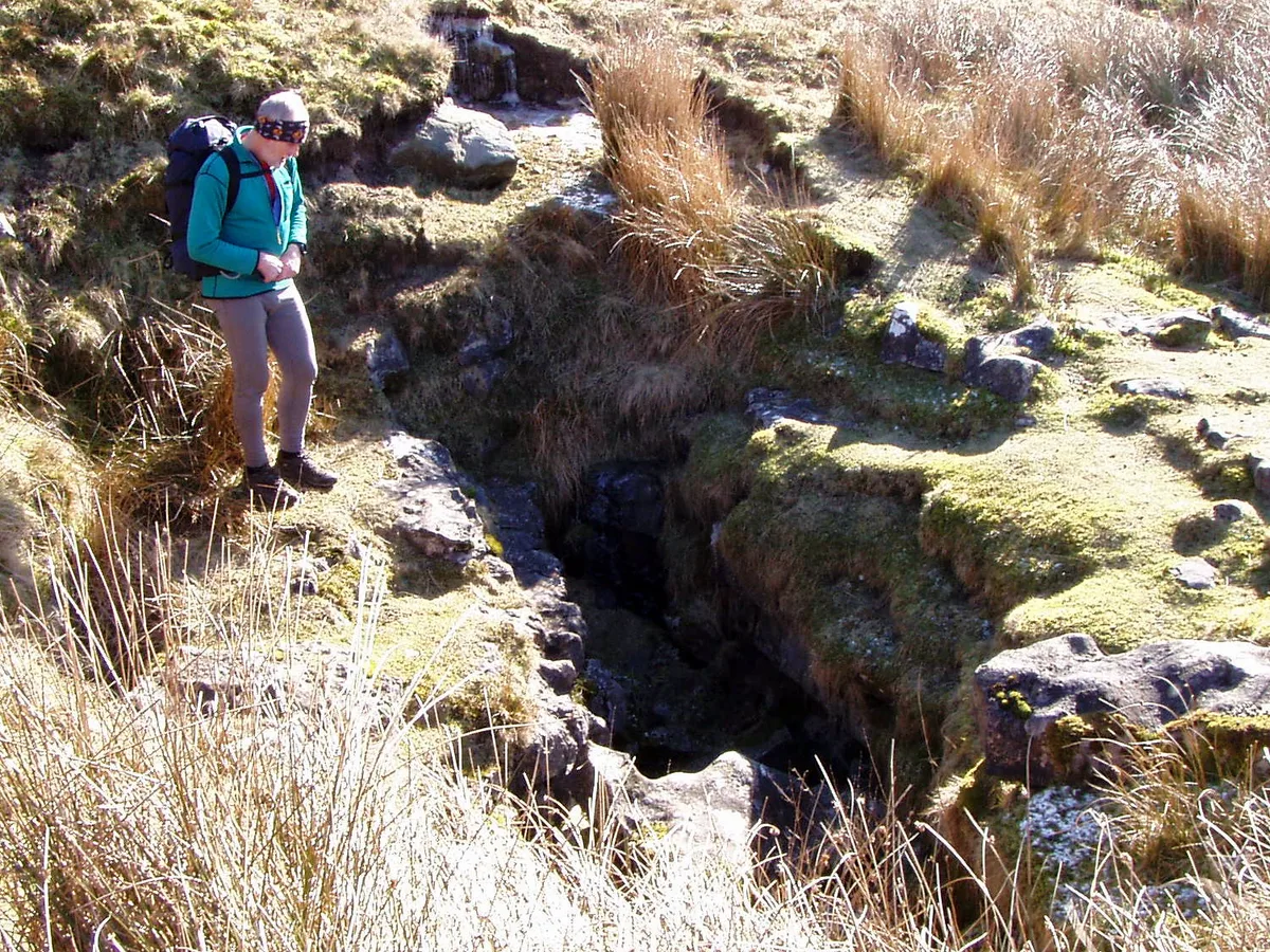
Stream Passage Pot is one of the entrances to the Gaping Gill system being located about 320 metres (350 yd) ESE of Gaping Gill Main Shaft. It is a popular and sporting entrance into the system, featuring three well-watered big shafts. It is the highest entrance of the Gaping Gill system, so the full depth of the system, 198 metres (650 ft), is measured from its entrance. It lies within the designated Ingleborough Site of Special Scientific Interest.
Excerpt from Wikipedia under CC BY-SA 4.0. See the source article linked in Sources below.
Background
History
The cave was dug into on 10 March 1949, and explored by the Northern Pennine Club during the following Easter weekend. The entrance became blocked in the early 1980s, and in 1984 it was re-opened by the Bradford Pothole Club who installed galvanised tubing through the unstable boulder ruckle in the shakehole. The galvanised tube was replaced by the current black poly tube in Summer 2024 after the galvanised pipe had deteriorated. In November 1979 the cave became the centre of a major rescue when Jeremy Peterson went missing on a solo pull-through trip. He was found alive and well after 57 hours, having gone off route and fallen down the Mud Pot pitch. He had fractured a wrist and was badly…
Description
Stream Passage Pot is at the end of a blind valley. The water sinks to one side of the valley before the end, and the entrance is through a boulder ruckle down a vertical lined shaft for 6 m. An awkward passage soon terminates in a small pitch 6 m into a chamber where the stream enters. A high meandering passage from the chamber leads after about 200 m to an 85 m deep rift which is descended in three stages. The descent route involves traversing and technical rope rigging to avoid the waterfalls. The last pitch drops into Stream Passage in Gaping Gill. The water flows through Stream Passage into Stream Chamber. From here a route to the right follows a succession of chambers towards Gaping…
Sourced from Wikipedia under CC BY-SA 4.0.
- Coordinates
- 54.1478, -2.3866
- District
- North Yorkshire
- Parish
- Clapham cum Newby
- Postcode
- LA2 8EE
- Parliamentary constituency
- Skipton and Ripon
- Nearest railway station
- Clapham — 5 km
- Official site
- www.cncc.org.uk
Sources
- wikidata: Q16248218 (CC0)
- wikipedia: Stream Passage Pot (CC BY-SA 4.0)
- commons: Stream Passage Pot Entrance.JPG (CC BY-SA 4.0)
Other places nearby
Loading nearby places…
Nearby
 📷 3
📷 3Caves · North West England
Stream Passage Pot
Stream Passage Pot is a cave in the United Kingdom.
 📷 3
📷 3Caves · North West England
Disappointment Pot
Disappointment Pot is a cave in the United Kingdom.
 📷 5
📷 5Caves · North West England
Wades Entrance
Wades Entrance — a cave broad in england-north-west, United Kingdom.
 📷 3
📷 3Caves · North West England
Flood Entrance Pot
Flood Entrance Pot is a cave in the United Kingdom.
 📷 3
📷 3Mountains & hills · North West England
Flood Entrance Pot
Flood Entrance Pot is a mountain or hill in the United Kingdom.
 📷 5
📷 5Caves · North West England
Gaping Gill
Gaping Gill is a cave in the United Kingdom.
More mountains in this region
 📷 3
📷 3Mountains & hills · North West England
Allen Crags
Allen Crags — Named summit at 785 m.
 📷 3
📷 3Mountains & hills · North West England
Alum Pot
Alum Pot — Open shaft pothole in North Yorkshire.
 📷 3
📷 3Mountains & hills · North West England
Arnside Knott
Arnside Knott — Named summit at 159 m.
 📷 3
📷 3Mountains & hills · North West England
Aye Gill Pike
Aye Gill Pike — Named summit at 556.3 m.
Frequently asked questions
- Where is Stream Passage Pot?
- Stream Passage Pot is in North-West England, United Kingdom (postcode LA2 8EE), in the parish of Clapham cum Newby.
- Is Stream Passage Pot a protected site?
- Yes — Stream Passage Pot is part of the Ingleborough SSSI Site of Special Scientific Interest and the INGLEBOROUGH National Nature Reserve.
- Is Stream Passage Pot free to visit?
- Yes, Stream Passage Pot is free to enter.
- How do I get to Stream Passage Pot?
- The nearest railway station is Clapham, about 5.0 km away. Drivers can navigate to postcode LA2 8EE.