Canals · West Midlands
Stourbridge Extension Canal
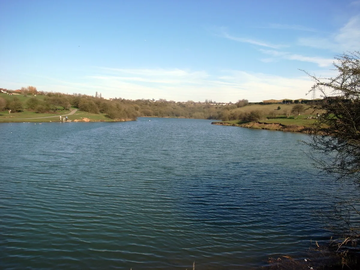
Stourbridge Extension Canal is a canal in the United Kingdom.

Wikimedia Commons contributors — see linked file page for photographer and licence licence
Plan your visit
- Typical visit
- 1 h–2 h
- Nearest railway station
- Lye · 3.4 km
- Free entry
- Dog-friendly
About
Stourbridge Extension Canal is a canal in the United Kingdom. Coordinates: 52.4872°, -2.1373°. This entry is part of The Great Britain Guide, a free, ad-free, open-data tourist directory.
Photo gallery
From the Wikipedia article
The Stourbridge Extension Canal was a short canal built to serve a number of mines in the Kingswinford area of Staffordshire in England. Although connected to the Stourbridge Canal, it was independent from it. It opened in 1840, and was abandoned in 1935. A short section of it is still used as moorings for boats using the Stourbridge Canal.
Excerpt from Wikipedia under CC BY-SA 4.0. See the source article linked in Sources below.
Background
History
In the 1820s, a number of coal mines opened up in the Kingswinford area, which was just to the north-west of the Fens branch of the Stourbridge Canal. Although a survey was carried out by Samuel Hodgekinson for a canal or a railway to service the mines, no definite proposals emerged. Gibbons and Co., owners of the first mine to open, built a tramway to Brockmoor in 1825, and a railway from the Staffordshire and Worcestershire Canal was constructed by Lord Dudley, which opened in 1829, but there were further plans for both canals and railways to the area of Shutt End. The Stourbridge Canal company then proposed an extension of their canal to Shutt End, but the scheme was opposed by Lord…
Description
The canal was barely open, when the railways posed a threat. The Oxford, Worcester and Wolverhampton Railway was active in the area, and in 1845 applied for an act of Parliament to authorise a number of routes, one of which would run along the banks of the canal. An agreement was reached, whereby the railway company would buy the canal if the act was granted. It was, as the Oxford, Worcester and Wolverhampton Railway Act 1845 (8 & 9 Vict. c. clxxxiv), and the canal passed into the hands of the railway company on 27 March 1847. Unlike many such takeovers, the Oxford, Worcester and Wolverhampton Railway Act 1845 specified that the canal was to be well maintained, that tolls were not to be…
Visiting
Most of the canal was filled in after its abandonment. A trading estate covers most of the northern end of the Sandhill Branch, and housing has been built over the middle section. A short stub, from the Brockmoor Junction with the Stourbridge Canal to the stop lock at Bromley has been retained in water, and mooring facilities with a boundary fence were constructed by British Waterways on the north bank of the stub in 2004.
Sourced from Wikipedia under CC BY-SA 4.0.
- Coordinates
- 52.4872, -2.1373
- District
- Dudley
- Parish
- Dudley, unparished area
- Postcode
- DY5 3AJ
- Parliamentary constituency
- Dudley
- Established
- 1840
- Nearest railway station
- Lye — 3.4 km
Sources
- wikidata: Q7620584 (CC0)
- wikipedia: Stourbridge Extension Canal (CC BY-SA 4.0)
- commons: Junction Footbridge - geograph.org.uk - 3551340.jpg (CC BY-SA 4.0)
Other places nearby
Loading nearby places…
Nearby
 📷 3
📷 3Theatres · West Midlands
Odeon Brierley Hill
Odeon Brierley Hill in England West Midlands, United Kingdom.
 📷 3
📷 3Parks · West Midlands
Buckpool and Fens Pool Local Nature Reserve
Buckpool and Fens Pool Local Nature Reserve — park in Pensnett, United Kingdom.
 📷 5
📷 5Natural landmarks · West Midlands
The Crestwood School
The Crestwood School — a school heritage in england-west-midlands, United Kingdom.
 📷 5
📷 5Historic churches · West Midlands
Jamia Masjid Rizvia
Jamia Masjid Rizvia — a church in england-west-midlands, United Kingdom.
 📷 3
📷 3Theatres · West Midlands
Danilo Brierley Hill
Danilo Brierley Hill in England West Midlands, United Kingdom.
 📷 3
📷 3Mountains & hills · West Midlands
Brierley Hill
Brierley Hill — Named summit at 158 m.
More places in this region
 📷 3
📷 3Canals · West Midlands
Anson Branch
Anson Branch — canal in West Midlands, England.
 📷 3
📷 3Canals · West Midlands
Ashton Canal
Ashton Canal — canal in north west England.
 📷 3
📷 3Canals · West Midlands
Aylesbury Canal Arm
Aylesbury Canal Arm — canal in the United Kingdom.
 📷 4
📷 4Canals · West Midlands
BCN Main Line
BCN Main Line — Canal in and around Birmingham , England.
Frequently asked questions
- Where is Stourbridge Extension Canal?
- Stourbridge Extension Canal is in the West Midlands, United Kingdom (postcode DY5 3AJ), in the parish of Dudley, unparished area.
- When was Stourbridge Extension Canal built?
- Built or established in 1840.
- Is Stourbridge Extension Canal free to visit?
- Yes, Stourbridge Extension Canal is free to enter.
- How do I get to Stourbridge Extension Canal?
- The nearest railway station is Lye, about 3.4 km away. Drivers can navigate to postcode DY5 3AJ.