Castles · Mid Wales
Stapleton Motte
Stapleton Motte — castle in Stapleton, Shropshire, England, UK.

Wikimedia Commons contributors — see linked file page for photographer and licence licence
Plan your visit
- Typical visit
- 1.5 h–3 h
- Nearest railway station
- Shrewsbury · 8.8 km
- Family-friendly
- Limited wheelchair access
About
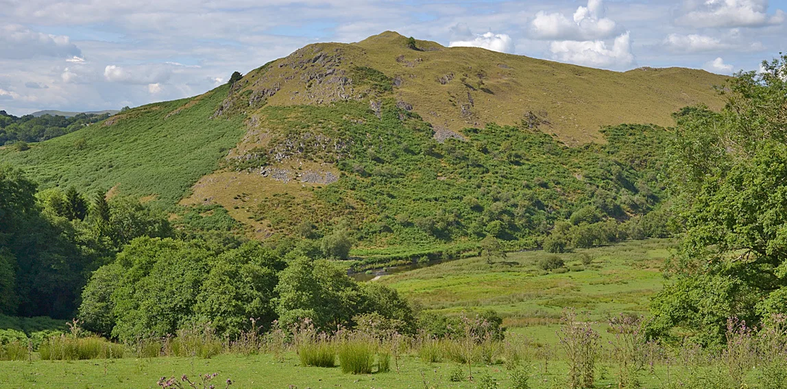
Stapleton Motte is a castle in Mid Wales. Officially recognised as scheduled monument. The site is within the Shropshire Hills National Landscape (AONB). It sits within the South Shropshire parliamentary constituency. The nearest railway station is Shrewsbury, about 8.8 km away. Postcode area SY5.
Photo gallery
Heritage listing
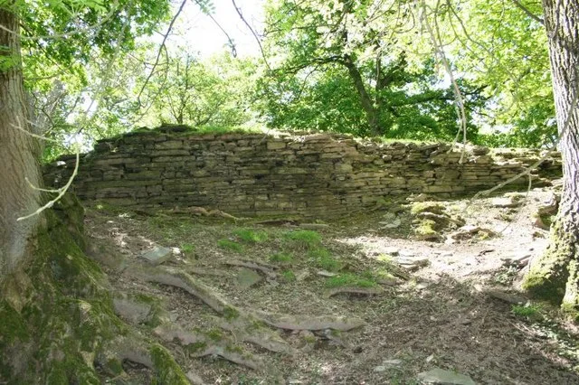
Details The monument includes the remains of a small motte castle situated on the north bank of a tributary of Cound Brook. The motte is believed to be the castle of Stapeleton-in-Legharness founded during the 12th century and which was in the custody of King John in 1207. The castle lies within the main north to south valley communication route along the Cound Brook valley south of Shrewsbury. It includes a castle mound, or motte, roughly circular in plan with a base diameter of 31m which rises 3m to a flat summit 22m in diameter. A slight hollow 2m wide and up to 0.3m deep around the north quarter of the site, through which the churchyard path runs, represents the only visible portion of the surrounding ditch. The ditch will survive as a buried feature of a similar width around the remaining sides of the mound. The eastern boundary of the churchyard crosses the motte summit and there are five grave markers set upon the part of the summit which falls within the churchyard. No bailey associated with the motte has yet been traced. The churchyard boundary fence and the five grave markers on top of the motte are excluded from the scheduling although the ground beneath is included. MAP EXTRACT The site of the monument is shown on the attached map extract. It includes a 2 metre boundary around the archaeological features, considered to be essential for the monument's support and preservation. Legacy The contents of this record have been generated from a legacy data system. Legacy System number: 19225 Legacy System: RSM
From the Historic England List Entry under OGL v3.
Protected designations
- Area of Outstanding Natural Beauty: Shropshire Hills
Designations sourced from Natural England open data under OGL v3.
Place summary
Stapleton Motte is a castle located in Mid Wales, within the parish of Condover, postcode SY5. It is designated as a scheduled monument and lies within the Area of Outstanding Natural Beauty (AONB) of the Shropshire Hills.
AI-generated from the structured facts on this page (operator, designation, listing, era). Not a substitute for visiting.
- Coordinates
- 52.6353, -2.7831
- District
- Shropshire
- Parish
- Condover
- Postcode
- SY5 7EF
- Parliamentary constituency
- South Shropshire
- Nearest railway station
- Shrewsbury — 8.8 km
Sources
- wikidata: Q17676871 (CC0)
- commons: Motte at Stapleton - geograph.org.uk - 1183142.jpg (CC BY-SA 4.0)
Other places nearby
Loading nearby places…
Nearby
 📷 3
📷 3Memorials & monuments · Mid Wales
Stapleton War Memorial
Stapleton War Memorial — Grade II listed building-listed memorial in wales-mid, United Kingdom.
 📷 5
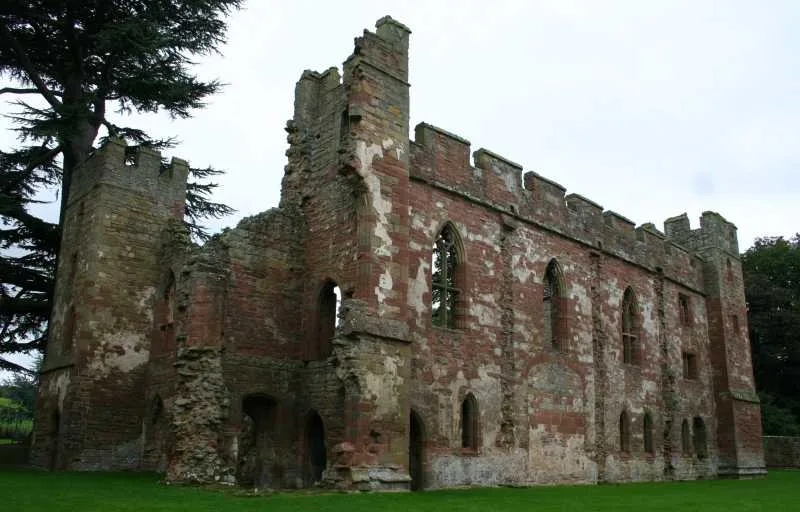
📷 5Castles · Mid Wales
Stapleton, Shropshire
Stapleton, Shropshire — a castle in wales-mid, United Kingdom.
 📷 3
📷 3Historic bridges · Mid Wales
Wayford Bridge
Wayford Bridge — Grade II listed building-listed bridge in wales-mid, United Kingdom.
Caravan parks · Mid Wales
Stoney Acres
Stoney Acres — a caravan park in wales mid.
 📷 4
📷 4Historic churches · Mid Wales
Annscroft
Annscroft in Wales Mid, United Kingdom.
Caravan parks · Mid Wales
Condover Park Touring Caravan Site
Condover Park Touring Caravan Site — a caravan park in wales mid.
More castles in this region
 📷 3
📷 3Castles · Mid Wales
Acton Burnell Castle
Acton Burnell Castle — Grade I listed castle in Shropshire, England, UK.
 📷 3
📷 3Castles · Mid Wales
Cefnllys Castle
Cefnllys Castle — medieval castle in Powys, Wales, UK.
 📷 3
📷 3Castles · Mid Wales
Aberdyfi Castle
Aberdyfi Castle — ruined castle in Ceredigion, Wales, UK.
 📷 3
📷 3Castles · Mid Wales
Aberedw Castle
Aberedw Castle — scheduled monument in Wales.
Frequently asked questions
- Where is Stapleton Motte?
- Stapleton Motte is in Mid Wales, United Kingdom (postcode SY5 7EF), in the parish of Condover.
- Is Stapleton Motte a listed building?
- Stapleton Motte is officially recognised as scheduled monument listed.
- Is Stapleton Motte a protected site?
- Yes — Stapleton Motte is part of the Shropshire Hills National Landscape (AONB).
- Does Stapleton Motte charge admission?
- Stapleton Motte typically charges admission. Check the official site for current ticket prices and opening hours.
- How do I get to Stapleton Motte?
- Drivers can navigate to postcode SY5 7EF. It sits within the South Shropshire parliamentary constituency.