Viewpoints · North East England
Standing Stones
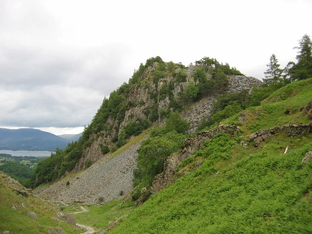
Standing Stones is a viewpoint in the United Kingdom.

Mick Garratt — CC BY-SA 2.0 via Wikimedia Commons licence
Plan your visit
- Typical visit
- 20 min–45 min
- Best time of year
- Clear days year-round
- Free entry
- Dog-friendly
About
Standing Stones is a named viewpoint in North-East England, marked on Ordnance Survey maps for its outlook. The site is part of the BORROWDALE RAINFOREST National Nature Reserve. It sits within the Penrith and Solway parliamentary constituency. Postcode area CA12.
Photo gallery
Protected designations
- Site of Special Scientific Interest: River Derwent and Tributaries SSSI
- Site of Special Scientific Interest: Lodore - Troutdale Woods SSSI
- Site of Special Scientific Interest: Buttermere Fells SSSI
- National Nature Reserve: BORROWDALE RAINFOREST
Designations sourced from Natural England open data under OGL v3.
From the Wikipedia article
A menhir (; from Brittonic languages: maen or men, "stone" and hir or hîr, "long"), standing stone, orthostat, or lith is a large upright stone, emplaced in the ground by humans, typically dating from the European middle Bronze Age. They can be found individually as monoliths, or as part of a group of similar stones. Menhirs' sizes can vary considerably, but they often taper toward the top. Menhirs are found across Europe, Africa, and Asia, with a concentration in Western Europe, notably in Ireland, Great Britain, and Brittany. Theories concerning their purpose remain speculative, with hypotheses ranging from druidic rituals to territorial markers or elements of an ideological system. Some menhirs feature engravings, including anthropomorphic figures and symbols, and are often associated with ancient religious ceremonies and burial chambers.
Excerpt from Wikipedia under CC BY-SA 4.0. See the source article linked in Sources below.
- Coordinates
- 54.5329, -3.1617
- District
- Cumberland
- Parish
- Borrowdale
- Postcode
- CA12 5XL
- Parliamentary constituency
- Penrith and Solway
Sources
- osm: n4986817383 (ODbL)
- wikipedia: Standing Stones (CC BY-SA 4.0)
Other places nearby
Loading nearby places…
Nearby
 📷 4
📷 4Natural landmarks · North East England
Castle Crag
Castle Crag — mountain in Borrowdale, Cumbria, England, UK.
 📷 4
📷 4Mountains & hills · North East England
Castle Crag
Castle Crag — Named summit at 290 m.
 📷 3
📷 3Castles · North East England
Castle Crag Hill Fort
Castle Crag Hill Fort — a castle in england-north-east, United Kingdom.
Vineyards · North East England
Castle Crag, Borrowdale
Castle Crag, Borrowdale — a UK vineyard in england north east, producing English or Welsh wine from cool-climate grape varieties.
 📷 3
📷 3Caves · North East England
Millican Dalton Cave
Millican Dalton Cave — a cave in england-north-east, United Kingdom.
 📷 3
📷 3Natural landmarks · North East England
Bowder Stone
Bowder Stone — a other in england-north-east, United Kingdom.
More viewpoints in this region
 📷 4
📷 4Viewpoints · North East England
Ashness Bridge
Ashness Bridge is a viewpoint in the United Kingdom.
 📷 4
📷 4Viewpoints · North East England
Ashness Bridge
Ashness Bridge is a viewpoint in the United Kingdom.
 📷 5
📷 5Viewpoints · North East England
Castlehead
Castlehead is a viewpoint in the United Kingdom.
 📷 3
📷 3Viewpoints · North East England
DOA
DOA is a viewpoint in the United Kingdom.
Frequently asked questions
- Where is Standing Stones?
- Standing Stones is in North-East England, United Kingdom (postcode CA12 5XL), in the parish of Borrowdale.
- Is Standing Stones a protected site?
- Yes — Standing Stones is part of the River Derwent and Tributaries SSSI Site of Special Scientific Interest and the Lodore - Troutdale Woods SSSI Site of Special Scientific Interest.
- Is Standing Stones free to visit?
- Yes, Standing Stones is free to enter.
- How do I get to Standing Stones?
- Drivers can navigate to postcode CA12 5XL. It sits within the Penrith and Solway parliamentary constituency.