Towns & cities · North West England
Stainforth
Stainforth — village and civil parish in North Yorkshire, England, UK.

Wikimedia Commons contributors — see linked file page for photographer and licence licence
Plan your visit
- Typical visit
- 3 h–6 h
- Nearest railway station
- Settle · 3.9 km
- Free entry
- Family-friendly
- Dog-friendly
About
Stainforth is a town, city, village or settlement in the United Kingdom. Recent population estimates put it at around 212 people. Address: BD24. Wikidata describes it as: "village and civil parish in North Yorkshire, England, UK". Coordinates: 54.1020°, -2.2746°.
Photo gallery
Protected designations
- Area of Outstanding Natural Beauty: Forest Of Bowland
Designations sourced from Natural England open data under OGL v3.
From the Wikipedia article
Stainforth is a village and civil parish in the county of North Yorkshire, England, situated north of Settle. Nearby there is a waterfall, Stainforth Force, where the river falls over limestone ledges into a deep, broad pool which can be accessed by walking a short way from the village. There was a Youth Hostel at Taitlands between 1942 and 2007. Until 1974 it was part of the West Riding of Yorkshire. From 1974 to 2023 it was part of the Craven District, it is now administered by the unitary North Yorkshire Council.
Excerpt from Wikipedia under CC BY-SA 4.0. See the source article linked in Sources below.
Background
History
Its name derives from the 'stony ford' which linked two settlements half a mile apart on opposite banks of the River Ribble north of Settle. Stainforth, on the eastern side, was formerly owned by Sawley Abbey, whose monks developed the estate, which prospered, while Little Stainforth, under private ownership, declined. In 1595 Edward Darcy received from four trustees acting for the previous owner the manor of Stainforth Underbargh and 20 dwelling houses with lands there. He was Groom of the Chamber to Elizabeth I and was knighted eight years later. In the 1670s, Samuel Watson replaced the ford by a packhorse bridge whose arch spans a wooded stretch of the river, and a grassy patch leads…
Sourced from Wikipedia under CC BY-SA 4.0.
- Coordinates
- 54.1020, -2.2746
- District
- North Yorkshire
- Parish
- Stainforth
- Postcode
- BD24
- Parliamentary constituency
- Skipton and Ripon
- Population
- 212
- Nearest railway station
- Settle — 3.9 km
Sources
- wikidata: Q1941870 (CC0)
- wikipedia: Stainforth, North Yorkshire (CC BY-SA 4.0)
- commons: Stainforth Village - geograph.org.uk - 1384237.jpg (CC BY-SA 4.0)
Other places nearby
Loading nearby places…
Nearby
 📷 3
📷 3Historic churches · North West England
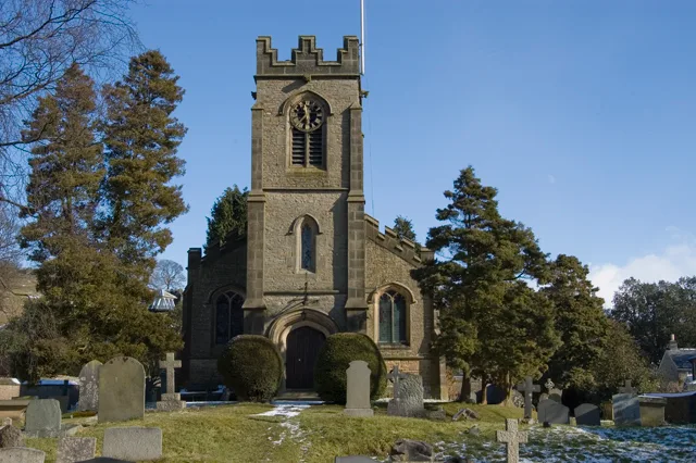
St Peter's Church, Stainforth
St Peter's Church, Stainforth — grade II listed church in Stainforth, Craven, North Yorkshire, England, UK.
 📷 3
📷 3Natural landmarks · North West England
Stainforth Foss
Stainforth Foss — a other in england-north-west, United Kingdom.
 📷 5
📷 5Historic bridges · North West England
Knight Stainforth Bridge
Knight Stainforth Bridge is a historic bridge in the United Kingdom.
Caravan parks · North West England
Knight Stainforth Hall Camping & Caravan Park
Knight Stainforth Hall Camping & Caravan Park — a caravan park in england north west.
 📷 3
📷 3Historic houses · North West England
Triple Draw Kilns
Triple Draw Kilns — a historic house in england-north-west, United Kingdom.
 📷 3
📷 3Natural landmarks · North West England
Catrigg Force
Catrigg Force — a other in england-north-west, United Kingdom.
More towns in this region
 Flagship📷 5
Towns & cities · North West England
Aughton
Aughton — village and civil parish within the West Lancashire district of Lancashire, England.
 Flagship📷 5
Towns & cities · North West England
Haigh
Haigh — village and civil parish of the Metropolitan Borough of Wigan in Greater Manchester, England.
 Flagship📷 5
Towns & cities · North West England
Lancaster
Lancaster — county town of Lancashire, England.
 Flagship📷 3
Towns & cities · North West England
Preston
Preston — city and the administrative centre of Lancashire, England.
Frequently asked questions
- Where is Stainforth?
- Stainforth is in North-West England, United Kingdom (postcode BD24), in the parish of Stainforth.
- Is Stainforth a protected site?
- Yes — Stainforth is part of the Forest Of Bowland National Landscape (AONB).
- Is Stainforth free to visit?
- Yes, Stainforth is free to enter.
- How do I get to Stainforth?
- The nearest railway station is Settle, about 3.9 km away. Drivers can navigate to postcode BD24.