Towns & cities · South West England
St Mawes
Also known as: Lannvowsedh
St Mawes — village in Cornwall, United Kingdom.

Wikimedia Commons contributors — see linked file page for photographer and licence licence
Plan your visit
- Typical visit
- 3 h–6 h
- Nearest railway station
- Falmouth Docks · 2.8 km
- Free entry
- Family-friendly
- Dog-friendly
About
St Mawes is a town, city, village or settlement in the United Kingdom. Address: TR2. Wikidata describes it as: "village in Cornwall, United Kingdom". Coordinates: 50.1580°, -5.0180°.
Photo gallery
Protected designations
- Site of Special Scientific Interest: Lower Fal & Helford Intertidal SSSI
- Area of Outstanding Natural Beauty: Cornwall
Designations sourced from Natural England open data under OGL v3.
From the Wikipedia article
St Mawes (Cornish: Lannvowsedh) is a village on the end of the Roseland Peninsula, in the eastern side of Falmouth harbour, on the south coast of Cornwall, England. The village, formerly two separate hamlets, lies on the east bank of the Carrick Roads, a large waterway created after the Ice Age from an ancient valley which flooded as the melt waters caused the sea level to rise. The immense natural harbour thus created is claimed to be the third largest in the world. St Mawes was once a busy fishing port, but the trade declined during the 20th century and the village now serves as a popular tourist location, with many properties functioning as holiday accommodation. The village is in the civil parish of St Just in Roseland and lies within the Cornwall Area of Outstanding Natural Beauty (AONB).
Excerpt from Wikipedia under CC BY-SA 4.0. See the source article linked in Sources below.
Background
History
by J.M.W. Turner, 1812]] The village takes its name from the Celtic saint Saint Maudez (Mawe), who may have come from Ireland but is mainly venerated in Brittany. A name: 'Musidum' in Roman times, has subsequently been applied to St. Mawes, although the source is dubious. St Mawes was once an important town and was made a borough in 1563, returning two members to parliament. It was disfranchised in 1832. The population in the 1841 census was 941.The town was described, in 1880, by an anonymous writer, <blockquote> ... as a quiet little fishing village, and consists of a long straggling street, fronting the water; it has, however a good pier, which was erected in 1854; and a sea-wall, with a…
Sourced from Wikipedia under CC BY-SA 4.0.
- Coordinates
- 50.1580, -5.0180
- District
- Cornwall
- Parish
- St. Just-in-Roseland
- Postcode
- TR2
- Parliamentary constituency
- Truro and Falmouth
- Nearest railway station
- Falmouth Docks — 2.8 km
- Official site
- www.stmawes.info
Sources
- wikidata: Q993884 (CC0)
- wikipedia: St Mawes (CC BY-SA 4.0)
- commons: St Mawes Castle Cornwall.jpg (CC BY-SA 4.0)
Other places nearby
Loading nearby places…
Nearby
 📷 4
📷 4Historic churches · South West England
St Mawes' Church, St Mawes
St Mawes' Church, St Mawes — a Grade II*-listed church in england-south-west, United Kingdom.
 📷 3
📷 3Historic churches · South West England
Holy well of St Mawes, 80m east of St Mawes Methodist Church
Holy well of St Mawes, 80m east of St Mawes Methodist Church — a Grade II*-listed church in england-south-west, United Kingdom.
 📷 3
📷 3Historic houses · South West England
St. Mawes Coastal Battery
St. Mawes Coastal Battery — a historic house in england-south-west, United Kingdom.
 📷 3
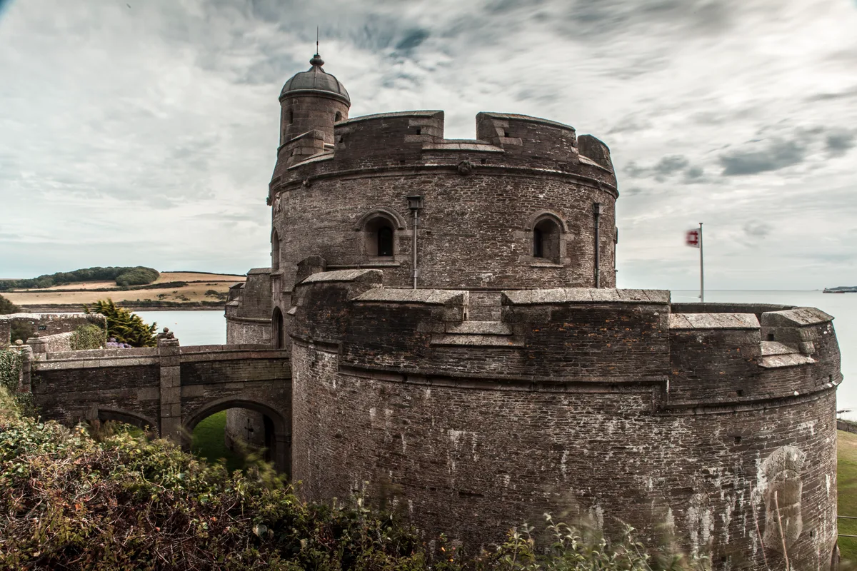
📷 3Castles · South West England
St Mawes Castle
St Mawes Castle — castle in Cornwall built in the 16th century.
 📷 5
📷 5Beaches · South West England
Cellars Beach
Cellars Beach is a beach in the United Kingdom.
 📷 5
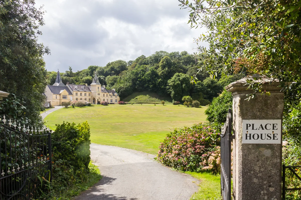
📷 5Stately homes · South West England
Place House
Place House — Manor in St Anthony in Roseland.
More towns in this region
 Flagship📷 10
Towns & cities · South West England
All Saints
All Saints — village and civil parish in Devon, England, UK.
 Flagship📷 10
Towns & cities · South West England
Axmouth
Axmouth — village and civil parish in Devon, England, UK.
 ★ Iconic📷 10
Towns & cities · South West England
Beer
Beer — village and civil parish in Devon, UK.
 Flagship📷 10
Towns & cities · South West England
Branscombe
Branscombe — village and civil parish in Devon, UK.
Frequently asked questions
- Where is St Mawes?
- St Mawes is in South-West England, United Kingdom (postcode TR2), in the parish of St. Just-in-Roseland.
- Is St Mawes a protected site?
- Yes — St Mawes is part of the Lower Fal & Helford Intertidal SSSI Site of Special Scientific Interest and the Cornwall National Landscape (AONB).
- Is St Mawes free to visit?
- Yes, St Mawes is free to enter.
- How do I get to St Mawes?
- The nearest railway station is Falmouth Docks, about 2.8 km away. Drivers can navigate to postcode TR2.