Beaches · South West England
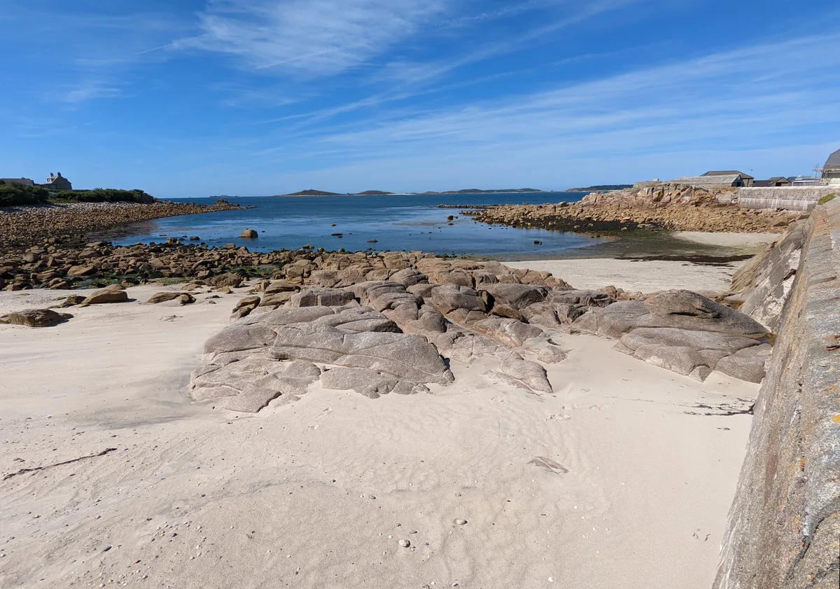
Maenporth Beach
Maenporth Beach is a beach in the United Kingdom.

Wikimedia Commons contributors — see linked file page for photographer and licence licence
Plan your visit
- Typical visit
- 1 h–3 h
- Best time of year
- Summer (Jun–Aug)
- Nearest railway station
- Penmere · 2.9 km
- Free entry
- Family-friendly
- Dog-friendly
About
Maenporth Beach is a named beach on the United Kingdom coastline. Coordinates: 50.1252°, -5.0934°. This entry is part of The Great Britain Guide, a free, ad-free, open-data tourist directory.
Photo gallery
Protected designations
- Site of Special Scientific Interest: Lower Fal & Helford Intertidal SSSI
- Area of Outstanding Natural Beauty: Cornwall
Designations sourced from Natural England open data under OGL v3.
From the Wikipedia article
Maenporth (Cornish: Meynporth, meaning stones cove) is a cove and beach in west Cornwall, England. It is situated approximately two miles (3 km) south-southwest of Falmouth on the estuary of the River Fal. Maenporth cove faces east across Falmouth Bay with views towards Pendennis Castle and the lighthouse on St Anthony Head. The South West Coast Path runs through Maenporth. Behind the cove, wetland supports varied birdlife including the grey heron and the little egret. The beach shelves gently and at low water leaves an area of shallow water that is safe for swimming. The beach has facilities for launching boats, scuba diving and sea kayaking. Other facilities include car parking, a cafe and public toilets. On the hill above the beach is modern holiday accommodation in the Maenporth Estate. Neighbouring beaches include Swanpool and Gyllyngvase.
Excerpt from Wikipedia under CC BY-SA 4.0. See the source article linked in Sources below.
Background
History
The beach head has been built up by easterly winds, and covers a previous natural harbour and human activity. The heritage environment record indicates a forest terrain beneath the sandy beach. A total of seven Bronze age tumuli in the area have been identified by aerial surveys, suggesting a significant settlement and trading base in the middle to late Bronze age. Well sheltered for vessels against westerly winds, and probably navigable in the two flooded valleys above the beach head, the likely trading commodity was tin, brought overland from the west. Sand obstructs the harbour entrance, thought to be on the south end of the inlet, where a more recent stone quay is now obscured by blown…
Sourced from Wikipedia under CC BY-SA 4.0.
- Coordinates
- 50.1252, -5.0934
- District
- Cornwall
- Parish
- Budock
- Postcode
- TR11 5HN
- Parliamentary constituency
- Truro and Falmouth
- Nearest railway station
- Penmere — 2.9 km
Sources
- osm: w436659206 (ODbL)
- wikipedia: Maenporth (CC BY-SA 4.0)
- commons: Maenporth - geograph.org.uk - 222161.jpg (CC BY-SA 4.0)
Other places nearby
Loading nearby places…
Nearby
 📷 5
📷 5Beaches · South West England
Maenporth Beach
Maenporth Beach is a beach in the United Kingdom.
 📷 3
📷 3Historic houses · South West England
Rosemerryn House
Rosemerryn House — house in Budock, Cornwall, England, UK.
Campsites · South West England
Tregedna Farm
Tregedna Farm — a campsite in england south west.
Hotels · South West England
Hotel Meudon
Hotel Meudon — a hotel in england south west.
Caravan parks · South West England
Pennance Mill Farm
Pennance Mill Farm — a caravan park in england south west.
 📷 5
📷 5Beaches · South West England
Arthur's Beach (Sunny Cove)
Arthur's Beach (Sunny Cove) is a beach in the United Kingdom.
More beaches in this region
 📷 5
📷 5Beaches · South West England
Amy's Cove
Amy's Cove is a beach in the United Kingdom.
 📷 5
📷 5Beaches · South West England
Arlo Porth
Arlo Porth is a beach in the United Kingdom.
📷 5Beaches · South West England
Arthur's Beach (Sunny Cove)
Arthur's Beach (Sunny Cove) is a beach in the United Kingdom.
 📷 5
📷 5Beaches · South West England
Ayrmer Cove
Ayrmer Cove is a beach in the United Kingdom.
Frequently asked questions
- Where is Maenporth Beach?
- Maenporth Beach is in South-West England, United Kingdom (postcode TR11 5HN), in the parish of Budock.
- Is Maenporth Beach a protected site?
- Yes — Maenporth Beach is part of the Lower Fal & Helford Intertidal SSSI Site of Special Scientific Interest and the Cornwall National Landscape (AONB).
- Is Maenporth Beach free to visit?
- Yes, Maenporth Beach is free to enter.
- How do I get to Maenporth Beach?
- The nearest railway station is Penmere, about 2.9 km away. Drivers can navigate to postcode TR11 5HN.