Historic churches · South East England
St. Mary's Church, Brading
St. Mary's Church, Brading — church in Brading, UK.

Wikimedia Commons contributors — see linked file page for photographer and licence licence
Plan your visit
- Typical visit
- 30 min–1 h
- Nearest railway station
- Brading · 0.6 km
- Free entry
- Family-friendly
About
St. Mary's Church, Brading is a historic church in the United Kingdom. Records date its origin to 1200. Heritage designation: Grade I listed building. Affiliated with Anglicanism. Wikidata describes it as: "church in Brading, UK". Coordinates: 50.6825°, -1.1428°.
Photo gallery
Heritage listing
Details BRADING SZ6086 HIGH STREET (East side) 1352-0/6/42 Church of St Mary 18/01/67 GV I Parish church. Nave of c1200, North and South aisles C13 with C15 windows, chancel and west Tower C13, south porch and north and south chapels C15, the chancel lengthened to the east in 1865 when the church was restored by the Oglander family. Built of Isle of Wight stone rubble with stone steeple and tiled roof. West Tower late C13 of 3 stages with processional way through from north to south. West north and south arches have large chamfers. Middle stage has double lancet under one pointed arch. Pseudo-machicolations and stone recessed spire with iron weathercock. External wooden ladder to bell chamber. North aisle has C13 west lancets and 3 Perpendicular double cinquefoil-headed lights with dripmould and pointed arched doorcase. Roof has 4 pseudo-gables, C19 brick ridge tiles and cross-shaped saddle stone. South aisle has 4 triple cinquefoil-headed lights in arched surround with dripmoulding and central C15 gabled south porch, not used as such at time of survey with cross-shaped saddlestone, offset buttresses and arched doorcase with hood moulding. South or Oglander chapel has 2 triple cinquefoil-headed lights in arched heads with dripmoulds divided by buttress and cross-shaped saddlestone. Chancel has gable end of 1866 with triple lancet having elaborate floral corbel stops. North or De Aula chapel has 2 C15 cinquefoil-headed lights in arched surround, buttresses and C13 arched doorway. Interior: nave has North and South arcades of c1200 with round piers and multi-scalloped capitals having square abaci with chamfered corners. Roof of Nave and aisles is of 1866. 3 wooden hatchments in North aisle. Small octagonal stone font lead lined and dated 1631. Larger square stone font, th
From the Historic England List Entry under OGL v3.
Protected designations
- Area of Outstanding Natural Beauty: Isle Of Wight
- Ramsar wetland: Solent & Southampton Water
Designations sourced from Natural England open data under OGL v3.
From the Wikipedia article
St Mary's Church is a parish church in the Church of England located in Brading, Isle of Wight.
Excerpt from Wikipedia under CC BY-SA 4.0. See the source article linked in Sources below.
Background
History
The church is medieval dating from the twelfth century. At this church the Rev. Legh Richmond is thought to have originated the now globally popular idea of using boards with movable numbers to indicate hymn numbers during church services. The 13th-century tower is of a very unusual style in that it is built on four piers at the entrance to the church. This is one of only four in examples in Britain. The tower contains a ring of 8 bells which the heaviest weighs 10.5cwt in the key of G. The oldest bell was made in 1594. The current church building has aspects dating from the late 12th century onward, with the majority of the present building resulting from the alterations of the 14th and…
Sourced from Wikipedia under CC BY-SA 4.0.
- Coordinates
- 50.6825, -1.1428
- District
- Isle of Wight
- Parish
- Brading
- Postcode
- PO36 0ED
- Parliamentary constituency
- Isle of Wight East
- Established
- 1200
- Nearest railway station
- Brading — 0.6 km
- Official site
- lilliputmuseum.net
Sources
- wikidata: Q7590153 (CC0)
- wikipedia: St Mary's Church, Brading (CC BY-SA 4.0)
- commons: St Mary's Church, Brading, Isle of Wight, England.jpg (CC BY-SA 4.0)
Other places nearby
Loading nearby places…
Nearby
 📷 5
📷 5Memorials & monuments · South East England
Monument To Thomas Wiseman Approximately 3 Metres East Of North Corner Of De Aula Chapel
Monument To Thomas Wiseman Approximately 3 Metres East Of North Corner Of De Aula Chapel — Grade II listed building-listed memorial in england-south-east, United Kingdom.
 📷 5
📷 5Memorials & monuments · South East England
Monument Approximately 8 Metres North Of Item 6/66
Monument Approximately 8 Metres North Of Item 6/66 — Grade II listed building-listed memorial in england-south-east, United Kingdom.
 📷 5
📷 5Memorials & monuments · South East England
Brading War Memorial
Brading War Memorial — Grade II listed building-listed memorial in england-south-east, United Kingdom.
📷 5Memorials & monuments · South East England
Monument Approximately 12 Metres South Of East Wall Of Oglander Chapel
Monument Approximately 12 Metres South Of East Wall Of Oglander Chapel — Grade II listed building-listed memorial in england-south-east, United Kingdom.
📷 5Memorials & monuments · South East England
Monument To Sarah, Wife Of Robert Love
Monument To Sarah, Wife Of Robert Love — Grade II listed building-listed memorial in england-south-east, United Kingdom.
📷 5Memorials & monuments · South East England
Monument Approximately 7 Metres East Of Item 6/70
Monument Approximately 7 Metres East Of Item 6/70 — Grade II listed building-listed memorial in england-south-east, United Kingdom.
Other places from this era
 📷 5
📷 5Historic churches · London
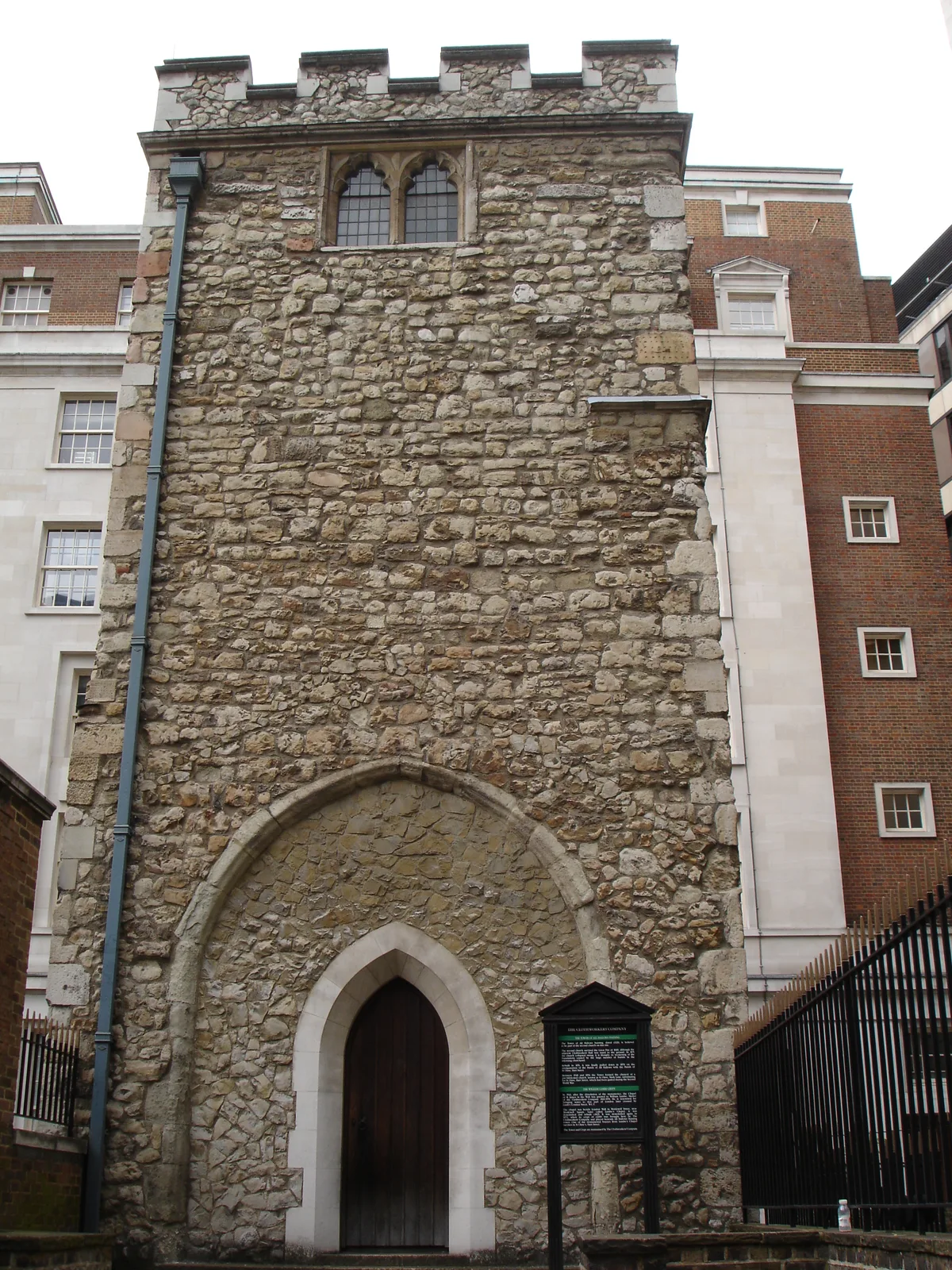
All Hallows Staining
All Hallows Staining — church in City of London, UK.
 📷 5
📷 5Historic churches · London
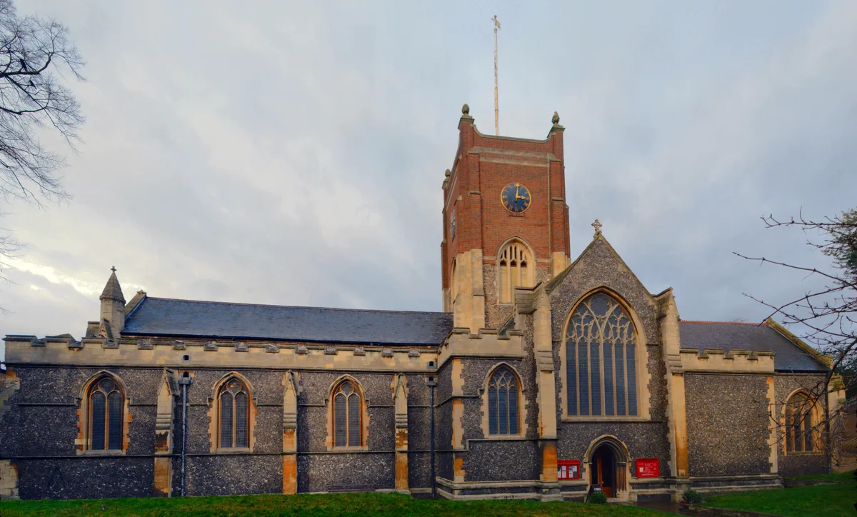
All Hallows' Church, Tottenham
All Hallows' Church, Tottenham — church in Tottenham, London.
 📷 5
📷 5Historic churches · London
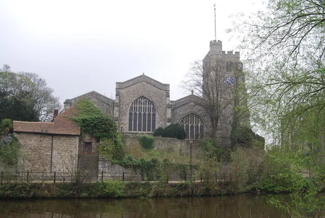
All Saints Church, Kingston upon Thames
All Saints Church, Kingston upon Thames — church in Kingston upon Thames, London.
 📷 5
📷 5Historic churches · London
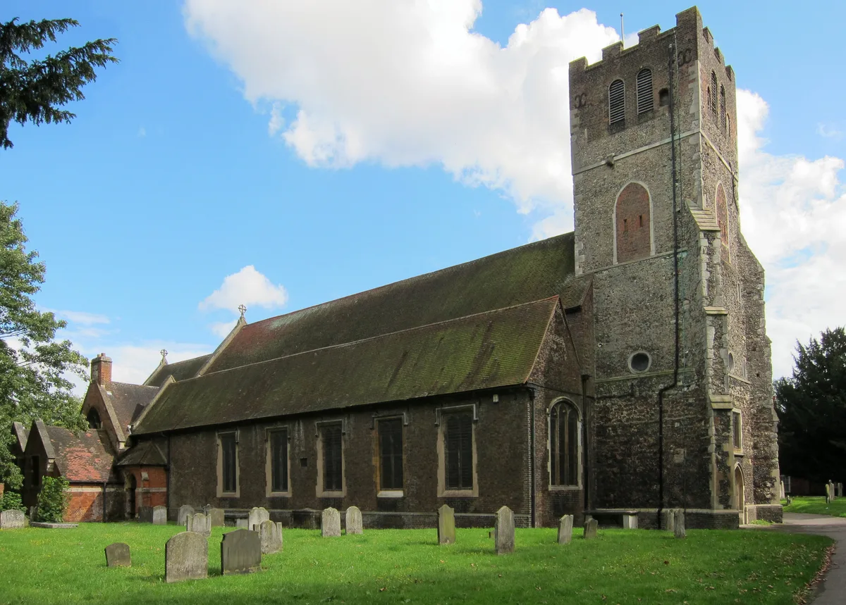
All Saints Church, Maidstone
All Saints Church, Maidstone — parish church associated with the Archbishop's Palace, Maidstone, Kent, England, UK.
More places in this region
 Flagship📷 10
Historic churches · South East England
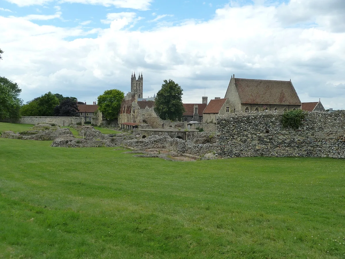
St Augustine's Abbey
St Augustine's Abbey — monastery in Canterbury, Kent, England, UK.
 📷 5
📷 5Historic churches · South East England
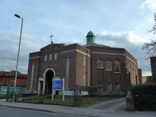
286
286 — church building in Swaythling, Southampton, England.
 📷 5
📷 5Historic churches · South East England
Abbey Church of St Gregory the Great, Downside Abbey
Abbey Church of St Gregory the Great, Downside Abbey — church in Stratton-on-the-Fosse, Somerset, England, UK.
 📷 5
📷 5Historic churches · South East England
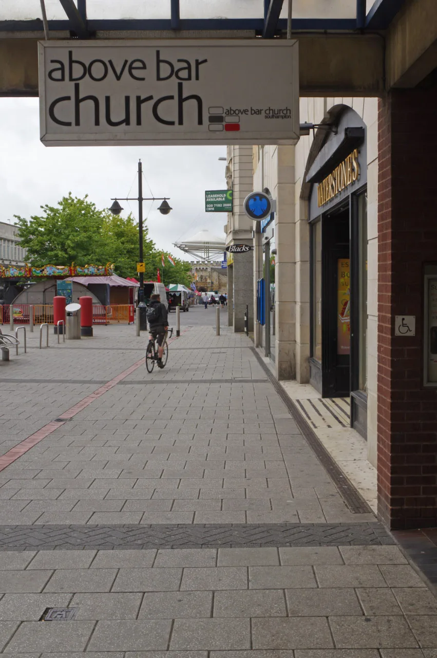
Above Bar Church, Southampton
Above Bar Church, Southampton — church in Southampton, UK.
Frequently asked questions
- Where is St. Mary's Church, Brading?
- St. Mary's Church, Brading is in South-East England, United Kingdom (postcode PO36 0ED), in the parish of Brading.
- When was St. Mary's Church, Brading built?
- Built or established in 1200.
- Is St. Mary's Church, Brading a listed building?
- St. Mary's Church, Brading is officially recognised as Grade I listed building listed.
- Is St. Mary's Church, Brading a protected site?
- Yes — St. Mary's Church, Brading is part of the Isle Of Wight National Landscape (AONB) and the Solent & Southampton Water Ramsar wetland.
- Is St. Mary's Church, Brading free to visit?
- Yes, St. Mary's Church, Brading is free to enter.
- How do I get to St. Mary's Church, Brading?
- The nearest railway station is Brading, about 0.6 km away. Drivers can navigate to postcode PO36 0ED.