Museums · North Wales
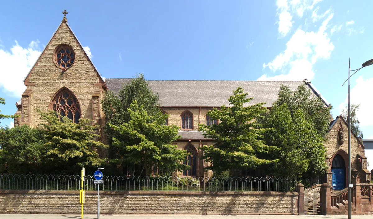
St Helens, Merseyside
St Helens, Merseyside — a museum in wales-north, United Kingdom.

Dave Bevis — CC BY-SA 2.0 via Wikimedia Commons licence
_-_geograph.org.uk_-_3923412.jpg)
Plan your visit
- Typical visit
- 1.5 h–3 h
- Best time of year
- Year-round
- Family-friendly
- Wheelchair accessible
About
St Helens, Merseyside is a museum in wales-north, United Kingdom, listed in the Wikipedia register of British heritage and tourism sites. See the linked Wikipedia article for full details.
Photo gallery
Place summary
St Helens, located in Merseyside, is home to a museum that showcases the region's industrial heritage. The facility highlights local history and cultural significance, with exhibits dedicated to the area's past.
AI-generated from the structured facts on this page (operator, designation, listing, era). Not a substitute for visiting.
Background
History
St Helens Town Hall built in 1876 to replace the original (damaged by a fire in 1871); its clock tower originally had a steeple but this was destroyed in a fire in 1913. In the centre of the modern town centre, adjacent to the town hall, is the Gamble Institute, built in 1896 and named after Sir David Gamble, who was the first mayor and who also gifted the land for the building. Today, the Gamble Institute building serves as the central library and also houses other municipal offices and archives. Other buildings of note are: The Friends' Meeting House, Church Street. This attractive stone-built Grade II listed hall has been used for Quaker worship for over 300 years since its…
Description
The last coal mine located close to the town centre (Ravenhead Colliery) and those located in the outlying districts of St Helens, including those that were just outside the original 1887 County Borough boundary, such as Clock Face (Clock Face Colliery), Sutton (Bold Colliery), Sutton Heath (Lea Green Colliery), Sutton Manor (Sutton Manor Colliery) and Haydock (Lyme Pit, Wood Pit, Old Boston), were all closed between the nationalisation of the deep coal mining industry in 1947 and 24 May 1991, when Sutton Manor Colliery, the last to go in the immediate St Helens area, finally closed its gates. The coal mining industry in St Helens and elsewhere had collapsed because the government…
Sourced from Wikipedia under CC BY-SA 4.0.
- Coordinates
- 53.4542, -2.7361
- District
- St. Helens
- Parish
- St. Helens, unparished area
- Postcode
- WA10 1LQ
- Parliamentary constituency
- St Helens South and Whiston
- Phone
- +44 1744 756000
- Official site
- www.sthelenstheatreroyal.com
Sources
- wikipedia: St Helens, Merseyside (CC BY-SA 4.0)
Other places nearby
Loading nearby places…
Nearby
 📷 3
📷 3Other places · North Wales
Queen Victoria
Queen Victoria — Public artwork (statue).
 📷 3
📷 3Historic libraries · North Wales
Gamble Institute, St Helens
Gamble Institute, St Helens — former library and tehnical school in St Helens, Merseyside, UK.
 📷 3
📷 3Theatres · North Wales
St Helens Theatre Royal
St Helens Theatre Royal is a theatre in the United Kingdom.
 📷 5
📷 5Theatres · North Wales
Hippodrome, St Helens
Hippodrome, St Helens — a cinema heritage in wales-north, United Kingdom.
📷 3Memorials & monuments · North Wales
Millenium Needle
Millenium Needle is a memorial in the United Kingdom.
 📷 4
📷 4Historic churches · North Wales
Holy Cross Church, St Helens
Holy Cross Church, St Helens — grade II listed church in St Helens, Merseyside, England, UK.
More museums in this region
 📷 4
📷 4Museums · North Wales
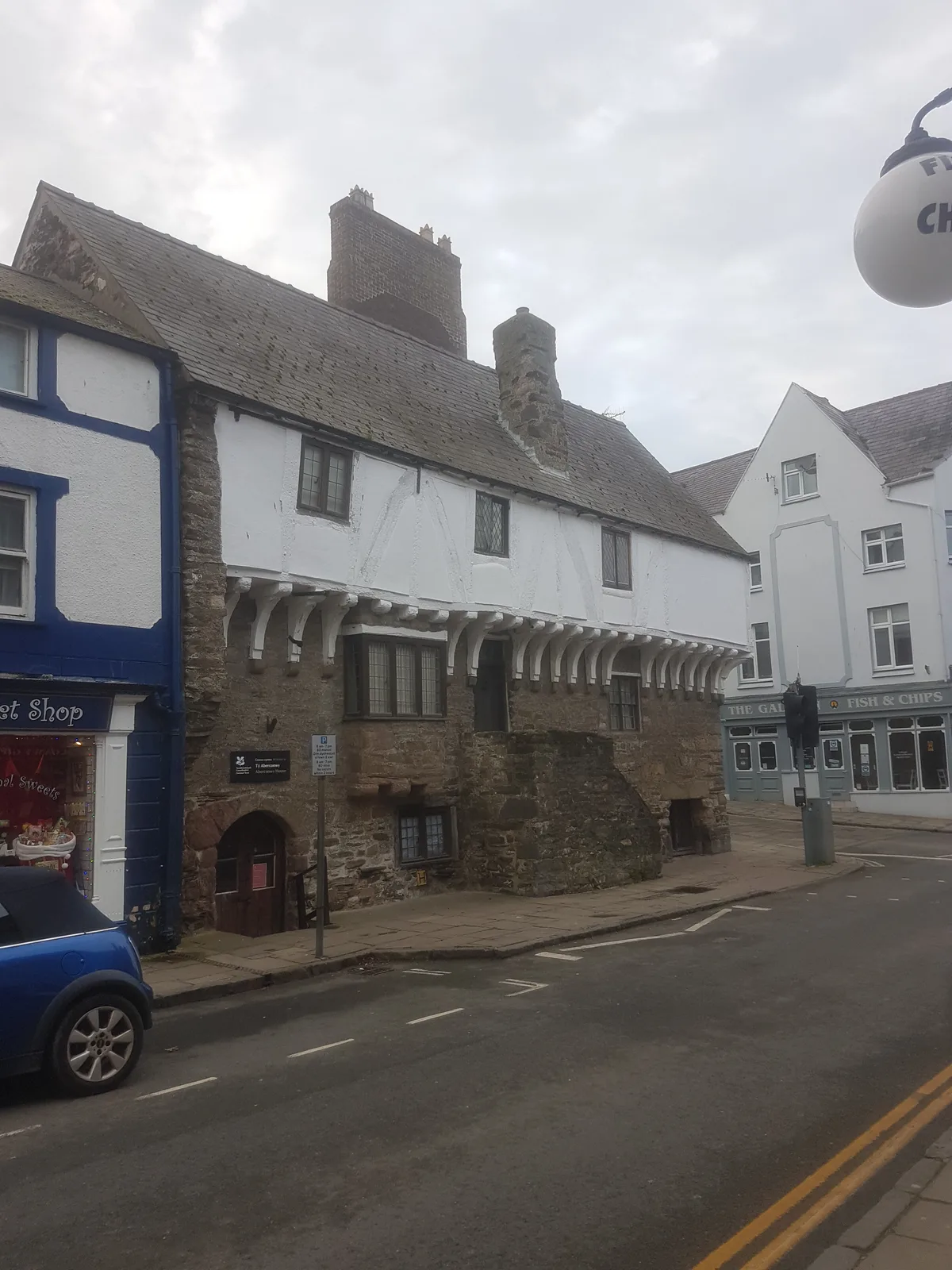
Aberconwy House Museum
Aberconwy House Museum — museum in Betws y Coed.
 📷 3
📷 3Museums · North Wales
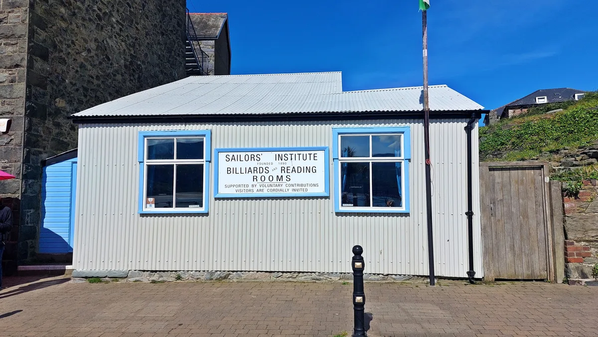
Barmouth Sailors' Institute
Barmouth Sailors' Institute — Community centre, heritage organisation and museum in the Barmouth, Wales, UK.
 📷 3
📷 3Museums · North Wales
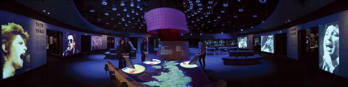
British Music Experience
British Music Experience is a museum in the United Kingdom.
 📷 3
📷 3Museums · North Wales
Caernarfon Castle and Town Walls
Caernarfon Castle and Town Walls — part of a World Heritage site in the United Kingdom.
Frequently asked questions
- Where is St Helens, Merseyside?
- St Helens, Merseyside is in North Wales, in the United Kingdom — coordinates 53.4542°, -2.7361°.
- Is St Helens, Merseyside wheelchair accessible?
- Yes — St Helens, Merseyside is tagged in OpenStreetMap as wheelchair-accessible.