Hill forts · South West England
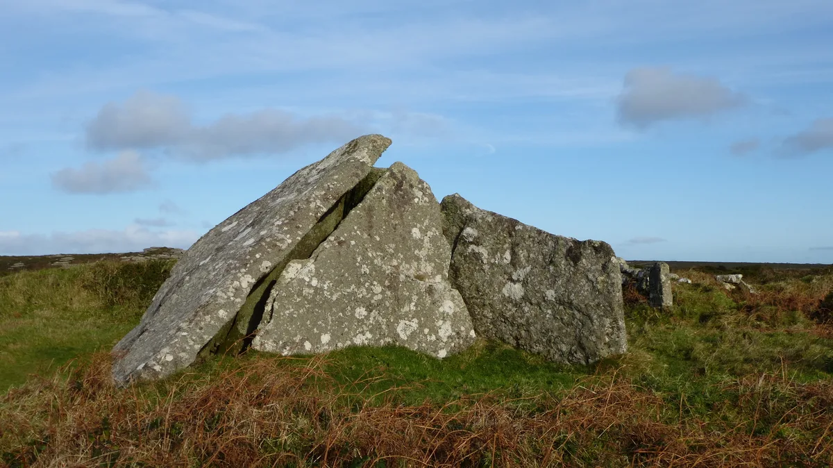
Sperris Quoit
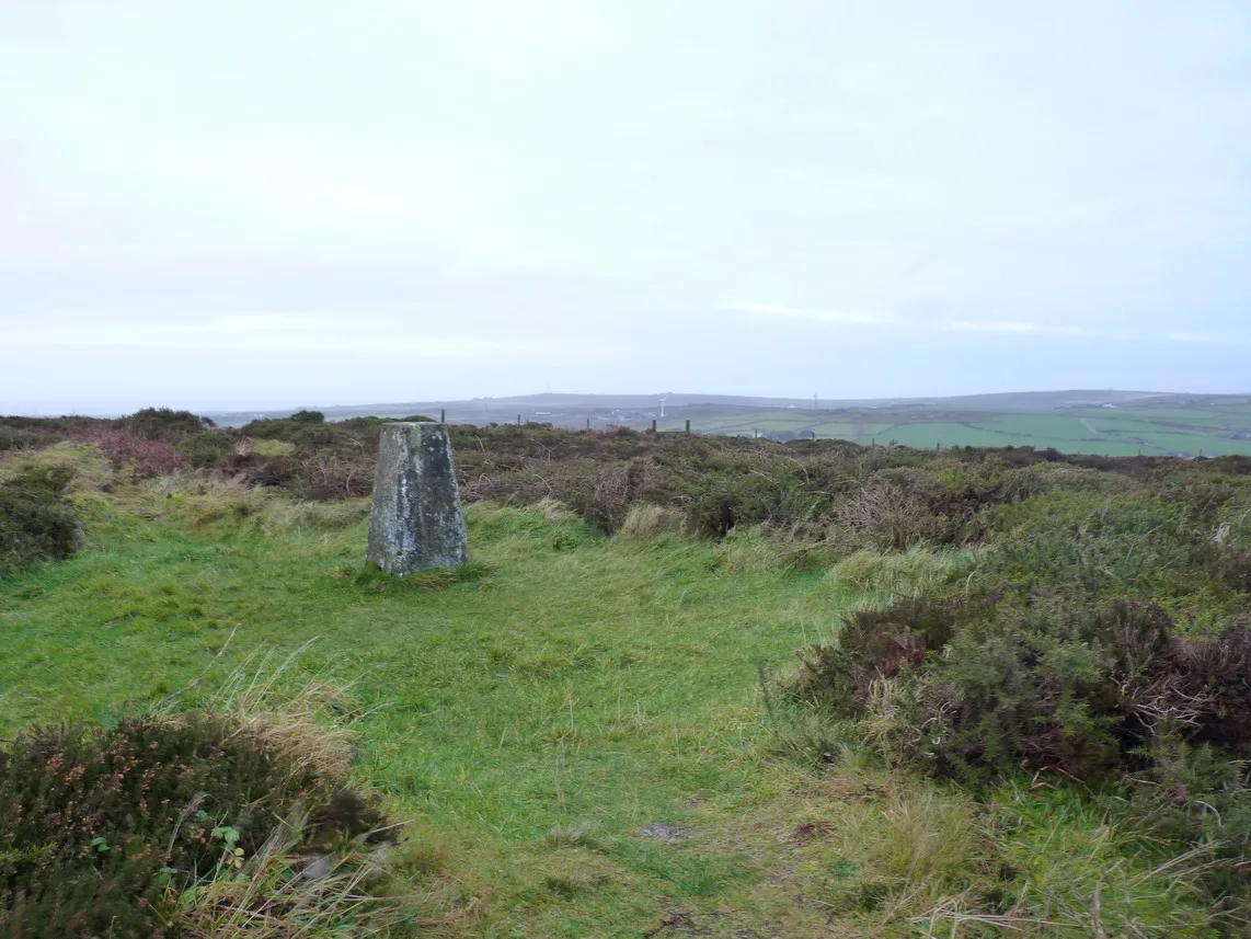
Sperris Quoit — dolmen in the Cornwall region, England.

Wikimedia Commons contributors — see linked file page for photographer and licence licence
Plan your visit
- Typical visit
- 1 h–2 h
- Nearest railway station
- St Ives · 5.2 km
- Free entry
- Dog-friendly
About
Sperris Quoit is a hill fort in the United Kingdom. Heritage designation: scheduled monument. Wikidata describes it as: "dolmen in the Cornwall region, England". Coordinates: 50.1902°, -5.5445°.
Photo gallery
Protected designations
- Site of Special Scientific Interest: Aire Point to Carrick Du SSSI
- Site of Special Scientific Interest: West Penwith Moors and Downs SSSI
- Area of Outstanding Natural Beauty: Cornwall
Designations sourced from Natural England open data under OGL v3.
From the Wikipedia article
Sperris Quoit is a ruined megalithic burial chamber or dolmen, and one of a type of tomb unique to West Penwith, located on a moor around 365 metres northeast of Zennor Quoit, being roughly halfway between Zennor and Amalveor, Cornwall. It is the northernmost quoit in the Penwith peninsula and a Scheduled Monument.
Excerpt from Wikipedia under CC BY-SA 4.0. See the source article linked in Sources below.
Background
History
Sperris Quoit is over 4000 years old, and may be older, possibly as old as 7000 years, as it has been dated variously at late- or post-Neolithic, and late Mesolithic or Neolithic. It was in relatively good condition until at least the early 19th century, but there is evidence that stones have been removed since then, for local building work in the village of Zennor. The site was rediscovered in 1954 by Thomas and Wakes, who excavated it in part.
Description
The quoit is situated in rough moorland on the side of Zennor Hill, at about 230 metres above sea level, and is close to several rocky outcrops. About 12 metres in diameter, five stones were found during the excavations, two standing, and three fallen, of which one has eroded to a stump, although due to heavy vegetation and dense gorse, only one upright of the chamber is visible, which is over 1.5 metres tall.
Sourced from Wikipedia under CC BY-SA 4.0.
- Coordinates
- 50.1902, -5.5445
- District
- Cornwall
- Parish
- Zennor
- Postcode
- TR26 3BP
- Parliamentary constituency
- St Ives
- Nearest railway station
- St Ives — 5.2 km
Sources
- wikidata: Q7576409 (CC0)
- wikipedia: Sperris Quoit (CC BY-SA 4.0)
- commons: Sperris Quoit.jpg (CC BY-SA 4.0)
Other places nearby
Loading nearby places…
Nearby
 📷 5
📷 5Archaeological sites · South West England
Entrance grave known as Zennor Quoit 600m north-east of Foage Farm
Entrance grave known as Zennor Quoit 600m north-east of Foage Farm — archaeological site in Zennor, Cornwall, England, UK.
 📷 4
📷 4Hill forts · South West England
Zennor Quoit
Zennor Quoit — Dolmen in the Cornwall region, England.
 📷 5
📷 5Museums · South West England
Wayside Folk Museum
Wayside Folk Museum — a museum in england-south-west, United Kingdom.
 📷 5
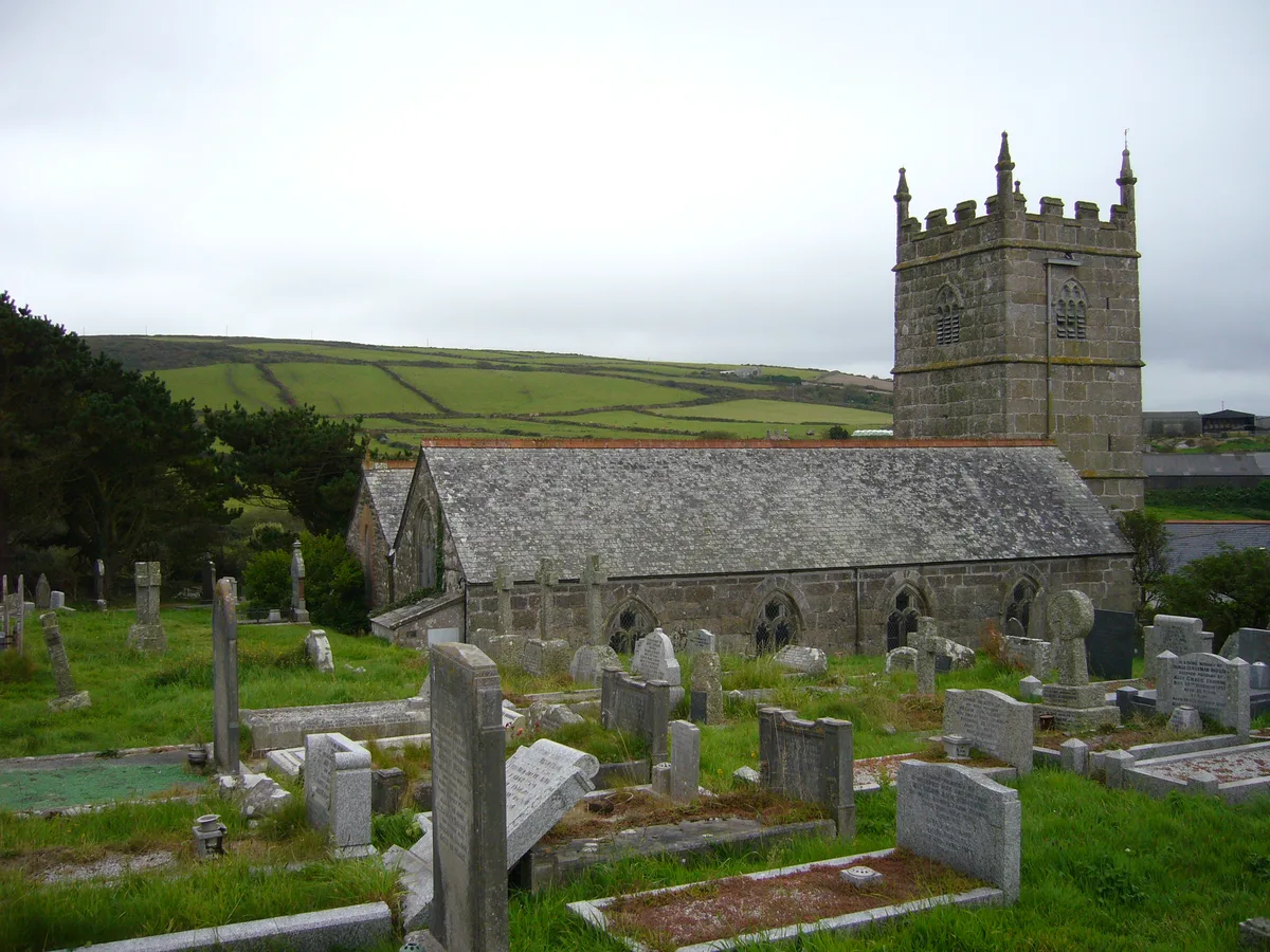
📷 5Historic churches · South West England
St Senara's Church, Zennor
St Senara's Church, Zennor — church in Cornwall, England, UK.
 📷 3
📷 3Memorials & monuments · South West England
Zennor War Memorial in the Church yard of St Sennar
Zennor War Memorial in the Church yard of St Sennar — Grade II listed building-listed memorial in england-south-west, United Kingdom.
 📷 3
📷 3Historic bridges · South West England
Bridge And Stile At Sw 48053975
Bridge And Stile At Sw 48053975 — Grade II listed building-listed bridge in england-south-west, United Kingdom.
More places in this region
 📷 5
📷 5Hill forts · South West England
Ballowall Barrow
Ballowall Barrow — archaeological site in St Just, Cornwall, England, UK.
 📷 5
📷 5Hill forts · South West England
Barnstaple Castle
Barnstaple Castle — castle in Devon, England, UK.
 📷 5
📷 5Hill forts · South West England
Bartinney Castle
Bartinney Castle — Iron Age enclosure in Cornwall, England, UK.
 📷 5
📷 5Hill forts · South West England
Berry's Wood
Berry's Wood — iron Age hill fort in south Devon, England, UK.
Frequently asked questions
- Where is Sperris Quoit?
- Sperris Quoit is in South-West England, United Kingdom (postcode TR26 3BP), in the parish of Zennor.
- Is Sperris Quoit a listed building?
- Sperris Quoit is officially recognised as scheduled monument listed.
- Is Sperris Quoit a protected site?
- Yes — Sperris Quoit is part of the Aire Point to Carrick Du SSSI Site of Special Scientific Interest and the West Penwith Moors and Downs SSSI Site of Special Scientific Interest.
- Is Sperris Quoit free to visit?
- Yes, Sperris Quoit is free to enter.
- How do I get to Sperris Quoit?
- The nearest railway station is St Ives, about 5.2 km away. Drivers can navigate to postcode TR26 3BP.