Harbours & ports · South East England
Sovereign Harbour
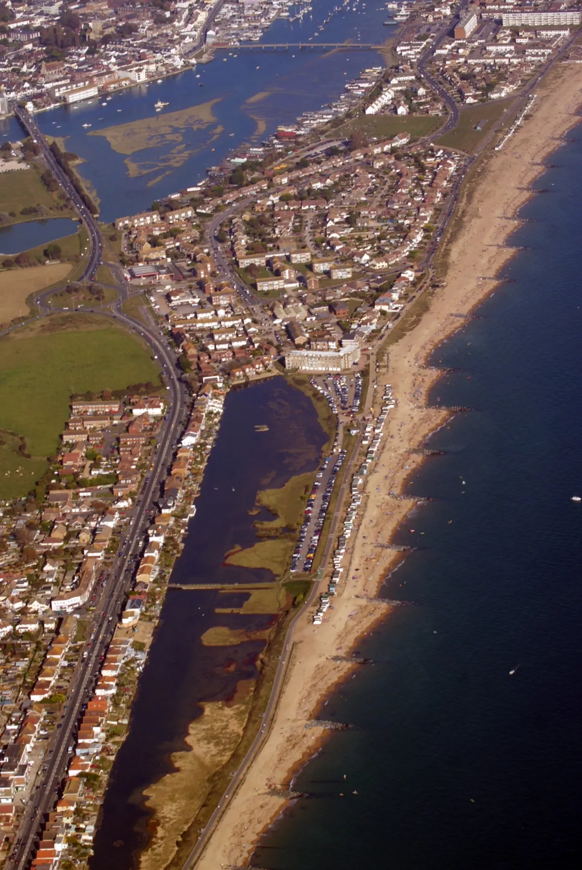
Sovereign Harbour — marina in Eastbourne, East Sussex, England.

Wikimedia Commons licence
Plan your visit
- Typical visit
- 45 min–1.5 h
- Nearest railway station
- Pevensey and Westham · 2.8 km
- Family-friendly
- Dog-friendly
About
Sovereign Harbour is a harbour in the United Kingdom. Address: BN23. Wikidata describes it as: "marina in Eastbourne, East Sussex, England". Coordinates: 50.7903°, 0.3297°.
Photo gallery
From the Wikipedia article
Sovereign Harbour is a residential and commercial development of the shingle beachland and marsh between Eastbourne and Pevensey Bay in the seaside town of Eastbourne, England.
Excerpt from Wikipedia under CC BY-SA 4.0. See the source article linked in Sources below.
Background
History
The concept for the area came as a gift of the land out of private ownership and ministry of defence use. After some change in legislation, planning was given to the no man's land that existed with no public access. The possibility of housing on the site came in the early 1970s when it was considered that community design and an inclusive plan would enable the site to accommodate visitors, businesses, and homes. The commercial area for retail began trading in 1993 and today still expects some additional business and commercial entities to open. The shingle area was formerly known as The Crumbles. Now Sovereign Harbour has a fishing quarter and boatyard, shops, restaurants and bars,…
Description
The tidal Outer Harbour is only used for entrance to the marina through twin sea locks, which are operated 24 hours a day. It needs frequent dredging to keep the access channel from the sea to the locks open and deep enough for vessels. The local RNLI lifeboat has its own mooring there. The entrance is beside Martello Tower No.66. All the harbours (Inner, South, West and North) are artificial and were dredged one after the other, after 1991. Behind the locks is the main marina called Inner Harbour. This is the central body of water and was the first harbour in use. It contains berths for both visiting and resident berth holders, and provides access to the other three harbours via lifting…
Sourced from Wikipedia under CC BY-SA 4.0.
- Coordinates
- 50.7903, 0.3297
- County
- East Sussex
- District
- Eastbourne
- Parish
- Eastbourne, unparished area
- Postcode
- BN23
- Parliamentary constituency
- Eastbourne
- Nearest railway station
- Pevensey and Westham — 2.8 km
Sources
- wikidata: Q2569013 (CC0)
- wikipedia: Sovereign Harbour (CC BY-SA 4.0)
Other places nearby
Loading nearby places…
Nearby
 📷 5
📷 5Memorials & monuments · South East England
Fisherman’s Memorial
Fisherman’s Memorial — a memorial in england-south-east, United Kingdom.
 📷 5
📷 5Theatres · South East England
Cineworld Cinema Eastbourne
Cineworld Cinema Eastbourne in England South East, United Kingdom.
 📷 5
📷 5Museums · South East England
SS Barnhill
SS Barnhill — a museum in england-south-east, United Kingdom.
Campsites · South East England
Bay View Park
Bay View Park — a campsite in england south east.
Caravan parks · South East England
Castle View Caravan Site
Castle View Caravan Site — a caravan park in england south east.
 📷 5
📷 5Stadiums · South East England
Priory Lane
Priory Lane — stadium in Eastbourne, England.
More places in this region
 Flagship📷 10
Harbours & ports · South East England
Shoreham-by-Sea
Shoreham-by-Sea — seaside town and port in West Sussex, England.
 📷 5
📷 5Harbours & ports · South East England
Chichester Harbour
Chichester Harbour — Harbour & Site of Special Scientific Interest in Chichester, West Sussex.
 📷 5
📷 5Harbours & ports · South East England
Colt Hill Wharf
Colt Hill Wharf is a harbour in the United Kingdom.
_2025-03-02.jpg?width=1200) 📷 5
📷 5Harbours & ports · South East England
Cormorant
Cormorant — Public artwork (sculpture) by Christian Funnell.
Frequently asked questions
- Where is Sovereign Harbour?
- Sovereign Harbour is in South East England, in the United Kingdom — coordinates 50.7903°, 0.3297°. The nearest railway station is Pevensey and Westham, around 2.8 km away.