Harbours & ports · South East England
Shoreham-by-Sea
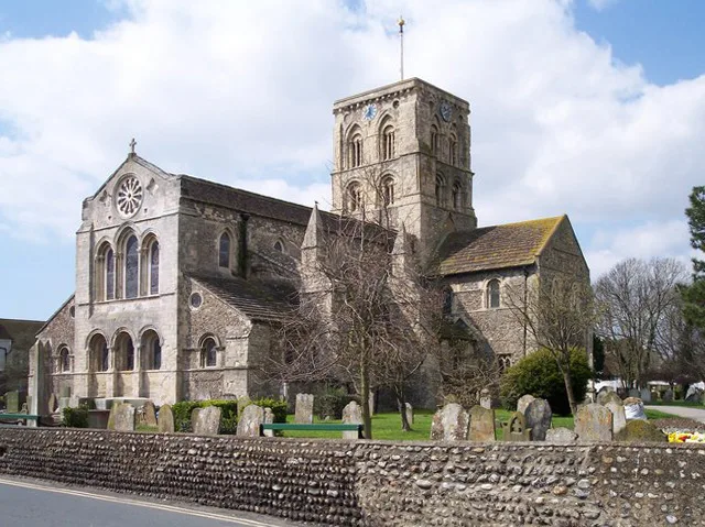
Shoreham-by-Sea — seaside town and port in West Sussex, England.

Wikimedia Commons contributors — see linked file page for photographer and licence licence
Plan your visit
- Typical visit
- 45 min–1.5 h
- Nearest railway station
- Shoreham-by-Sea · 0.3 km
- Family-friendly
- Dog-friendly
About
Shoreham-by-Sea is a harbour in the United Kingdom. It covers approximately 4 km². Recent population estimates put it at around 20,547 people. Address: BN43. Wikidata describes it as: "seaside town and port in West Sussex, England". Coordinates: 50.8329°, -0.2682°.
Photo gallery
From the Wikipedia article
Shoreham-by-Sea (often shortened to Shoreham) is a coastal town and port in the Adur district, in the county of West Sussex, England. In 2011 it had a population of 20,547. The town is bordered to its north by the South Downs, to its west by the Adur Valley, and to its south by the River Adur and Shoreham Beach on the English Channel. The town lies in the middle of the ribbon of urban development along the English south coast, approximately equidistant from the city of Brighton and Hove to the east and the town of Worthing to the west. Shoreham covers an area of 2,430 acres (980 ha) and has a population of 20,547 (2011 census).
Excerpt from Wikipedia under CC BY-SA 4.0. See the source article linked in Sources below.
Background
History
]] ]] ]] Old Shoreham dates back to pre-Roman times. St Nicolas' Church, inland by the River Adur, is partly Anglo-Saxon in its construction. The name of the town has an Old English origin. The town and port of New Shoreham was established by the Norman conquerors towards the end of the 11th century. St Mary de Haura Church (St Mary of the Haven) was built in the decade following 1103 (the Domesday Book was dated 1086), and around this time the town was laid out on a grid pattern that, in essence, still survives in the town centre. The present church is approximately half the size of the original structure – the former nave was already in ruins by the time of the English Civil War, although…
Description
Hedges are very rare on these Downs (except around farmsteads). The Crooked Moon Hedge () lies on the top of a prehistoric field lynchet; these southern slopes of Southwick Hill were covered with an Iron Age field system whose banks lay regularly on east–west and south–north axes. At its northern end, it is the boundary between Kingston Buci and Southwick parishes, and at its southern end it bounded Kingston Buci sheep Down to the west, and one of the parish open fields to the east. The hedge contains a lot of maple and ash and may have been bird-sown. As per Hooper's rule, the hedge is three to four centuries old.<sup>:209</sup>
Sourced from Wikipedia under CC BY-SA 4.0.
- Coordinates
- 50.8329, -0.2682
- County
- West Sussex
- District
- Adur
- Parish
- Adur, unparished area
- Postcode
- BN43
- Parliamentary constituency
- East Worthing and Shoreham
- Population
- 20,547
- Nearest railway station
- Shoreham-by-Sea — 0.3 km
- Official site
- www.adur.gov.uk
Sources
- wikidata: Q770599 (CC0)
- wikipedia: Shoreham-by-Sea (CC BY-SA 4.0)
- commons: Shoreham-by-Sea, West Sussex, England-2Oct2011.jpg (CC BY-SA 4.0)
Other places nearby
Loading nearby places…
Nearby
 📷 5
📷 5Other places · South East England
Adur District
Adur District — a other in england-south-east, United Kingdom.
 📷 5
📷 5Galleries · South East England
Shoreham Art Gallery
Shoreham Art Gallery — a gallery in england-south-east, United Kingdom.
 📷 5
📷 5Memorials & monuments · South East England
Lancing College
Lancing College — a memorial in england-south-east, United Kingdom.
 📷 5
📷 5Historic churches · South East England
St Mary de Haura Church, Shoreham-by-Sea
St Mary de Haura Church, Shoreham-by-Sea — church in Shoreham-by-Sea, West Sussex, England, UK.
 📷 5
📷 5Memorials & monuments · South East England
Captain Henry Roberts
Captain Henry Roberts — a memorial in england-south-east, United Kingdom.
📷 5Memorials & monuments · South East England
Reg Leggett
Reg Leggett — a memorial in england-south-east, United Kingdom.
More places in this region
 📷 5
📷 5Harbours & ports · South East England
Chichester Harbour
Chichester Harbour — Harbour & Site of Special Scientific Interest in Chichester, West Sussex.
 📷 5
📷 5Harbours & ports · South East England
Colt Hill Wharf
Colt Hill Wharf is a harbour in the United Kingdom.
_2025-03-02.jpg?width=1200) 📷 5
📷 5Harbours & ports · South East England
Cormorant
Cormorant — Public artwork (sculpture) by Christian Funnell.
 📷 5
📷 5Harbours & ports · South East England
Folkestone Harbour
Folkestone Harbour — harbour at Folkestone, Kent, England, UK.
Frequently asked questions
- Where is Shoreham-by-Sea?
- Shoreham-by-Sea is in South East England, in the United Kingdom — coordinates 50.8329°, -0.2682°. The nearest railway station is Shoreham-by-Sea, around 0.3 km away.