Towns & cities · South East England
Lancing
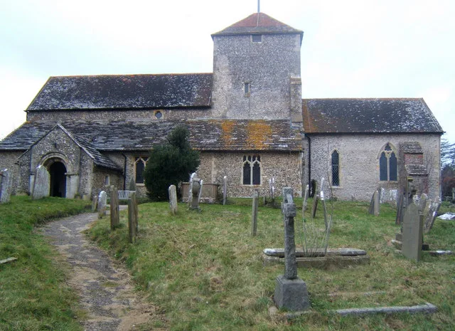
Lancing — village and civil parish in West Sussex, England.

Wikimedia Commons contributors — see linked file page for photographer and licence licence
Plan your visit
- Typical visit
- 3 h–6 h
- Nearest railway station
- Lancing · 0.6 km
- Free entry
- Family-friendly
- Dog-friendly
About
Lancing is a town, city, village or settlement in the United Kingdom. It covers approximately 14 km². Recent population estimates put it at around 18,743 people. Wikidata describes it as: "village and civil parish in West Sussex, England". Coordinates: 50.8320°, -0.3190°.
Photo gallery
From the Wikipedia article
Lancing is a large coastal village and civil parish in the Adur district of West Sussex, England, on the western edge of the Adur Valley. It occupies part of the narrow central section of the Sussex coastal plain between smaller Sompting to the west, larger Shoreham-by-Sea to the east, and the parish of Coombes to the north. Excluding definitive suburbs it may have the largest undivided village cluster in Britain. However, its economy is commonly analysed as integral to the Brighton/Worthing/Littlehampton conurbation. Its settled area beneath the South Downs National Park covers 3.65 square miles (9.5 square kilometres; 2,340 acres), the majority of its land. The Lancing area is characterised by mid-rise coastal urban homes, farmland, and wildlife reserves of the northern chalk downs and River Adur estuary. There are non-religious structures that date back to the early 16th century. The population in 2002 was approximately 19,000. In the 2011 census the population for Lancing and Coombes was recorded as 18,810. The village was a popular seaside resort in the mid-19th century. Summer tourist hallmarks are the traditional guesthouses on the A259 coast road (Brighton Road), as well as a caravan/campsite in Old Salts Farm Road, and beach chair hire and ice cream businesses.
Excerpt from Wikipedia under CC BY-SA 4.0. See the source article linked in Sources below.
Background
History
In 1828, remains of what may be an Iron Age shrine and to its west a later Romano-British temple were found just west of Lancing Ring. The Romano-British temple was located within an oval temenos and seems to have been built in the 1st century AD. A track has existed since Celtic British times which ran from Chanctonbury Ring via Cissbury Ring to Lancing Ring and from then on to a probable ford across the River Adur by the modern Sussex Pad, close to the Old Tollbridge at Old Shoreham. Among this lowest lying farmland to the east of the village proper are remains of medieval salt workings. The Roman road from Noviomagus Reginorum (Chichester) to Novus Portus (probably Portslade near…
Sourced from Wikipedia under CC BY-SA 4.0.
- Coordinates
- 50.8320, -0.3190
- County
- West Sussex
- District
- Adur
- Parish
- Lancing
- Postcode
- BN15 9PG
- Parliamentary constituency
- East Worthing and Shoreham
- Population
- 18,743
- Nearest railway station
- Lancing — 0.6 km
- Official site
- www.lancingparishcouncil.gov.uk
Sources
- wikidata: Q1020014 (CC0)
- wikipedia: Lancing, West Sussex (CC BY-SA 4.0)
- commons: Lancing Chapel.jpg (CC BY-SA 4.0)
Other places nearby
Loading nearby places…
Nearby
 📷 5
📷 5Memorials & monuments · South East England
The Penfold Family
The Penfold Family — a memorial in england-south-east, United Kingdom.
 📷 5
📷 5Memorials & monuments · South East England
Penstone House
Penstone House — a memorial in england-south-east, United Kingdom.
 📷 5
📷 5Theatres · South East England
Lancing Repertory Players
Lancing Repertory Players is a theatre in the United Kingdom.
 📷 5
📷 5Historic churches · South East England
St James the Less Church, Lancing
St James the Less Church, Lancing is a historic church in the United Kingdom.
 📷 5
📷 5Manor houses · South East England
Grants Manor
Grants Manor — Grade II listed building-listed manor in england-south-east, United Kingdom.
 📷 5
📷 5Theatres · South East England
Odeon Lancing
Odeon Lancing — a cinema heritage in england-south-east, United Kingdom.
More towns in this region
 Flagship📷 10
Towns & cities · South East England
Aldermaston
Aldermaston — village and civil parish in West Berkshire in England, UK.
 Flagship📷 10
Towns & cities · South East England
Aldingbourne
Aldingbourne — village and civil parish in Arun, West Sussex, UK.
 Flagship📷 10
Towns & cities · South East England
Aldington
Aldington — village and civil parish in the Ashford District of Kent, England.
 Flagship📷 10
Towns & cities · South East England
Aldworth
Aldworth — village and civil parish in the English county of Berkshire.
Frequently asked questions
- Where is Lancing?
- Lancing is in West Sussex, South-East England, United Kingdom (postcode BN15 9PG), in the parish of Lancing.
- Is Lancing free to visit?
- Yes, Lancing is free to enter.
- How do I get to Lancing?
- The nearest railway station is Lancing, about 0.6 km away. Drivers can navigate to postcode BN15 9PG.