Natural landmarks · Scottish Lowlands
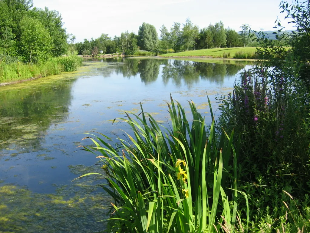
Snipe Loch
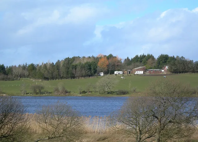
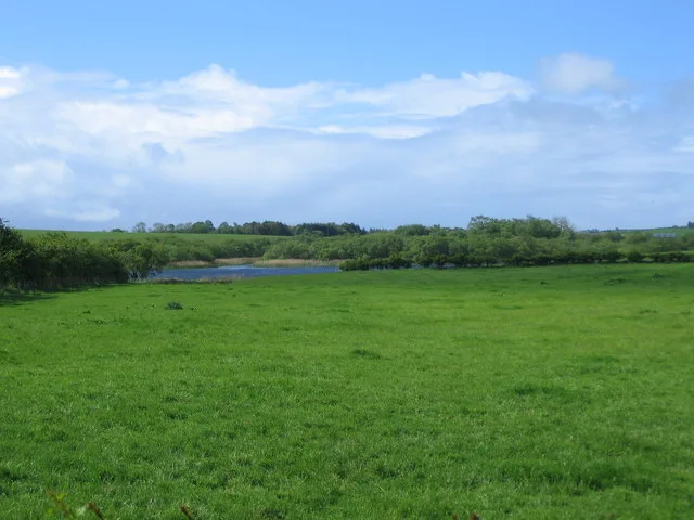
Snipe Loch — lake in East Ayrshire, Scotland, UK, outflows south-east to Martnaham Loch.

Wikimedia Commons contributors — see linked file page for photographer and licence licence
Plan your visit
- Typical visit
- 1 h–2 h
- Nearest railway station
- Ayr · 6.0 km
- Free entry
- Dog-friendly
About
Snipe Loch is a named natural landmark in the United Kingdom. Wikidata describes it as: "lake in East Ayrshire, Scotland, UK, outflows south-east to Martnaham Loch". Coordinates: 55.4238°, -4.5526°.
Photo gallery
From the Wikipedia article
Snipe Loch (NS385173) or Loch Snipe is a freshwater loch. It is situated in a low-lying area close to the B742 road next to Clocaird Farm in the Parish of Coylton, East Ayrshire, Scotland. The loch lies to the north of Martnaham Loch, 5 miles (7 km) east of Ayr.
Excerpt from Wikipedia under CC BY-SA 4.0. See the source article linked in Sources below.
Background
History
Snipe Loch is a post-glacial 'Kettle Hole' fed by the outflow from Loch Fergus and its outflow running into Martnaham Loch. The early OS maps show a sluice on the outflow, allowing the water level to be controlled. The loch was fed by springs situated near the lane at Cloncaird Farm. The early OS maps show an arm of the loch running almost as far as the lane to old Glencaird (sic). The name could appropriately refer to the bird, snipe, Lymnocryptes minimus, however in Scots the word can refer to a featureless place, lacking significant characteristics, something long and thin, or a boggy place. In Scots the snipe is variously known as a "bluiter wheep, earn-bleater, heather-bleat,…
Sourced from Wikipedia under CC BY-SA 4.0.
- Coordinates
- 55.4238, -4.5526
- District
- South Ayrshire
- Postcode
- KA6 6ES
- Parliamentary constituency
- Ayr, Carrick and Cumnock
- Nearest railway station
- Ayr — 6 km
Sources
- wikidata: Q7372814 (CC0)
- wikipedia: Snipe Loch (CC BY-SA 4.0)
- commons: Fishing platforms at Snipe Loch - geograph.org.uk - 184981.jpg (CC BY-SA 4.0)
Other places nearby
Loading nearby places…
Nearby
 📷 5
📷 5Natural landmarks · Scottish Lowlands
Martnaham Loch
Martnaham Loch — lake in East Ayrshire, Scotland, UK, outflows west to Perclewan Burn.
 📷 3
📷 3Archaeological sites · Scottish Lowlands
Lindston House Henge
Lindston House Henge — a archaeological in scotland-lowlands, United Kingdom.
 📷 3
📷 3Castles · Scottish Lowlands
Martnaham Castle
Martnaham Castle — a castle in scotland-lowlands, United Kingdom.
 📷 5
📷 5Natural landmarks · Scottish Lowlands
Loch Fergus
Loch Fergus — lake in South Ayrshire, Scotland, UK, outflows west via a watercousrse to Snipe Loch.
 📷 2
📷 2Archaeological sites · Scottish Lowlands
Lindston Henge
Lindston Henge — a archaeological in scotland-lowlands, United Kingdom.
 📷 3
📷 3Natural landmarks · Scottish Lowlands
Lindston Loch
Lindston Loch — lake in South Ayrshire, Scotland, UK.
More natural landmarks in this region
 Flagship📷 3
Natural landmarks · Scottish Lowlands
Bassenthwaite Lake
Bassenthwaite Lake — lake in Cumbria, England, UK.
 Flagship📷 3
Natural landmarks · Scottish Lowlands
Loch Enoch
Loch Enoch — lake in Dumfries and Galloway, Scotland, UK.
 📷 5
📷 5Natural landmarks · Scottish Lowlands
Annandale Water
Annandale Water — lake in Dumfries and Galloway, Scotland, UK.
 📷 3
📷 3Natural landmarks · Scottish Lowlands
Bakestall
Bakestall — mountain in United Kingdom.
Frequently asked questions
- Where is Snipe Loch?
- Snipe Loch is in the Scottish Lowlands, United Kingdom (postcode KA6 6ES).
- Is Snipe Loch free to visit?
- Yes, Snipe Loch is free to enter.
- How do I get to Snipe Loch?
- The nearest railway station is Ayr, about 6.0 km away. Drivers can navigate to postcode KA6 6ES.