Natural landmarks · Scottish Lowlands
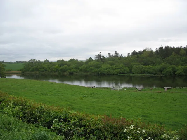
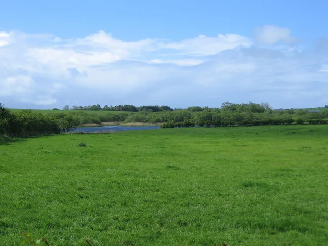
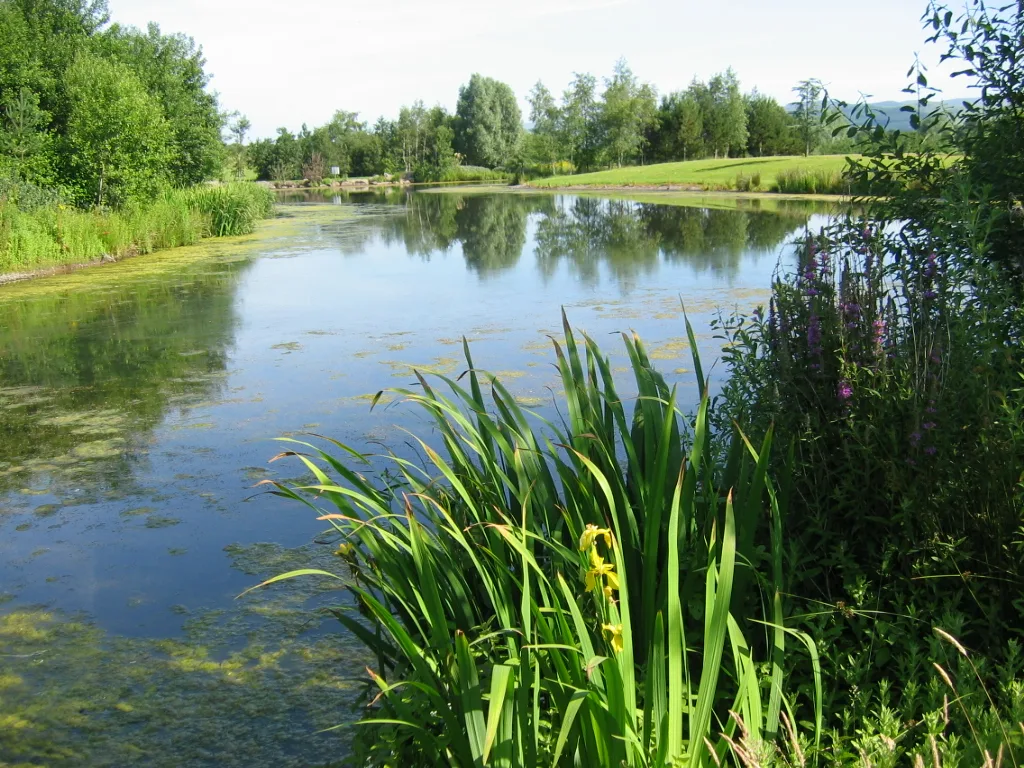
Martnaham Loch
Martnaham Loch — lake in East Ayrshire, Scotland, UK, outflows west to Perclewan Burn.

Wikimedia Commons contributors — see linked file page for photographer and licence licence
Plan your visit
- Typical visit
- 1 h–2 h
- Nearest railway station
- Ayr · 6.7 km
- Free entry
- Dog-friendly
About
Martnaham Loch is a named natural landmark in the United Kingdom. Wikidata describes it as: "lake in East Ayrshire, Scotland, UK, outflows west to Perclewan Burn". Coordinates: 55.4234°, -4.5398°.
Photo gallery
From the Wikipedia article
Martnaham Loch (NS 396 172) is a freshwater loch lying across the border between East and South Ayrshire Council Areas, two kilometres (1+1⁄4 miles) from Coylton, in the parishes of Coylton and Dalrymple, three miles (five kilometres) from Ayr. The loch lies along an axis from northeast to southwest. The remains of a castle lie on a possibly artificial islet within the loch. The Campbells of Loudoun once held the lands, followed by the Kennedys of Cassillis.
Excerpt from Wikipedia under CC BY-SA 4.0. See the source article linked in Sources below.
Background
Description
Martnaham Loch is a large post-glacial "Kettle Hole" fed by the Sandhill Burn, the Whitehill Burn and an outflow from Snipe Loch which in turn receives water from Loch Fergus. Matuane, and even Mertineton in 1700. The name may be Anglian or Gaelic and any connection with Saint Ninian's tutor, Saint Martin of Tours would be speculation.
Sourced from Wikipedia under CC BY-SA 4.0.
- Coordinates
- 55.4234, -4.5398
- District
- South Ayrshire
- Postcode
- KA6 6ES
- Parliamentary constituency
- Ayr, Carrick and Cumnock
- Nearest railway station
- Ayr — 6.7 km
Sources
- wikidata: Q6777288 (CC0)
- wikipedia: Martnaham Loch (CC BY-SA 4.0)
- commons: Martnaham Loch at Jelliston - geograph.org.uk - 365262.jpg (CC BY-SA 4.0)
Other places nearby
Loading nearby places…
Nearby
 📷 3
📷 3Castles · Scottish Lowlands
Martnaham Castle
Martnaham Castle — a castle in scotland-lowlands, United Kingdom.
 📷 5
📷 5Natural landmarks · Scottish Lowlands
Snipe Loch
Snipe Loch — lake in East Ayrshire, Scotland, UK, outflows south-east to Martnaham Loch.
 📷 5
📷 5Natural landmarks · Scottish Lowlands
Loch Fergus
Loch Fergus — lake in South Ayrshire, Scotland, UK, outflows west via a watercousrse to Snipe Loch.
 📷 3
📷 3Archaeological sites · Scottish Lowlands
Lindston House Henge
Lindston House Henge — a archaeological in scotland-lowlands, United Kingdom.
 📷 3
📷 3Golf courses · Scottish Lowlands
Roodlea Golf Centre
Roodlea Golf Centre — golf course in South Ayrshire, Scotland, UK.
 📷 2
📷 2Archaeological sites · Scottish Lowlands
Lindston Henge
Lindston Henge — a archaeological in scotland-lowlands, United Kingdom.
More natural landmarks in this region
 Flagship📷 3
Natural landmarks · Scottish Lowlands
Bassenthwaite Lake
Bassenthwaite Lake — lake in Cumbria, England, UK.
 Flagship📷 3
Natural landmarks · Scottish Lowlands
Loch Enoch
Loch Enoch — lake in Dumfries and Galloway, Scotland, UK.
 📷 5
📷 5Natural landmarks · Scottish Lowlands
Annandale Water
Annandale Water — lake in Dumfries and Galloway, Scotland, UK.
 📷 3
📷 3Natural landmarks · Scottish Lowlands
Bakestall
Bakestall — mountain in United Kingdom.
Frequently asked questions
- Where is Martnaham Loch?
- Martnaham Loch is in the Scottish Lowlands, United Kingdom (postcode KA6 6ES).
- Is Martnaham Loch free to visit?
- Yes, Martnaham Loch is free to enter.
- How do I get to Martnaham Loch?
- The nearest railway station is Ayr, about 6.7 km away. Drivers can navigate to postcode KA6 6ES.