Mountains & hills · Northern Ireland
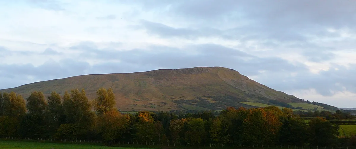
Slieve Beagh
Also known as: Sliabh Beatha
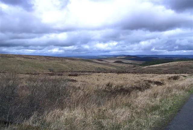
Slieve Beagh — Named summit at 380 m.

Wikimedia Commons contributors — see linked file page for photographer and licence licence
Plan your visit
- Typical visit
- 3 h–8 h
- Best time of year
- Late spring – early autumn (May–Oct)
- Free entry
- Dog-friendly
About
Slieve Beagh is a named summit in the United Kingdom. Also known as: Sliabh Beatha. Wikidata describes it as: "Named summit at 380 m.". Coordinates: 54.3388°, -7.1954°.
Photo gallery
From the Wikipedia article
Slieve Beagh (Irish: Sliabh Beatha) is a mountainous area straddling the border between County Monaghan in the Republic of Ireland and County Fermanagh and County Tyrone in Northern Ireland. A point just east of its summit is the highest point in Monaghan; however the true summit is on the Fermanagh-Tyrone border. The point where the three counties meet, is referred to as the "Three County Hollow".
Excerpt from Wikipedia under CC BY-SA 4.0. See the source article linked in Sources below.
- Coordinates
- 54.3388, -7.1954
- Address
- County Monaghan, County Fermanagh, County Tyrone
- Official site
- web.archive.org
Sources
- osm: n332373405 (ODbL)
- wikipedia: Slieve Beagh (CC BY-SA 4.0)
- commons: Bragan Townland - geograph.org.uk - 782344.jpg (CC BY-SA 4.0)
Other places nearby
Loading nearby places…
Nearby
 📷 3
📷 3Historic houses · Northern Ireland
Shane Barnagh's Stables
Shane Barnagh's Stables — a historic house in northern-ireland, United Kingdom.
 📷 3
📷 3Historic houses · Northern Ireland
Cooneen Ghost House
Cooneen Ghost House — a other in northern-ireland, United Kingdom.
 📷 3
📷 3Natural landmarks · Northern Ireland
Sliabh Beagh
Sliabh Beagh — mountain in United Kingdom.
 📷 3
📷 3Natural landmarks · Northern Ireland
Aghacramphill
Aghacramphill in Northern Ireland, United Kingdom.
Vineyards · Northern Ireland
Clogher Demesne
Clogher Demesne — a UK vineyard in northern ireland, producing English or Welsh wine from cool-climate grape varieties.
 📷 3
📷 3Memorials & monuments · Northern Ireland
IRA Memorial
IRA Memorial — a memorial in northern-ireland, United Kingdom.
More mountains in this region
 📷 5
📷 5Mountains & hills · Northern Ireland
Belfast Lough
Belfast Lough — intertidal inlet in Northern Ireland.
 📷 5
📷 5Mountains & hills · Northern Ireland
Belmore Mountain
Belmore Mountain — Named summit at 398 m.
 📷 4
📷 4Mountains & hills · Northern Ireland
Ben Crom
Ben Crom — Named summit at 526 m.
 📷 3
📷 3Mountains & hills · Northern Ireland
Benbradagh
Benbradagh — Named summit at 465 m.
Frequently asked questions
- Where is Slieve Beagh?
- Slieve Beagh is in Northern Ireland, in the United Kingdom — coordinates 54.3388°, -7.1954°.
- Is Slieve Beagh free to visit?
- Yes — admission to Slieve Beagh is free.