Mountains & hills · Northern Ireland
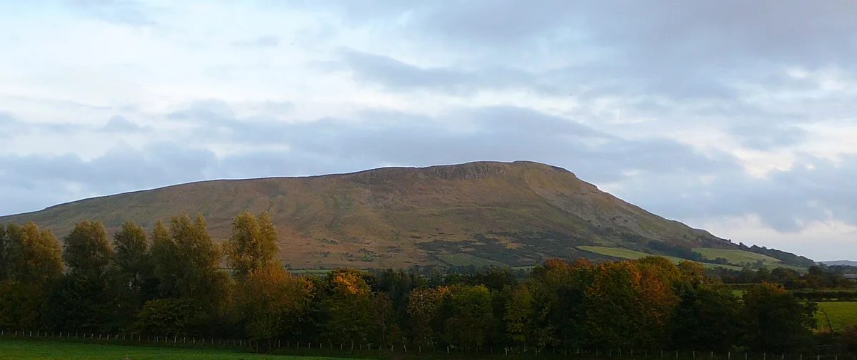
Benbradagh
Also known as: An Bhinn Bhradach
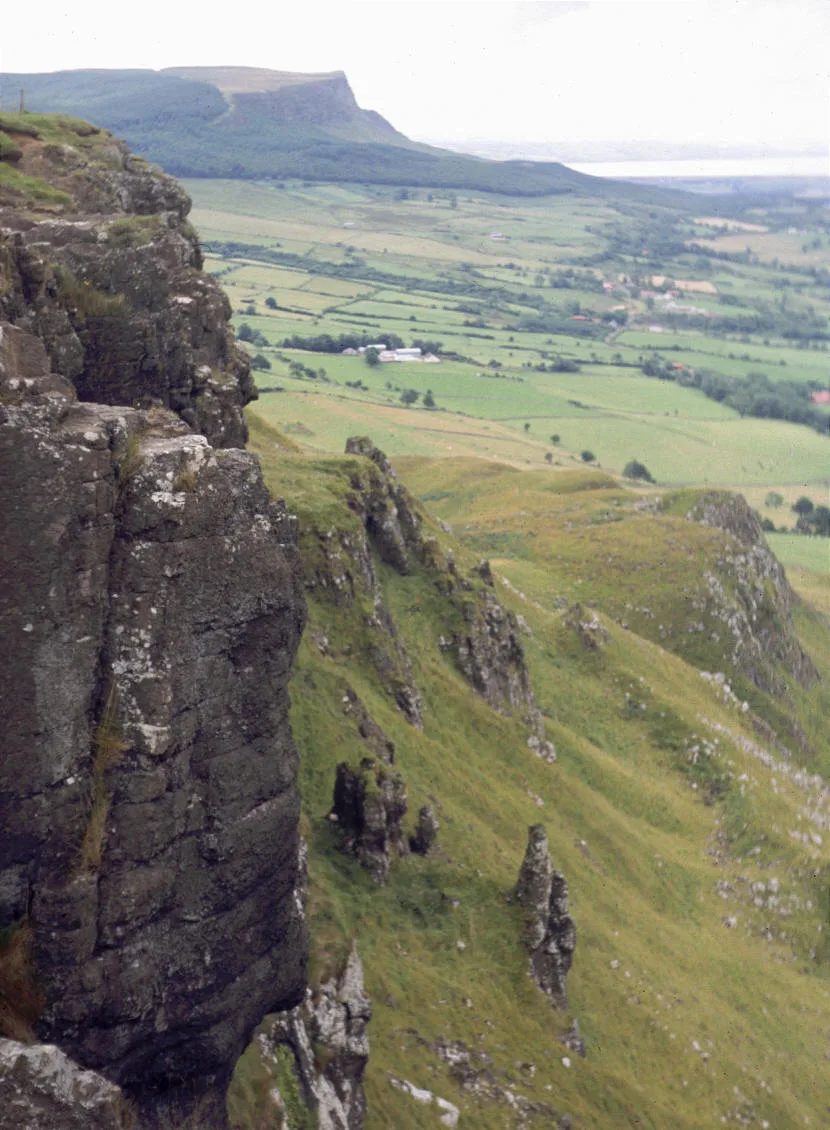
Benbradagh — Named summit at 465 m.

Wikimedia Commons contributors — see linked file page for photographer and licence licence
Plan your visit
- Typical visit
- 3 h–8 h
- Best time of year
- Late spring – early autumn (May–Oct)
- Free entry
- Dog-friendly
About
Benbradagh is a named summit in the United Kingdom. Also known as: An Bhinn Bhradach. Wikidata describes it as: "Named summit at 465 m.". Coordinates: 54.9445°, -6.8740°.
Photo gallery
From the Wikipedia article
Benbradagh (from Irish Binn Bhradach 'treacherous peak') is a large hill near Dungiven in County Londonderry, Northern Ireland. It rises to 465 metres (1,526 ft) and is north of the Sperrin Mountains. Benbradagh was used from the 1940s to the early 1970s as a United States Military communications base for its North Atlantic fleet. US forces also built underground stores for high explosives at Benbradagh. In the early 1980s, Col Buckley, of the Directorate of Military Intelligence (Ireland), believed the UK could use the facility to store nuclear weapons. Col Buckley complained that he did not have "the monitoring or surveillance systems" to confirm whether nuclear weapons were being kept there, but the British strongly denied having nuclear weapons in Northern Ireland.
Excerpt from Wikipedia under CC BY-SA 4.0. See the source article linked in Sources below.
- Coordinates
- 54.9445, -6.8740
- District
- Causeway Coast and Glens
- Postcode
- BT47 4QN
- Parliamentary constituency
- East Londonderry
- Official site
- mountainviews.ie
Sources
- osm: n332373069 (ODbL)
- wikipedia: Benbradagh (CC BY-SA 4.0)
- commons: Benbradagh.jpg (CC BY-SA 4.0)
Other places nearby
Loading nearby places…
Nearby
 📷 3
📷 3Natural landmarks · Northern Ireland
Benbradagh
Benbradagh — mountain in the United Kingdom.
Campsites · Northern Ireland
Hillfoot Campsite
Hillfoot Campsite — a campsite in northern ireland.
 📷 4
📷 4Natural landmarks · Northern Ireland
Lenamore
Lenamore in Northern Ireland, United Kingdom.
 📷 5
📷 5Natural landmarks · Northern Ireland
County Londonderry
County Londonderry in Northern Ireland, United Kingdom.
 📷 2
📷 2Natural landmarks · Northern Ireland
Derryork railway station
Derryork railway station in Northern Ireland, United Kingdom.
 📷 3
📷 3Natural landmarks · Northern Ireland
Dungiven GAC
Dungiven GAC in Northern Ireland, United Kingdom.
More mountains in this region
 📷 5
📷 5Mountains & hills · Northern Ireland
Belfast Lough
Belfast Lough — intertidal inlet in Northern Ireland.
 📷 5
📷 5Mountains & hills · Northern Ireland
Belmore Mountain
Belmore Mountain — Named summit at 398 m.
 📷 4
📷 4Mountains & hills · Northern Ireland
Ben Crom
Ben Crom — Named summit at 526 m.
 📷 3
📷 3Mountains & hills · Northern Ireland
Binevenagh
Binevenagh — Named summit at 385 m.
Frequently asked questions
- Where is Benbradagh?
- Benbradagh is in Northern Ireland, United Kingdom (postcode BT47 4QN).
- Is Benbradagh free to visit?
- Yes, Benbradagh is free to enter.
- How do I get to Benbradagh?
- Drivers can navigate to postcode BT47 4QN. It sits within the East Londonderry parliamentary constituency.