Mountains & hills · Scottish Highlands
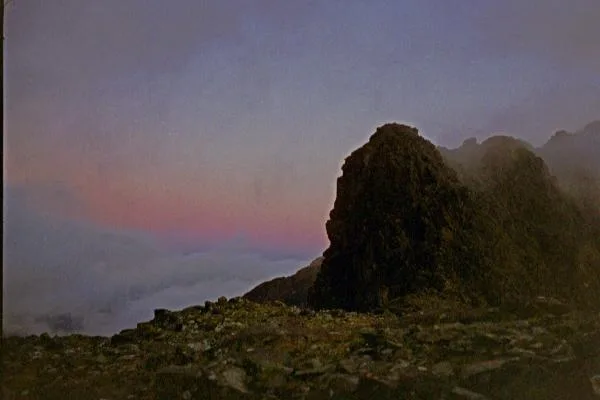
Sgùrr Mhic Choinnich
Sgùrr Mhic Choinnich — Named summit at 948 m.

Wikimedia Commons contributors — see linked file page for photographer and licence licence
Plan your visit
- Typical visit
- 3 h–8 h
- Best time of year
- Late spring – early autumn (May–Oct)
- Free entry
- Dog-friendly
About
Sgùrr Mhic Choinnich is a named summit in the United Kingdom. Wikidata describes it as: "Named summit at 948 m.". Coordinates: 57.2091°, -6.2239°.
Photo gallery
From the Wikipedia article
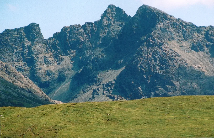
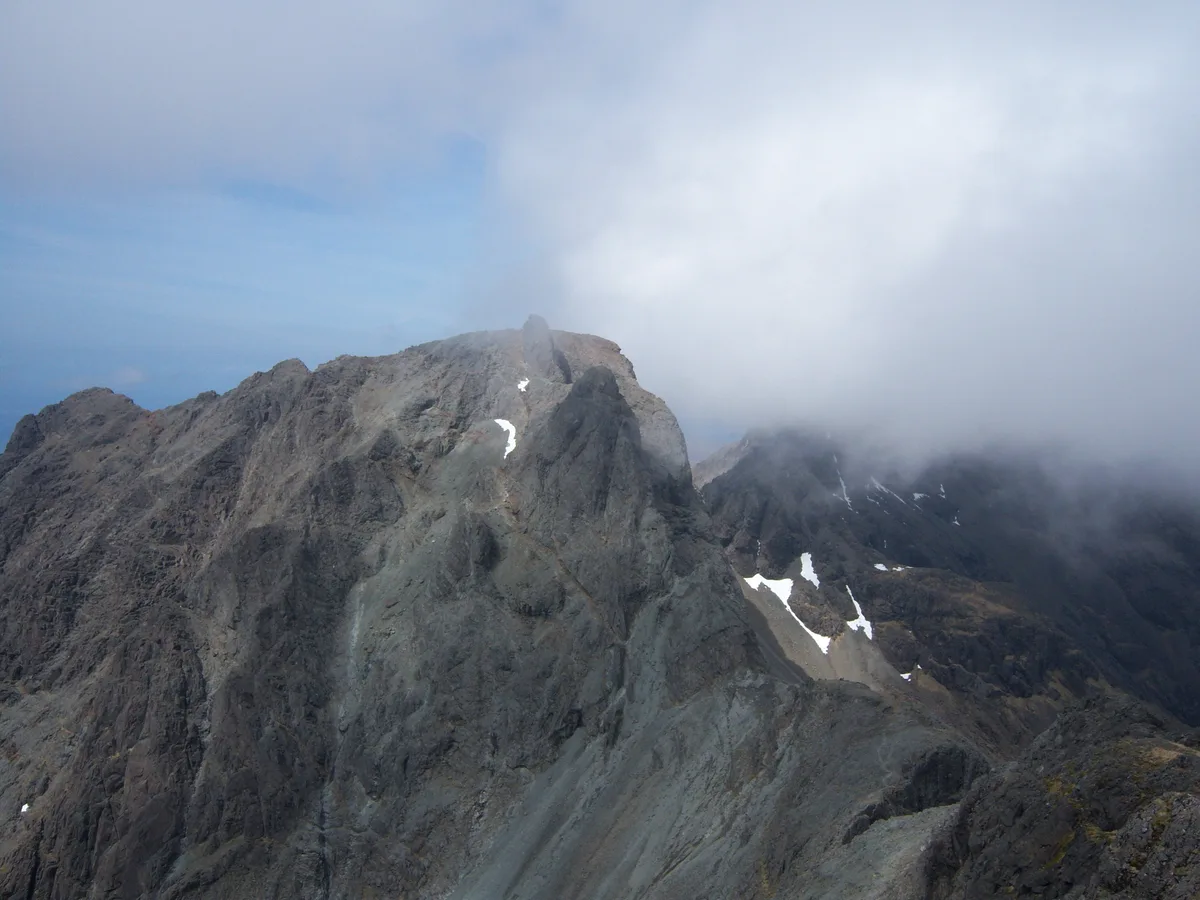
Sgùrr MhicChoinnich is a mountain on the Isle of Skye in Scotland. It is in the Black Cuillin range of mountains and is classified as a Munro. Like all the other Black Cuillin mountains it is made predominantly of gabbro rock and has little vegetation. The mountain is named after the mountain guide John MacKenzie who was with Charles Pilkington, James Heelis and Horace Walker in 1887 when the peak was first ascended. The most common route to the summit involves climbing the An Stac scree slopes out of Coire Lagan to reach the bealach between Sgùrr MhicChoinnich and Sgùrr Dearg. From here an airy and challenging scramble up the peak's north ridge is required to attain the summit. The ascent is a challenging climb by the standards of British mountains, being an exposed scramble at Grade 2 standard. The south face of the mountain, by contrast, falls sheer to the bealach between Sgùrr MhicChoinnich and Sgùrr Thearlaich, and the easiest route up this face (King's Chimney) is a V. Diff rock climb. Moreover, this bealach cannot be reached from below without further rock climbing, and the north ridge of Sgùrr Thearlaich which leads down to the bealach contains an awkward rock step (a Moderate rock climb) which must be taken in descent. For those with the ability to reach this bealach, however, a remarkable terrace, Collie's Ledge, which is only a Grade 2 scramble, avoids King's Chimney entirely by traversing the western flank of the peak and joining up with the north ridge. This ledge is difficult to find, but when located, it is often used by mountaineers on the full traverse of the Cuillin ridge to gain the summit without having to climb King's Chimney.
Excerpt from Wikipedia under CC BY-SA 4.0. See the source article linked in Sources below.
- Coordinates
- 57.2091, -6.2239
- Address
- Skye, {{SCO}}
- Official site
- www.hill-bagging.co.uk
Sources
- osm: n388371682 (ODbL)
- wikipedia: Sgùrr MhicChoinnich (CC BY-SA 4.0)
- commons: Sgurr Mhic Choinnich - geograph.org.uk - 14102.jpg (CC BY-SA 4.0)
Other places nearby
Loading nearby places…
Nearby
 📷 5
📷 5Natural landmarks · Scottish Highlands
Sgùrr Mhic Choinnich
Sgùrr Mhic Choinnich — 948m high mountain in Highland, Scotland, UK.
 📷 3
📷 3Mountains & hills · Scottish Highlands
Sgùrr Alasdair
Sgùrr Alasdair — Named summit at 992 m.
 📷 3
📷 3Natural landmarks · Scottish Highlands
Sgùrr Alasdair
Sgùrr Alasdair — 992m high mountain in Highland, Scotland, UK.
 📷 3
📷 3Mountains & hills · Scottish Highlands
Sgùrr Theàrlaich
Sgùrr Theàrlaich — a mountain in scotland-highlands, United Kingdom.
 📷 3
📷 3Natural landmarks · Scottish Highlands
Sgùrr Dearg
Sgùrr Dearg — mountain on the Isle of Skye in Highland, Scotland, UK.
 📷 3
📷 3Mountains & hills · Scottish Highlands
The Inaccessible Pinnacle
The Inaccessible Pinnacle — Named summit at 986 m.
More mountains in this region
 📷 3
📷 3Mountains & hills · Scottish Highlands
A' Bhuidheanach Bheag
A' Bhuidheanach Bheag — Named summit at 936 m.
 📷 3
📷 3Mountains & hills · Scottish Highlands
A' Chailleach
A' Chailleach — Named summit at 997 m.
 📷 3
📷 3Mountains & hills · Scottish Highlands
A' Chailleach
A' Chailleach — Named summit at 930 m.
 📷 3
📷 3Mountains & hills · Scottish Highlands
A' Chaoirnich
A' Chaoirnich — Named summit at 875 m.
Frequently asked questions
- Where is Sgùrr Mhic Choinnich?
- Sgùrr Mhic Choinnich is in Scottish Highlands, in the United Kingdom — coordinates 57.2091°, -6.2239°.
- Is Sgùrr Mhic Choinnich free to visit?
- Yes — admission to Sgùrr Mhic Choinnich is free.