Natural landmarks · Scottish Highlands
Sgùrr Dearg
Also known as: Sgurr Dearg, An Sgùrr Dearg
Sgùrr Dearg — mountain on the Isle of Skye in Highland, Scotland, UK.

Wikimedia Commons contributors — see linked file page for photographer and licence licence
Plan your visit
- Typical visit
- 1 h–2 h
- Free entry
- Dog-friendly
About
Sgùrr Dearg is a named natural landmark in the United Kingdom. Wikidata describes it as: "mountain on the Isle of Skye in Highland, Scotland, UK". Coordinates: 57.2127°, -6.2348°.
Photo gallery
From the Wikipedia article
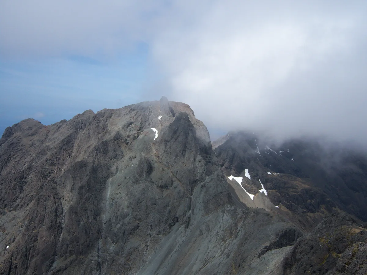
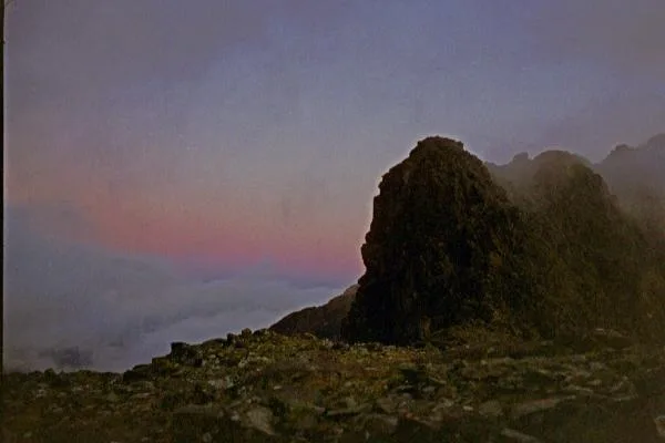
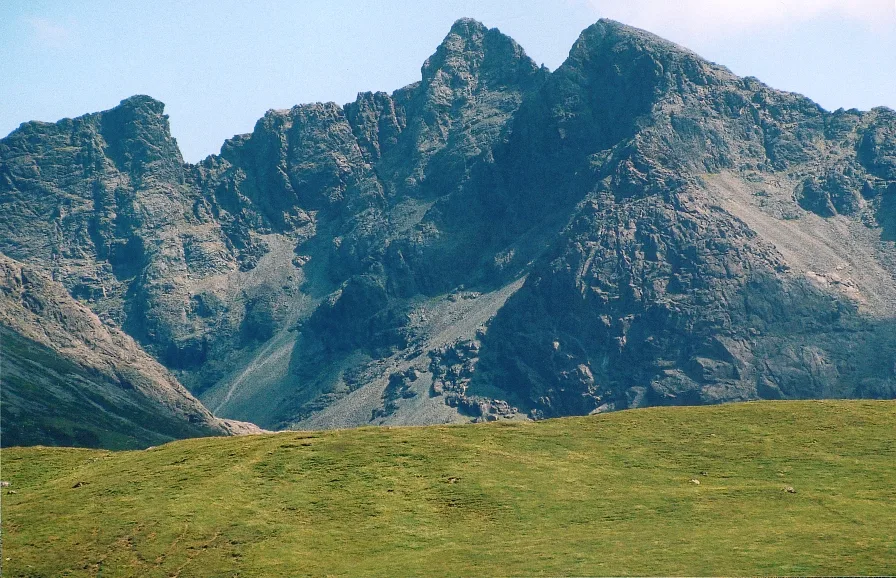
Sgùrr Dearg (Scottish Gaelic for 'red rocky peak') is a mountain in the Cuillin on the Isle of Skye, Scotland. It is topped by the Inaccessible Pinnacle (or An Stac in Gaelic), a fin of rock measuring 50 metres (160 ft) along its longest edge. The top of the Pinnacle stands at 985.8 m (3,234 ft) above sea level, making Sgùrr Dearg the only Munro with a peak that can only be reached by rock climbing. This makes it the biggest hurdle for many Munro baggers. First climbed by Charles and Lawrence Pilkington in 1880, the Pinnacle was never climbed by Sir Hugh Munro himself. Because of its status as the most difficult of the Munros it has now spawned a cottage industry for the local guides, who are often seen escorting parties of novice climbers. Unlike much of the Cuillin, the pinnacle is basalt, not gabbro, and thus is somewhat slippery when wet.
Excerpt from Wikipedia under CC BY-SA 4.0. See the source article linked in Sources below.
Background
Description
The Inaccessible Pinnacle (An Stac in Gaelic), colloquially called the 'In Pin' or 'In Pinn' by mountaineers, was first climbed on 18 August 1880 by a pair of Lancashire brothers, Charles and Lawrence Pilkington. They were guided to the foot of the climb from Sligachan via Coruisk and Bealach Coire na Banachdich by a local shepherd called John Mackenzie. They climbed it by the east ridge, and had to throw down a lot of loose rock as they climbed. The usual ascent of the Inaccessible Pinnacle itself is by its long east ridge, a climb of 50 m vertically involving two roped 30 m pitches. Although graded Moderate (the lowest grade now in use in the British grading system), with good holds, the…
Sourced from Wikipedia under CC BY-SA 4.0.
- Coordinates
- 57.2127, -6.2348
- Address
- Skye, Scotland
- Official site
- www.hill-bagging.co.uk
Sources
- wikidata: Q1862487 (CC0)
- wikipedia: Sgùrr Dearg (CC BY-SA 4.0)
- commons: In pinn.jpg (CC BY-SA 4.0)
Other places nearby
Loading nearby places…
Nearby
 📷 3
📷 3Mountains & hills · Scottish Highlands
Inaccessible Pinnacle
Inaccessible Pinnacle — a mountain in scotland-highlands, United Kingdom, 986 m.
 📷 3
📷 3Mountains & hills · Scottish Highlands
The Inaccessible Pinnacle
The Inaccessible Pinnacle — Named summit at 986 m.
 📷 3
📷 3Mountains & hills · Scottish Highlands
Sgùrr Dearg
Sgùrr Dearg — Named summit at 977 m.
 📷 5
📷 5Natural landmarks · Scottish Highlands
Sgùrr Mhic Choinnich
Sgùrr Mhic Choinnich — 948m high mountain in Highland, Scotland, UK.
 📷 5
📷 5Mountains & hills · Scottish Highlands
Sgùrr Mhic Choinnich
Sgùrr Mhic Choinnich — Named summit at 948 m.
 📷 3
📷 3Natural landmarks · Scottish Highlands
Sgùrr Alasdair
Sgùrr Alasdair — 992m high mountain in Highland, Scotland, UK.
More natural landmarks in this region
 Flagship📷 3
Natural landmarks · Scottish Highlands
Dunalastair Water
Dunalastair Water — lake in Perth and Kinross, Scotland, UK, on the River Tummel.
 Flagship📷 3
Natural landmarks · Scottish Highlands
Loch Arkaig
Loch Arkaig — lake in Highland, Scotland, UK, outflows east to River Arkaig.
 Flagship📷 3
Natural landmarks · Scottish Highlands
Loch Assynt
Loch Assynt — lake in Highland, Scotland, UK, outflows to the River Inver and Loch na Garbh Uidhe.
 Flagship📷 3
Natural landmarks · Scottish Highlands
Loch Awe
Loch Awe — lake in Argyll and Bute, Scotland, UK, outflows to the River Awe.
Frequently asked questions
- Where is Sgùrr Dearg?
- Sgùrr Dearg is in Scottish Highlands, in the United Kingdom — coordinates 57.2127°, -6.2348°.
- Is Sgùrr Dearg free to visit?
- Yes — admission to Sgùrr Dearg is free.