Natural landmarks · Scottish Highlands
Sgòr an Lochain Uaine
Also known as: Sgor an Lochain Uaine, Sgòrr an Lochain Uaine
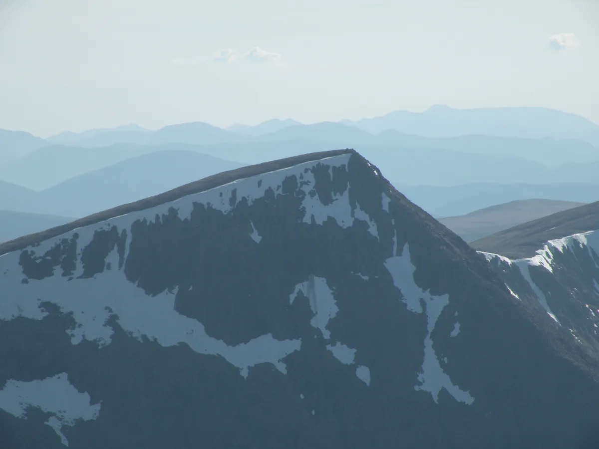
Sgòr an Lochain Uaine — 1258m high mountain in Aberdeenshire, Scotland, UK.

Wikimedia Commons contributors — see linked file page for photographer and licence licence
Plan your visit
- Typical visit
- 1 h–2 h
- Nearest railway station
- Sheiling / Middle · 8.6 km
- Free entry
- Dog-friendly
About
Sgòr an Lochain Uaine is a named natural landmark in the United Kingdom. Wikidata describes it as: "1258m high mountain in Aberdeenshire, Scotland, UK". Coordinates: 57.0584°, -3.7259°.
Photo gallery
From the Wikipedia article
Sgòr an Lochain Uaine (Scottish Gaelic for 'peak of the little green lake') is one of the Cairngorms mountains in the Scottish Highlands. Rising to 1,258 metres (4,127 ft), by some counts it is the fifth-highest mountain in Scotland (and the United Kingdom). It is in the western massif of the Cairngorms, standing between Braeriach and Cairn Toul, overlooking An Garbh Choire and the Lairig Ghru pass. It was promoted to Munro status by the Scottish Mountaineering Club's 1997 revision of the tables. It is usually climbed together with other peaks: if coming from the south it may be climbed with Cairn Toul and The Devil's Point, whilst from the north one must first cross Braeriach. The mountain takes its name from An Lochan Uaine, the lochan lying in the corrie on the north-east side of the peak. It is also sometimes called "The Angel's Peak", a name allegedly given to it in the 19th century by Alexander Copland, a founding member of the Cairngorm Club, in contrast to the nearby Devil's Point.
Excerpt from Wikipedia under CC BY-SA 4.0. See the source article linked in Sources below.
- Coordinates
- 57.0584, -3.7259
- Address
- Cairngorms, Scotland
- Nearest railway station
- Sheiling / Middle — 8.6 km
- Official site
- www.hill-bagging.co.uk
Sources
- wikidata: Q767214 (CC0)
- wikipedia: Sgòr an Lochain Uaine (CC BY-SA 4.0)
- commons: Sgor an Lochain Uaine.jpg (CC BY-SA 4.0)
Other places nearby
Loading nearby places…
Nearby
 📷 3
📷 3Mountains & hills · Scottish Highlands
Sgor an Lochain Uaine
Sgor an Lochain Uaine — Named summit at 1258 m.
 📷 3
📷 3Natural landmarks · Scottish Highlands
Cairn Toul
Cairn Toul — 1291m high mountain in Aberdeenshire, Scotland, UK.
 📷 3
📷 3Mountains & hills · Scottish Highlands
Cairn Toul
Cairn Toul — Named summit at 1291 m.
 📷 3
📷 3Mountains & hills · Scottish Highlands
Stob Coire an t-Saighdeir
Stob Coire an t-Saighdeir — a mountain in scotland-highlands, United Kingdom.
 📷 3
📷 3Mountains & hills · Scottish Highlands
Braeriach
Braeriach — Named summit at 1296 m.
 📷 3
📷 3Natural landmarks · Scottish Highlands
Braeriach
Braeriach — 1296m high mountain on the Aberdeenshire and Highland border, Scotland, UK.
More natural landmarks in this region
 Flagship📷 3
Natural landmarks · Scottish Highlands
Dunalastair Water
Dunalastair Water — lake in Perth and Kinross, Scotland, UK, on the River Tummel.
 Flagship📷 3
Natural landmarks · Scottish Highlands
Loch Arkaig
Loch Arkaig — lake in Highland, Scotland, UK, outflows east to River Arkaig.
 Flagship📷 3
Natural landmarks · Scottish Highlands
Loch Assynt
Loch Assynt — lake in Highland, Scotland, UK, outflows to the River Inver and Loch na Garbh Uidhe.
 Flagship📷 3
Natural landmarks · Scottish Highlands
Loch Awe
Loch Awe — lake in Argyll and Bute, Scotland, UK, outflows to the River Awe.
Frequently asked questions
- Where is Sgòr an Lochain Uaine?
- Sgòr an Lochain Uaine is in Scottish Highlands, in the United Kingdom — coordinates 57.0584°, -3.7259°. The nearest railway station is Sheiling / Middle, around 8.6 km away.
- Is Sgòr an Lochain Uaine free to visit?
- Yes — admission to Sgòr an Lochain Uaine is free.