Natural landmarks · Scottish Highlands
Sgairneach Mhòr
Sgairneach Mhòr — mountain in Perth and Kinross, Scotland, UK.

Wikimedia Commons contributors — see linked file page for photographer and licence licence
Plan your visit
- Typical visit
- 1 h–2 h
- Free entry
- Dog-friendly
About
Sgairneach Mhòr is a named natural landmark in the United Kingdom. Wikidata describes it as: "mountain in Perth and Kinross, Scotland, UK". Coordinates: 56.8284°, -4.2978°.
Photo gallery
From the Wikipedia article
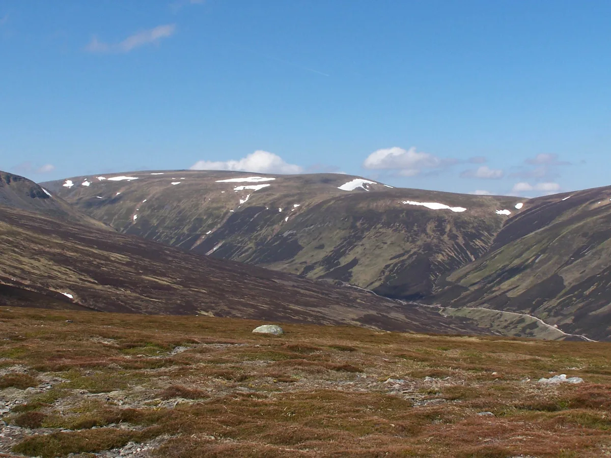
Sgairneach Mhòr is a Scottish mountain which lies in a group of seven Munros near the summit of the Pass of Drumochter and are known as the Drumochter mountains or informerly as the “A9 Munros”. The mountain is situated 13 km SSW of Dalwhinnie and four km east of the large Loch Ericht.
Excerpt from Wikipedia under CC BY-SA 4.0. See the source article linked in Sources below.
Background
Description
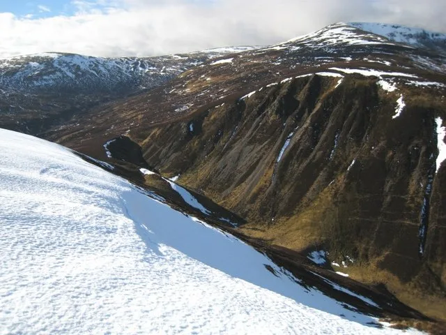
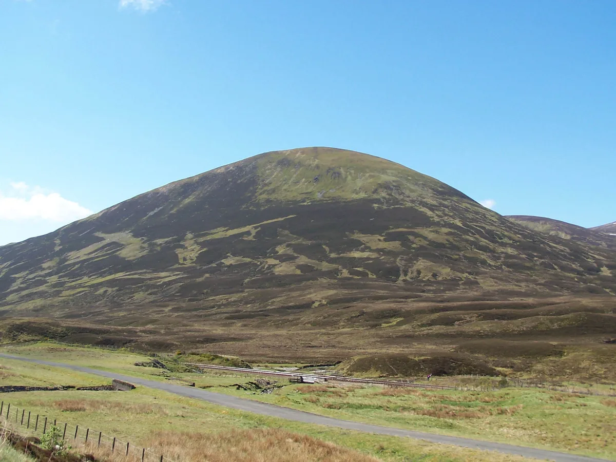
Sgairneach Mhòr lies to the west of the A9 road in area of high ground which was historically called the Druim Uachdair (the ridge of the upper ground). It is a Munro and a Marilyn with a height of 991 metres (3251 feet). The hill is well seen from the Pass of Drumochter showing off its impressive north facing corrie Coire Creagach which holds snow well into the spring. This notable rocky corrie gives the mountain its name which translates from the Gaelic as “Big Rocky Hillside” and this underlines the fact that Sgairneach Mhòr is the only hill in the group with any significant stony areas on its surface and makes it the most visually striking of the Drumochter hills.
Sourced from Wikipedia under CC BY-SA 4.0.
- Coordinates
- 56.8284, -4.2978
- Address
- Perth and Kinross, Scotland
- Official site
- www.walkhighlands.co.uk
Sources
- wikidata: Q6979246 (CC0)
- wikipedia: Sgairneach Mhòr (CC BY-SA 4.0)
- commons: Sgairneach Mhor - geograph.org.uk - 342002.jpg (CC BY-SA 4.0)
Other places nearby
Loading nearby places…
Nearby
 📷 3
📷 3Mountains & hills · Scottish Highlands
Sgairneach Mhòr
Sgairneach Mhòr — Named summit at 991 m.
 📷 3
📷 3Mountains & hills · Scottish Highlands
Beinn Udlamain
Beinn Udlamain — Named summit at 1011 m.
 📷 3
📷 3Natural landmarks · Scottish Highlands
Beinn Udlamain
Beinn Udlamain — mountain on the Perth and Kinross, and Highland border, Scotland, UK.
 📷 3
📷 3Natural landmarks · Scottish Highlands
The Sow of Atholl
The Sow of Atholl — mountain in Perth and Kinross, Scotland, UK.
 📷 3
📷 3Mountains & hills · Scottish Highlands
The Sow of Atholl
The Sow of Atholl — Named summit at 803 m.
 📷 2
📷 2Mountains & hills · Scottish Highlands
Beinn Udlamain - An Sgulan
Beinn Udlamain - An Sgulan — a mountain in scotland-highlands, United Kingdom.
More natural landmarks in this region
 Flagship📷 3
Natural landmarks · Scottish Highlands
Dunalastair Water
Dunalastair Water — lake in Perth and Kinross, Scotland, UK, on the River Tummel.
 Flagship📷 3
Natural landmarks · Scottish Highlands
Loch Arkaig
Loch Arkaig — lake in Highland, Scotland, UK, outflows east to River Arkaig.
 Flagship📷 3
Natural landmarks · Scottish Highlands
Loch Assynt
Loch Assynt — lake in Highland, Scotland, UK, outflows to the River Inver and Loch na Garbh Uidhe.
 Flagship📷 3
Natural landmarks · Scottish Highlands
Loch Awe
Loch Awe — lake in Argyll and Bute, Scotland, UK, outflows to the River Awe.
Frequently asked questions
- Where is Sgairneach Mhòr?
- Sgairneach Mhòr is in Scottish Highlands, in the United Kingdom — coordinates 56.8284°, -4.2978°.
- Is Sgairneach Mhòr free to visit?
- Yes — admission to Sgairneach Mhòr is free.