Historic bridges · Yorkshire & the Humber
Scammonden Bridge
Scammonden Bridge is a historic bridge in the United Kingdom.

Wikimedia Commons contributors — see linked file page for photographer and licence licence
Plan your visit
- Typical visit
- 15 min–30 min
- Nearest railway station
- Slaithwaite · 4.2 km
- Free entry
- Dog-friendly
About
Scammonden Bridge is a named historic bridge in the United Kingdom. Coordinates: 53.6475°, -1.9311°. This entry is part of The Great Britain Guide, a free, ad-free, open-data tourist directory.
Photo gallery
Protected designations
- Site of Special Scientific Interest: South Pennine Moors SSSI
Designations sourced from Natural England open data under OGL v3.
From the Wikipedia article
Scammonden Bridge, also known locally as the Brown Cow Bridge (after the nearby Brown Cow Inn, now closed), spans the Deanhead cutting carrying the B6114 (the former A6025) Elland to Buckstones road over the M62 motorway in Kirklees, West Yorkshire, England. The bridge and Scammonden Reservoir to the west are named after Scammonden, the village that was flooded to accommodate the reservoir whose dam carries the motorway. On opening, the bridge was the longest concrete arch bridge in the UK.
Excerpt from Wikipedia under CC BY-SA 4.0. See the source article linked in Sources below.
Background
History
The bridge was built for the West Riding County Council to the designs of the county surveyor, Colonel S. Maynard Lovell. In March 1962 a model of the 37 mi section of the M62 was displayed in Wakefield, the administrative centre of the West Riding County Council. The route of the motorway, from the A572 to the A640 at Huddersfield, was announced by Tom Fraser on 29 October 1964. On opening, it was believed to be one of the largest concrete single spans in Europe. The bridge had high winds; pedestrians found it sometimes hard to walk along it, so a new type of road sign, for high winds, was installed. The £8m contract was given in late October 1966.
Architecture
The bridge was planned as a flat arch bridge, but aerodynamic considerations led to an open spandrel design. The main span supports eight spandrel columns and there are four other columns over the motorway cutting. The spandrel columns are 18 in thick. The arch is a twin box section. Its deck is an inverted T-type pretensioned prestressed concrete beam. The bridge deck is 24 ft wide. Using computers, its design was calculated to withstand 110 mph winds, and was tested in wind tunnels at the University of Nottingham and the National Physical Laboratory. The motorway cutting was profiled with 15 ft 'steps'. The road it carried was the A6025, but is now the B6114 between Elland and the A640…
Sourced from Wikipedia under CC BY-SA 4.0.
- Coordinates
- 53.6475, -1.9311
- District
- Calderdale
- Parish
- Ripponden
- Postcode
- HX4 0ED
- Parliamentary constituency
- Calder Valley
- Nearest railway station
- Slaithwaite — 4.2 km
- Opening
- 18 May 1970
Sources
- osm: w659000142 (ODbL)
- wikipedia: Scammonden Bridge (CC BY-SA 4.0)
- commons: Scammonden Bridge - geograph.org.uk - 717377.jpg (CC BY-SA 4.0)
Other places nearby
Loading nearby places…
Nearby
 📷 5
📷 5Reservoirs & lochs · Yorkshire & the Humber
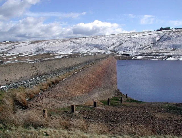
Scammonden Reservoir
Scammonden Reservoir — reservoir in West Yorkshire, England, UK.
 📷 3
📷 3Memorials & monuments · Yorkshire & the Humber
Scammonden Stanza Stones
Scammonden Stanza Stones — a memorial in england-yorkshire, United Kingdom.
 📷 3
📷 3Archaeological sites · Yorkshire & the Humber
ring of stones
ring of stones — a archaeological in england-yorkshire, United Kingdom.
 📷 3
📷 3Memorials & monuments · Yorkshire & the Humber
Rishworth war memorial
Rishworth war memorial — Grade II listed building-listed memorial in england-yorkshire, United Kingdom.
 📷 3
📷 3Reservoirs & lochs · Yorkshire & the Humber
Deanhead Reservoir
Deanhead Reservoir — reservoir in West Yorkshire, England, UK.
 📷 3
📷 3Historic bridges · Yorkshire & the Humber
Merry Dale Bridge
Merry Dale Bridge is a historic bridge in the United Kingdom.
More bridges in this region
.jpg?width=1200) 📷 3
📷 3Historic bridges · Yorkshire & the Humber
Aberford Bridge
Aberford Bridge is a historic bridge in the United Kingdom.
 📷 5
📷 5Historic bridges · Yorkshire & the Humber
Aldwark Bridge
Aldwark Bridge is a historic bridge in the United Kingdom.
 📷 3
📷 3Historic bridges · Yorkshire & the Humber
Anchor Bridge
Anchor Bridge is a historic bridge in the United Kingdom.
 📷 3
📷 3Historic bridges · Yorkshire & the Humber
Apperley Viaduct
Apperley Viaduct is a historic bridge in the United Kingdom.
Frequently asked questions
- Where is Scammonden Bridge?
- Scammonden Bridge is in Yorkshire, United Kingdom (postcode HX4 0ED), in the parish of Ripponden.
- Who owns Scammonden Bridge?
- Scammonden Bridge is owned by | maint = National Highways.
- Is Scammonden Bridge a protected site?
- Yes — Scammonden Bridge is part of the South Pennine Moors SSSI Site of Special Scientific Interest.
- Is Scammonden Bridge free to visit?
- Yes, Scammonden Bridge is free to enter.
- How do I get to Scammonden Bridge?
- The nearest railway station is Slaithwaite, about 4.2 km away. Drivers can navigate to postcode HX4 0ED.