Other places · North East England
Sandhoe
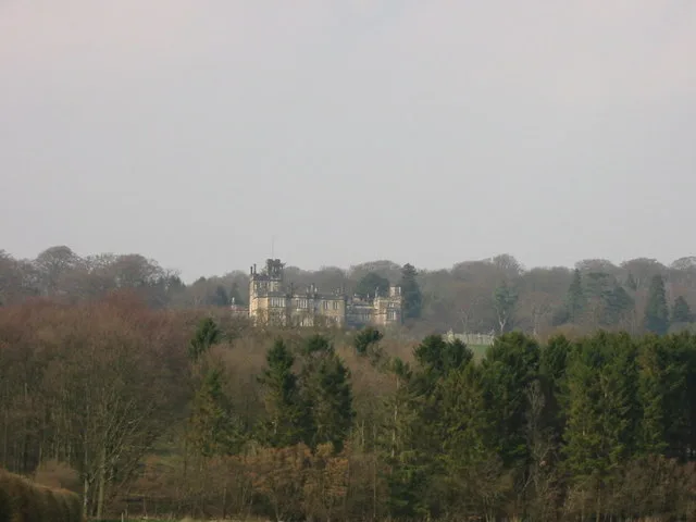
Sandhoe in England North East, United Kingdom.

Oliver Dixon — CC BY-SA 2.0 via Wikimedia Commons licence
Plan your visit
- Typical visit
- 1 h–2 h
About
Sandhoe is a place of interest in England North East, United Kingdom — drawn from open-data sources for visitor reference. See the linked Wikipedia article for the full description.
Photo gallery
From the Wikipedia article
Sandhoe is a hamlet and civil parish in Northumberland, England. It lies about 3 kilometres (2 mi) northwest of Corbridge and 3 kilometres south of Hadrian's Wall. The parish touches Acomb, Corbridge, Hexham and Wall.
Excerpt from Wikipedia under CC BY-SA 4.0. See the source article linked in Sources below.
Background
History
The name "Sandhoe" means 'Sandy hill-spur'. Sandhoe is a deserted medieval village, the village was first recorded in the 13th century but by 1769 it had completely disappeared and is now covered by modern housing. Sandhoe was formerly a township in the parish of St. John-Lee, in 1866 Sandhoe became a civil parish in its own right. <!--
Sourced from Wikipedia under CC BY-SA 4.0.
- Coordinates
- 54.9930, -2.0400
- District
- Northumberland
- Parish
- Sandhoe
- Postcode
- NE46 4LX
- Parliamentary constituency
- Hexham
- Official site
- www.neighbourhood.statistics.gov.uk
Sources
Other places nearby
Loading nearby places…
Nearby
 📷 4
📷 4Historic houses · North East England
Sandhoe Hall
Sandhoe Hall in England North East, United Kingdom.
 📷 5
📷 5Castles · Scottish Lowlands
Beaufront Castle
Beaufront Castle — Grade I listed castle in Northumberland, England, UK.
 📷 3
📷 3Historic bridges · Scottish Lowlands
Bridge On Old Road Over Cor Burn
Bridge On Old Road Over Cor Burn — Grade II listed building-listed bridge in scotland-lowlands, United Kingdom.
 📷 3
📷 3Hill forts · Scottish Lowlands
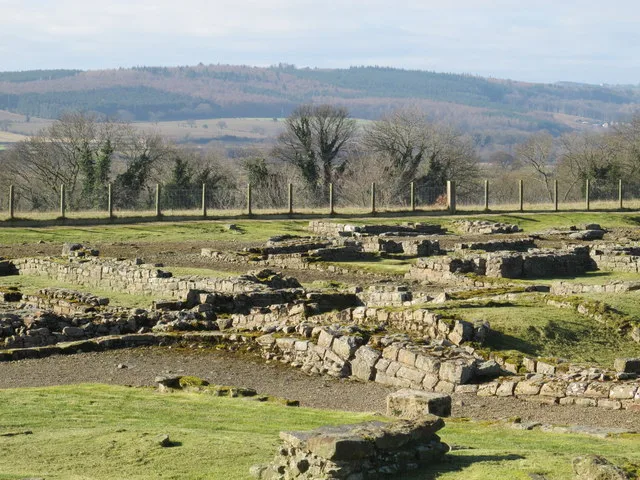
Coria
Coria — archaeological site in Corbridge, Northumberland, England, UK.
 📷 3
📷 3Museums · Scottish Lowlands
Corstopitum Visitor's Centre
Corstopitum Visitor's Centre — a museum in scotland-lowlands, United Kingdom.
 📷 3
📷 3Archaeological sites · Scottish Lowlands
Corbridge Roman Town Fort
Corbridge Roman Town Fort — a other in scotland-lowlands, United Kingdom.
More places in this region
.jpg?width=1200) 📷 3
📷 3Other places · North East England
Stockton Flyer
Stockton Flyer — Public artwork (installation).
 📷 3
📷 3Other places · North East England
Temenos
Temenos — Public artwork (sculpture) by Anish Kapoor.
 📷 5
📷 5Other places · North East England
Appleby Horse Fair
The Appleby Horse Fair, previously known as Appleby New Fair, is an annual gathering of Romani people (Gypsies) and Travellers in Appleby-in-Westmorland in Cumbria, England. The horse fair is held eac
 📷 5
📷 5Other places · North East England
Locomotion No. 1
Locomotion No. 1 (originally named Active) is an early steam locomotive that was built in 1825 by the pioneering railway engineers George and Robert Stephenson at their manufacturing firm, Robert Step
Frequently asked questions
- Where is Sandhoe?
- Sandhoe is in North East England, in the United Kingdom — coordinates 54.9930°, -2.0400°.